The places of the Ligurian east coast: an overview
Introduction
In this page I introduce the places along the coast between the eastern outskirts of Genova and the river Magra mouth, where the Liguria region almost ends and the mountains really face the sea. Except for some short periods, this is really a year-round hiking area; along some sides exposed to full sun full summer will be the less comfortable season. Not considering, however, that during the high touristic season, here corresponding more to spring and early autumn than summer, some trails of the more popular places, like the Cinque Terre and mount of Portofino, can be unbelievably crowded by individuals or groups. With a careful planning of period and itinerary, you may however have the satisfaction of starting from the sea, ascend to the mountains and, maybe, triumphantly return with backpack on your shoulders, strolling among people promenading along the alleys of some renowned seaside resorts. beyond this, between Genova and the Cinque Terre you have the almost unique possibility of combining walks between the coastal centres, at different heights, and use the train to return, or to hop from one place to the other.
Ligurian east coast: between Genova and Moneglia
Along the Ligurian east coast, the coastal ridges divide from the sea the valleys of the two main river systems, flowing almost parallel to the coastline: rivers Lavagna and Vara. between the two systems, the valleys Sturla and Cichero more deeply penetrate inland, forming, together with Lavagna and, from the east, river Graveglia, the mouth of Entella; river Graveglia, from its side, also forms a short valley, almost parallel to the coast that, at its bottom end, borders the upper Vara valley. Let’s see now this first stretch, in the western part of the Ligurian east coast.
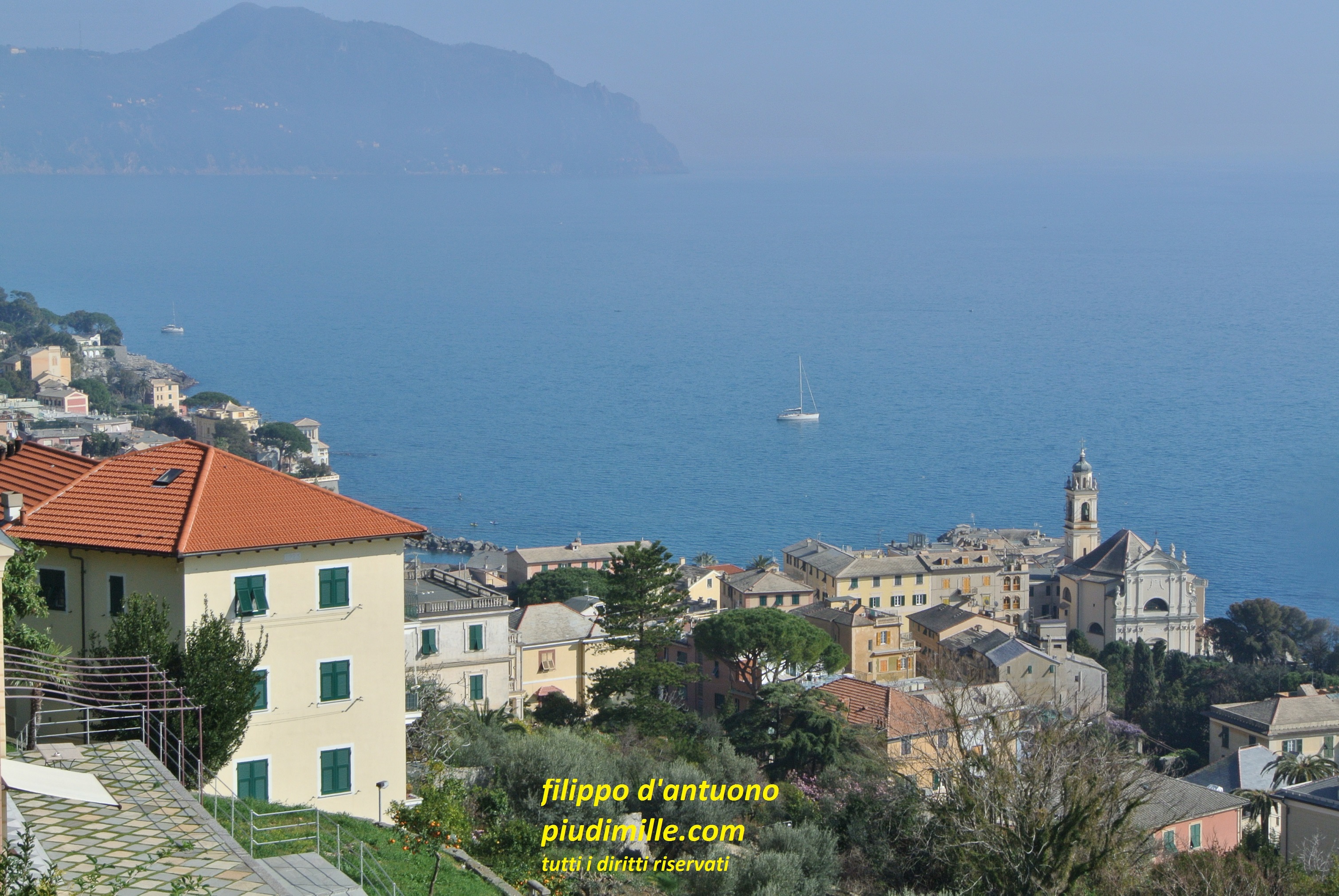
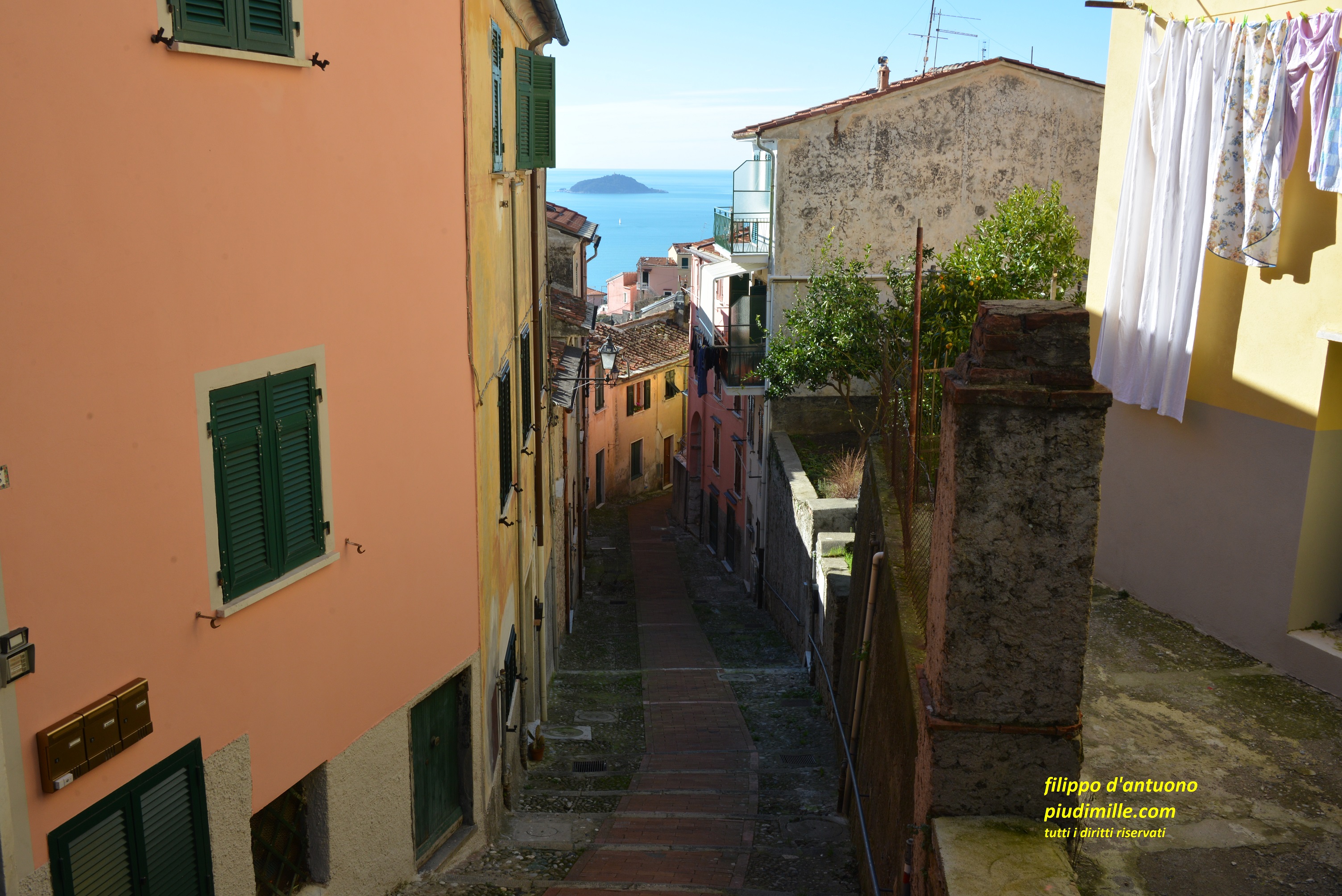
Between Nervi and Recco
Near to the Scoffera pass starts a ridge, heading east, delimiting the south side of valley Fontanabuona, Form the mount Bado knot, to the west, another ridge marks the limit of the Bisagno valley, also running parallel to the coast, to end in the city of Genova. On the sea side some short valleys end just in some peripheral centres of the city, like Nervi and Bogliasco. Finally, the ridge heading south from the knot of mount Bado marks the west limit of the Sori valley, which top end borders the upper Fontanabuona valley.
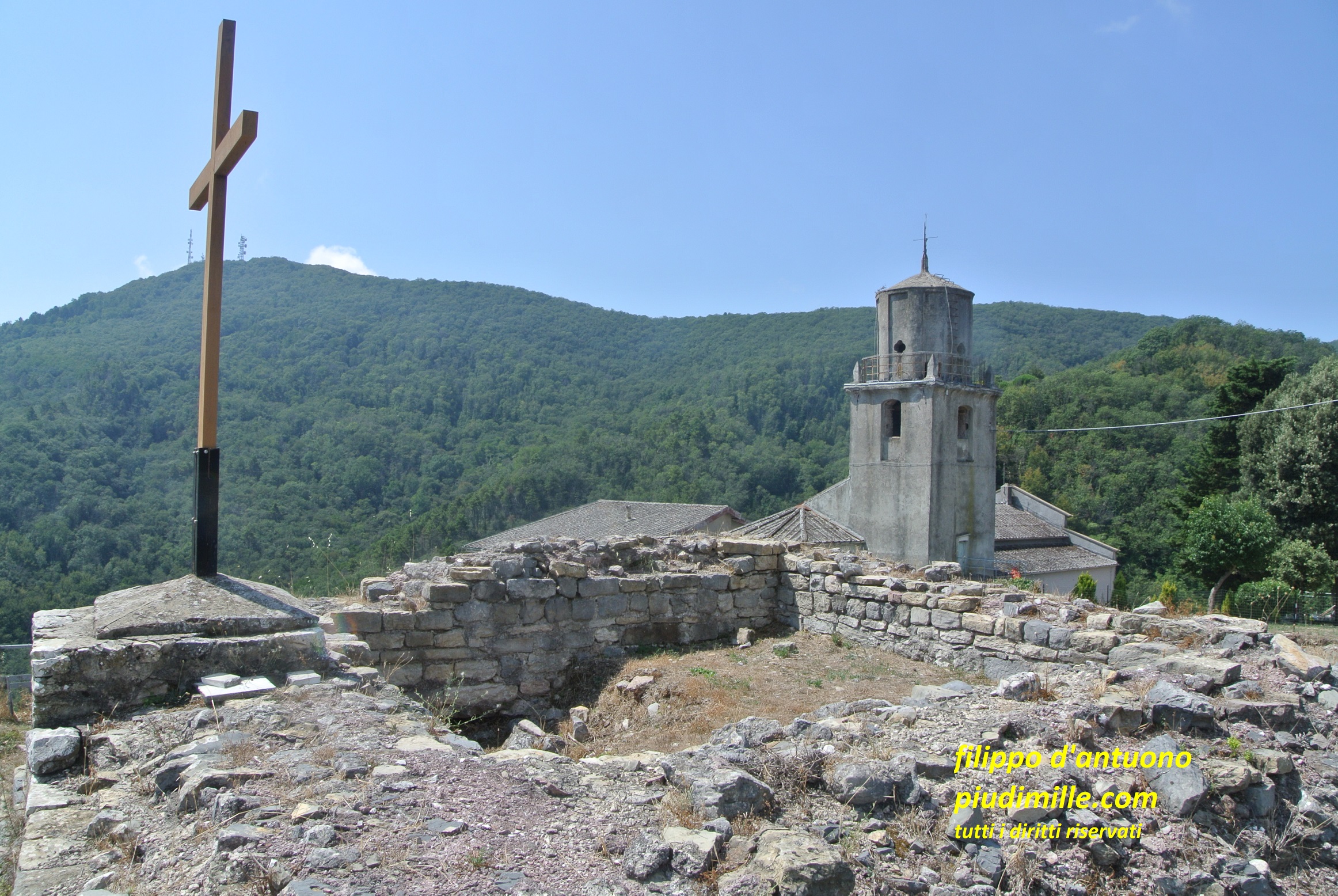
The paths ascending from this first stretch either run parallel to the coast or continue to the dividing coastal ridge. In these place also starts one of the characteristic features of the whole Ligurian coast; each coastal main town have one, or more sanctuaries on the above cliffs; some of them can now be reached also by car, some others not, and remain target for hikes or pilgrimage.
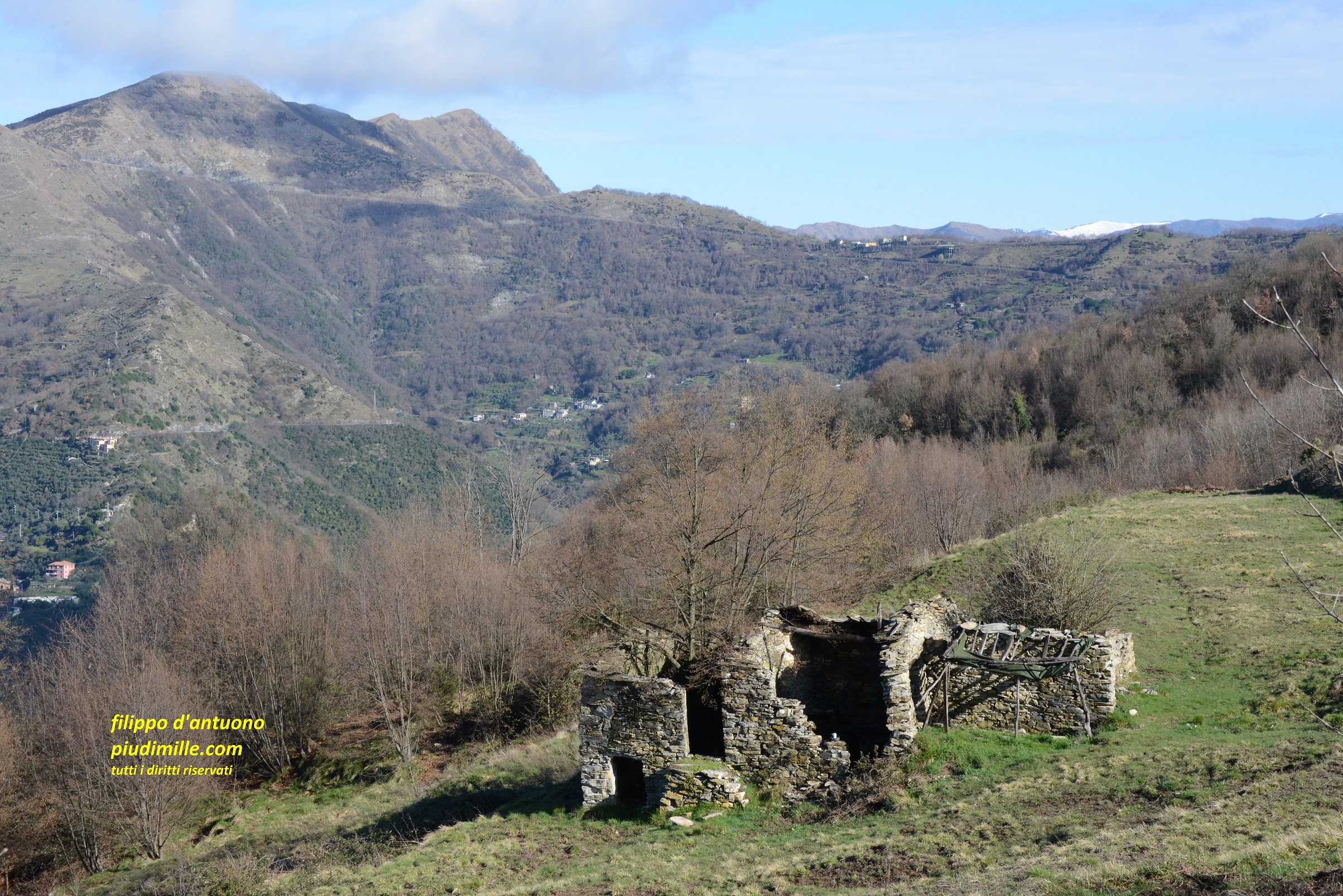
In this area you will also have the first surprises: ascending along the ridges from Nervi, Bogliasco, Pieve Ligure, Sori, few steps away from the coastline, in view of the highway, you find remote terraced valleys, with chestnut groves on the shaded sides, pastoral environments of archaic aspect, with mule tracks, dividing stone walls and ruins of rural huts, until mounts Bado and Croce dei Fo’, with a look of high mountain environment. From there, you have views of mount Antola, snow covered during winter, and the Maritime Alps arch that, on clear days, is visible from the whole the Ligurian east coast, but there is closer.
This kind of environment continues in the valley of di Recco, which eastern limit is the long ridge that, beyond the Ruta pass, raises to the mount of Portofino.
In this first stretch you have the choice of walking along the trails at mid height, connecting the coastal centres among olive groves, or turn around the tops end of the valleys, with more demanding hikes, through solitary and often evocative environments.
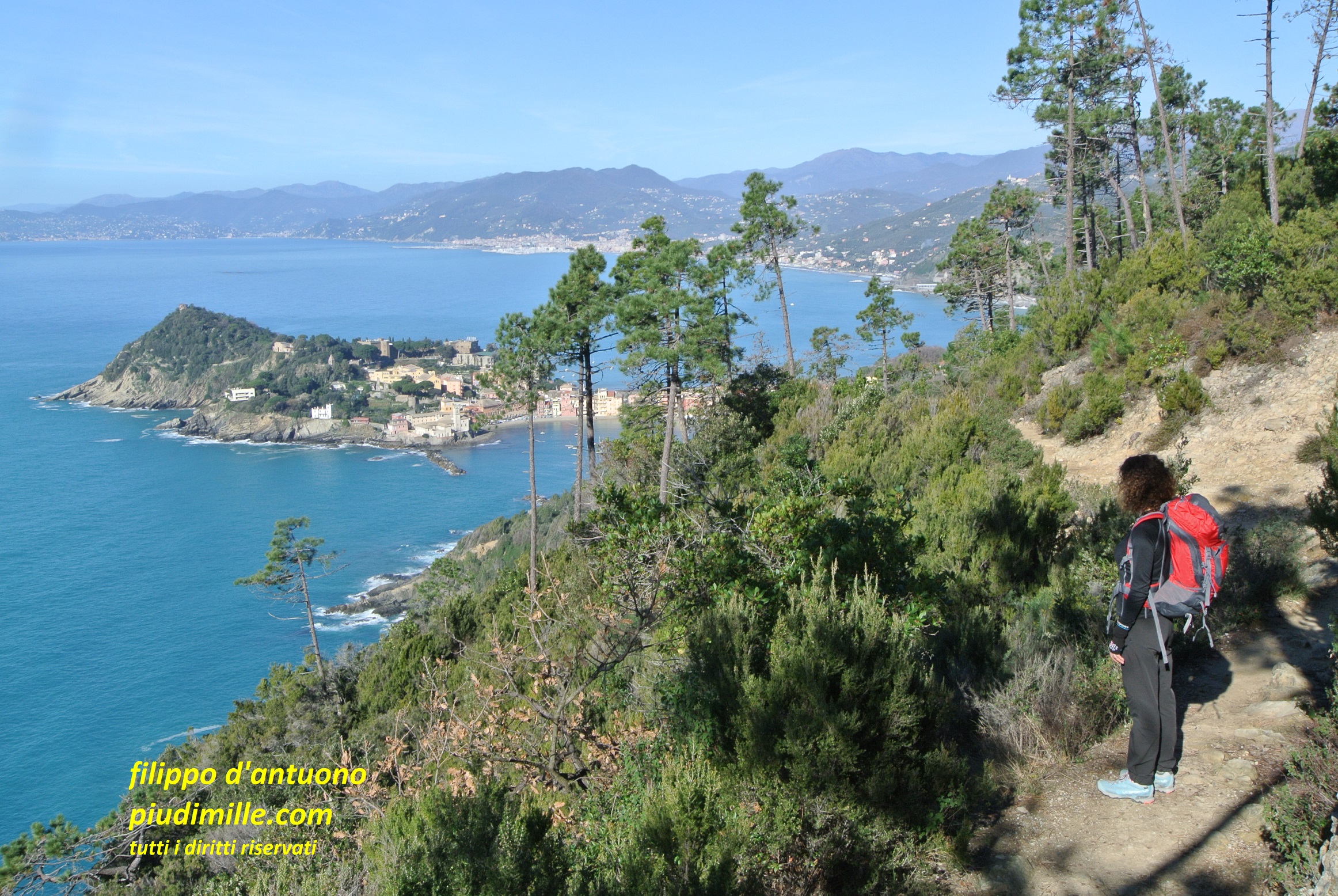
A view of Bolgliasco and the mount of Portofino, from the coastal path
The Sant’Apollinare snactuary, overlooking Sori from the hill
The evocative environment of the mountains between Sori and mount Bado
The mount of Portofino
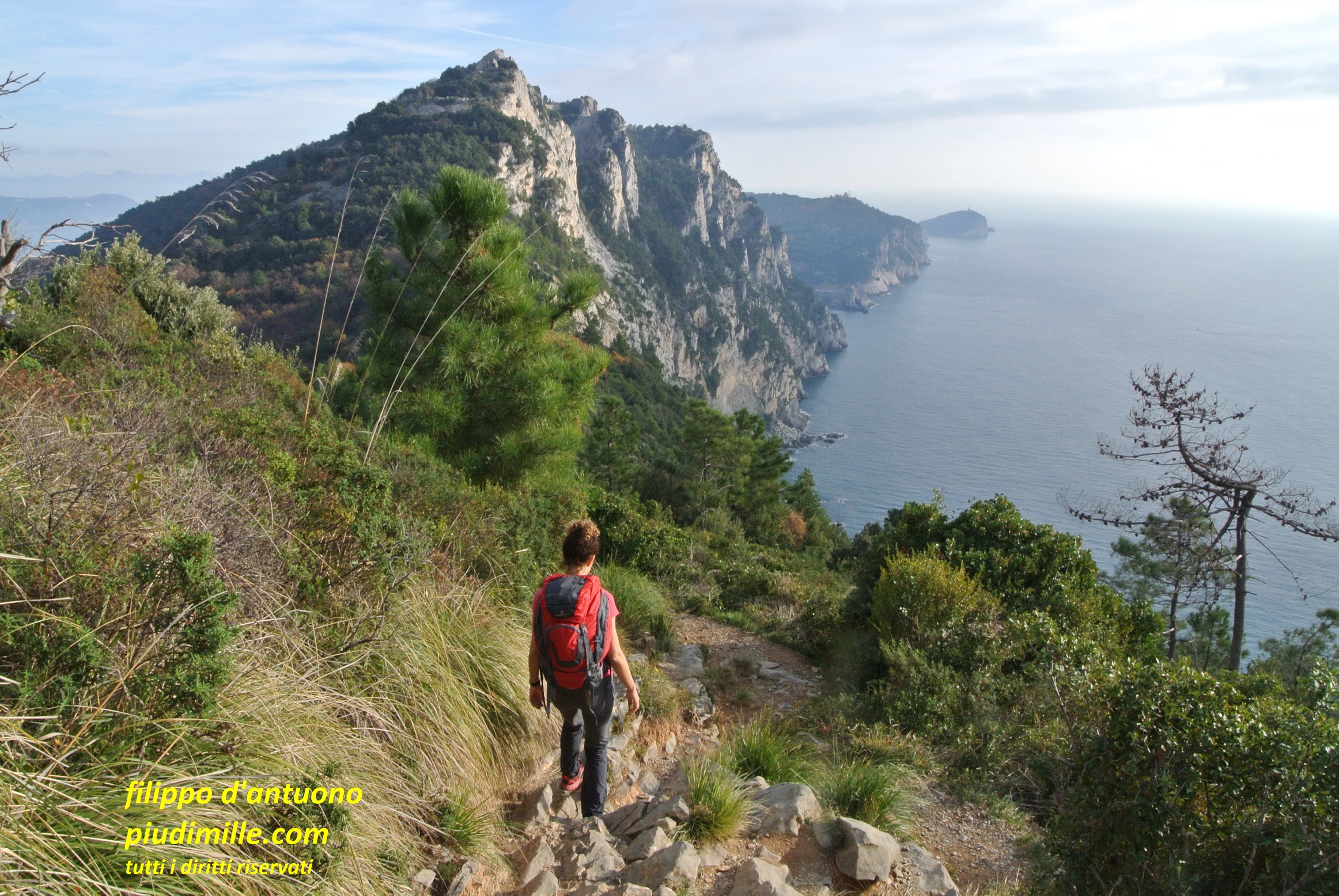
Mount of Portofino is a separate hiking world.Between Camogli, west, and Santa Margherita Ligure, east, you can find almost any kind of paths. More rough, sometimes demanding, in the western part, smoother and more relaxing on the side of Santa Margherita and Portofino. In the centre, there is the more famous touristic place: the bay and abbey of San Fruttuoso. The main towns: Camogli, Santa Margherita and even the historical centre of Rapallo, although oppressed by the extended and ugly outskirts, are worth a visit. On the other side, it can happen that Portofino could leave you disappointed, because of its somewhat elitist atmosphere and prices, let’s say, a bit out of market, for common people.
Inland of mount of Portofino, the coastal ridge turns around the valley of Rapallo, where it takes its more rough shapes, between mounts Bello, Manico del Lume and Pegge. Some of the trails there are fascinating and, at the same time, solitary and demanding.
Camogli, from the west side of mount of Portofino
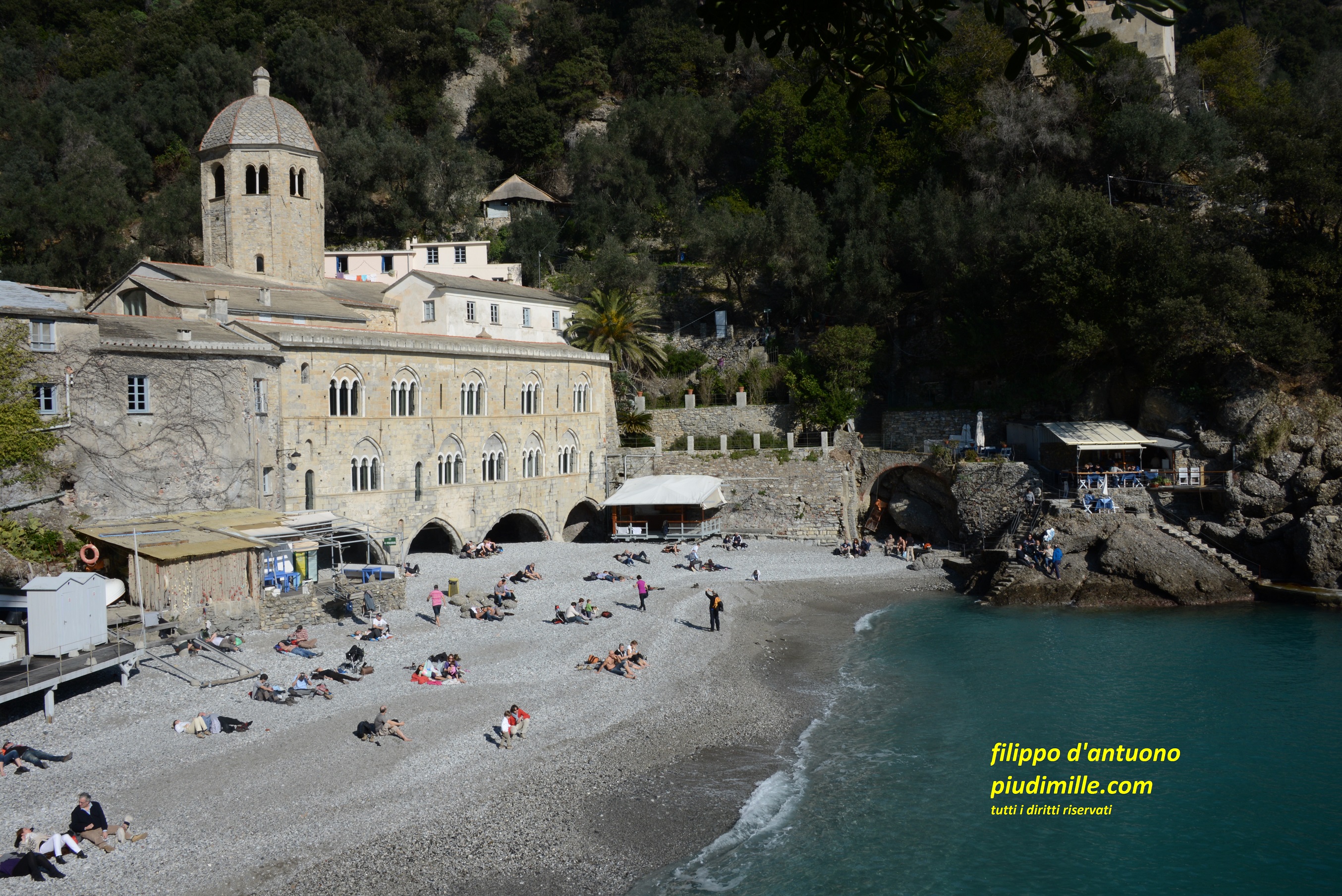
Descending to the bay and the abbey of San Fruttuoso
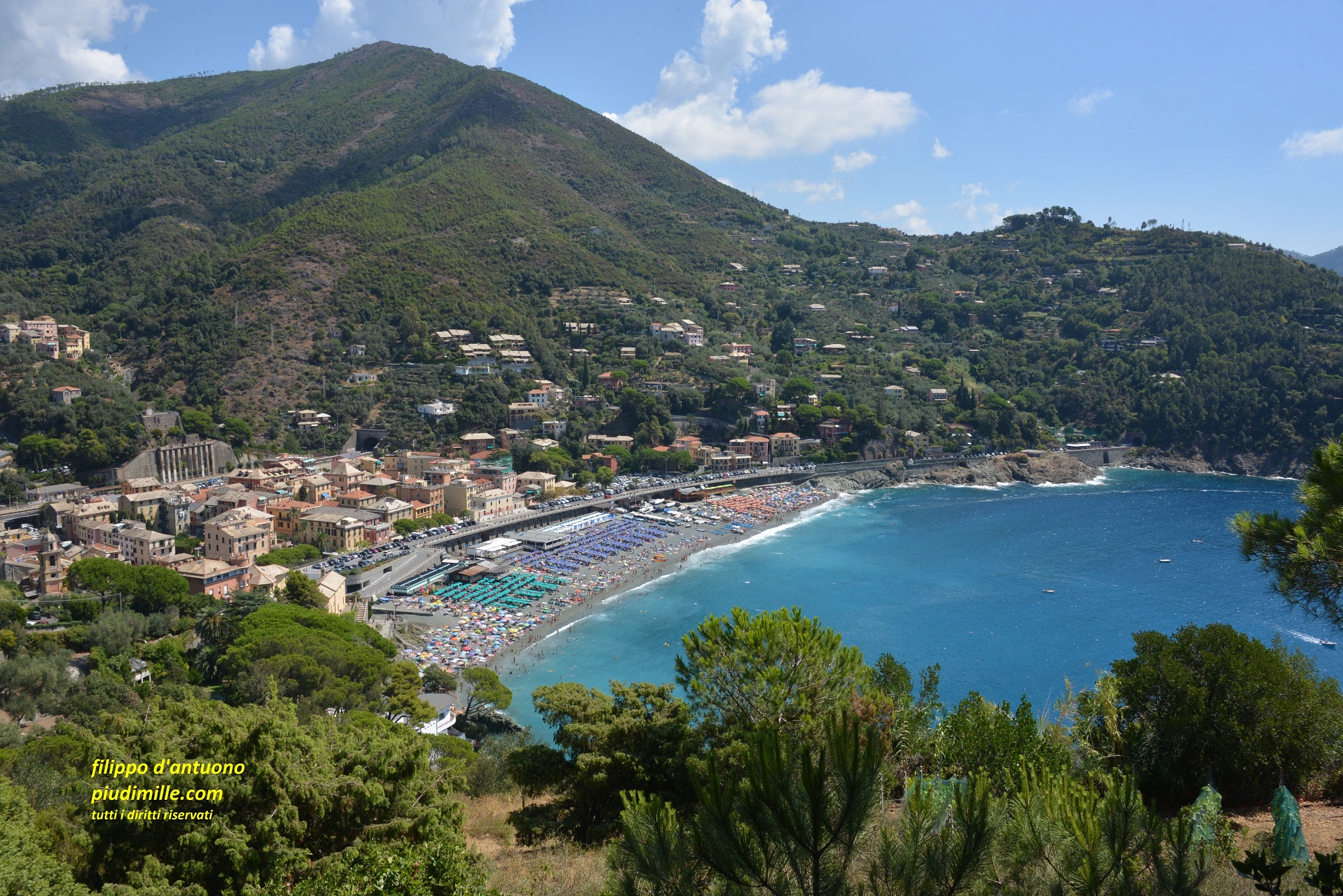
The Tigullio, between Rapallo and Sestri Levante
Reached the Montallegro sanctuary, that is also the terminal of the cableway from Rapallo, the ridge becomes wider and forested, more accessible, but still very beautiful. It runs closer to the sea, so the valleys between Rapallo, Zoagli and Chiavari are very short, but with beautiful itineraries either from the coast to the ridge or connecting the centres at mid height.
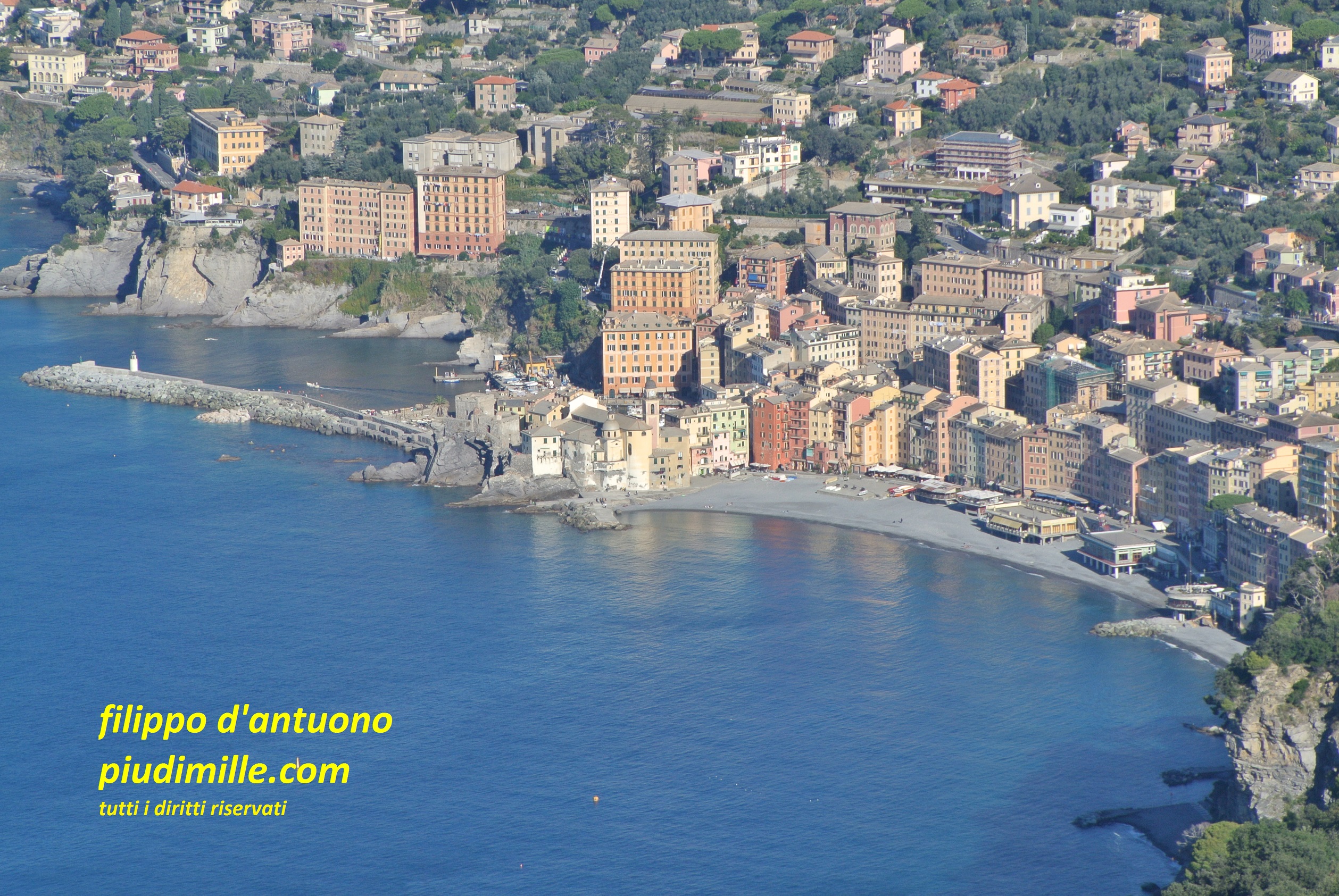
At Chiavari, where you do not have to miss the historical centre, the coastal ridge has a break; to find it again, cross the Entella mouth. to start again from Lavagna, where yuo enter in the central part of this stretch of coast..
From the town, you can ascend on the ridge bordering the south side of Graveglia valley, still among stone terraces, olive groves and views over the sea, to suddenly enter again in somewhat mountain environments, to mount Capenardo; or, you could stay lower, to reach Sestri Levante, also using a stretch of the ancient Roman via Aurelia.
The steep sides of mount Manico del Lume, from Montallegro
The beautiful view from the Santa Giulia church, between Lavagna and Sestri Levante
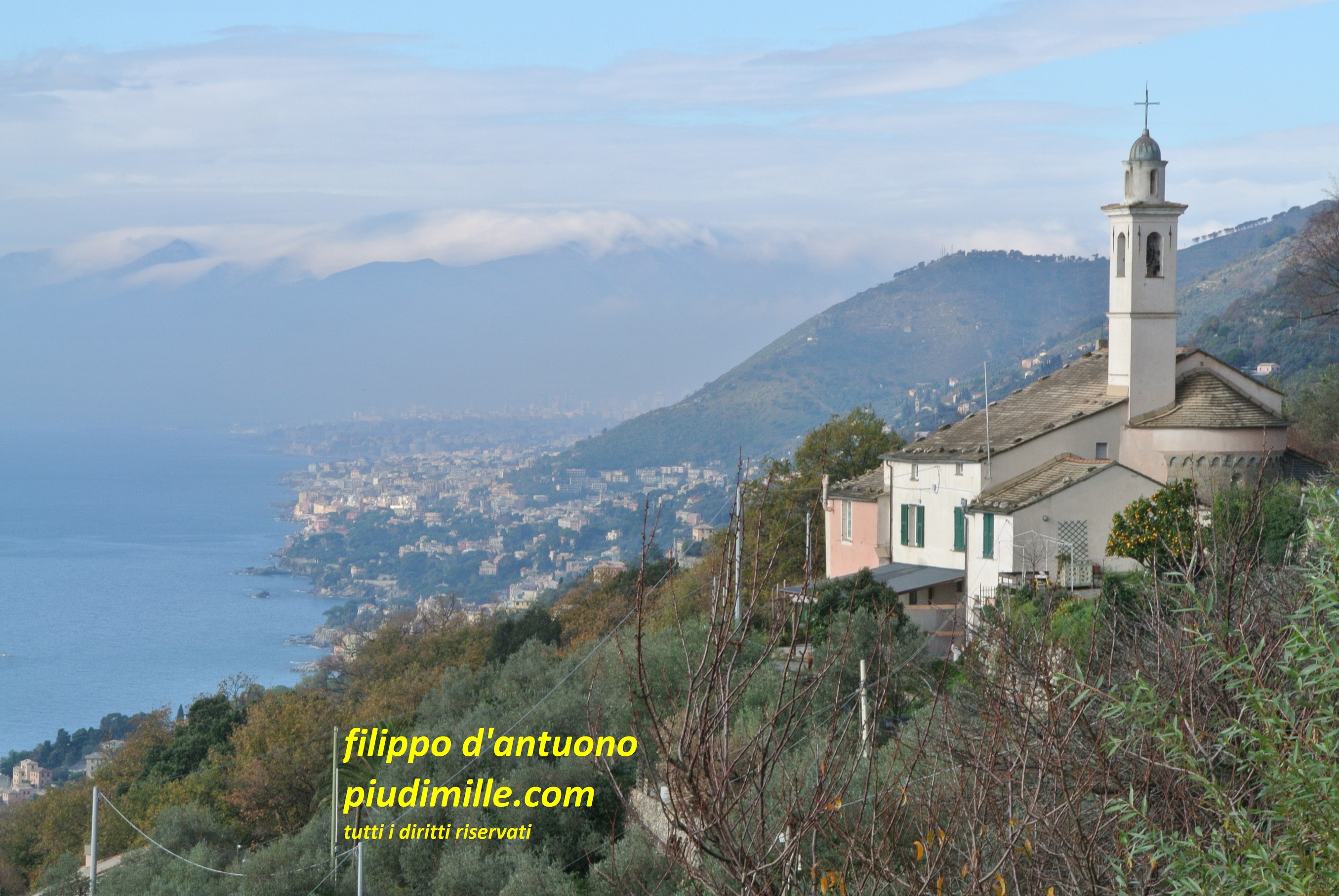
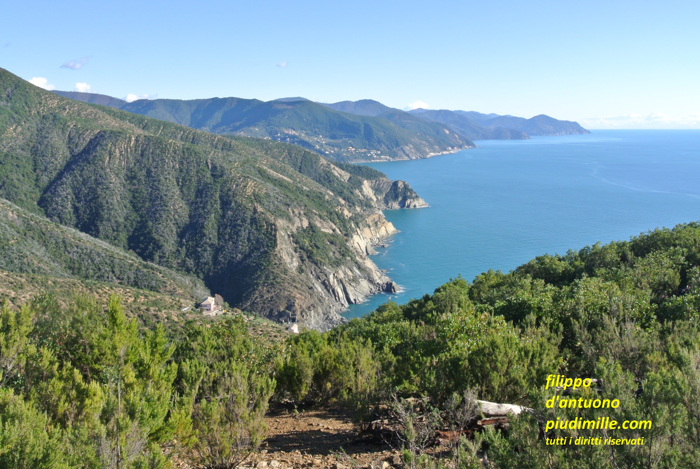
Between Sestri Levante and Moneglia
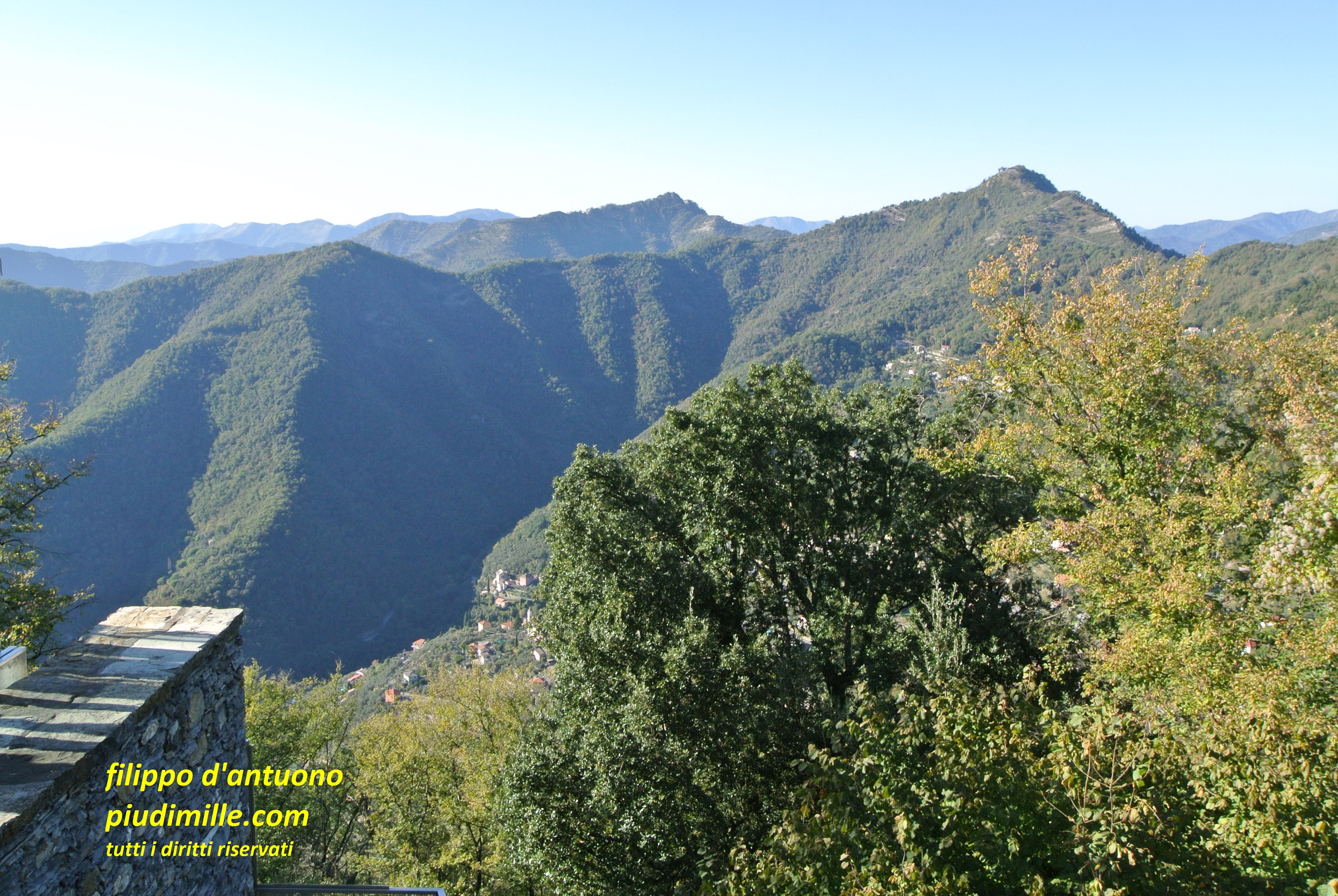
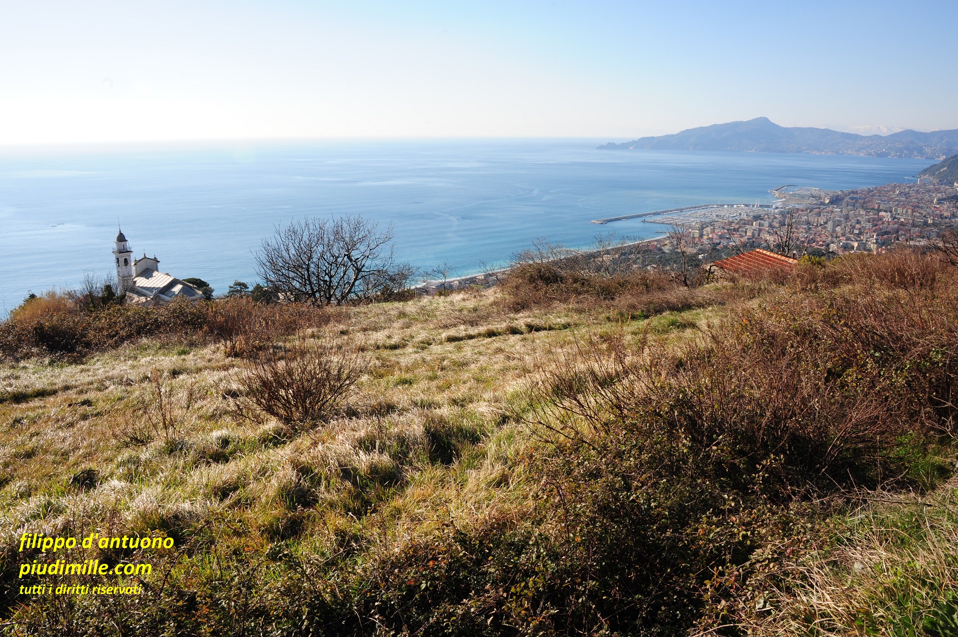
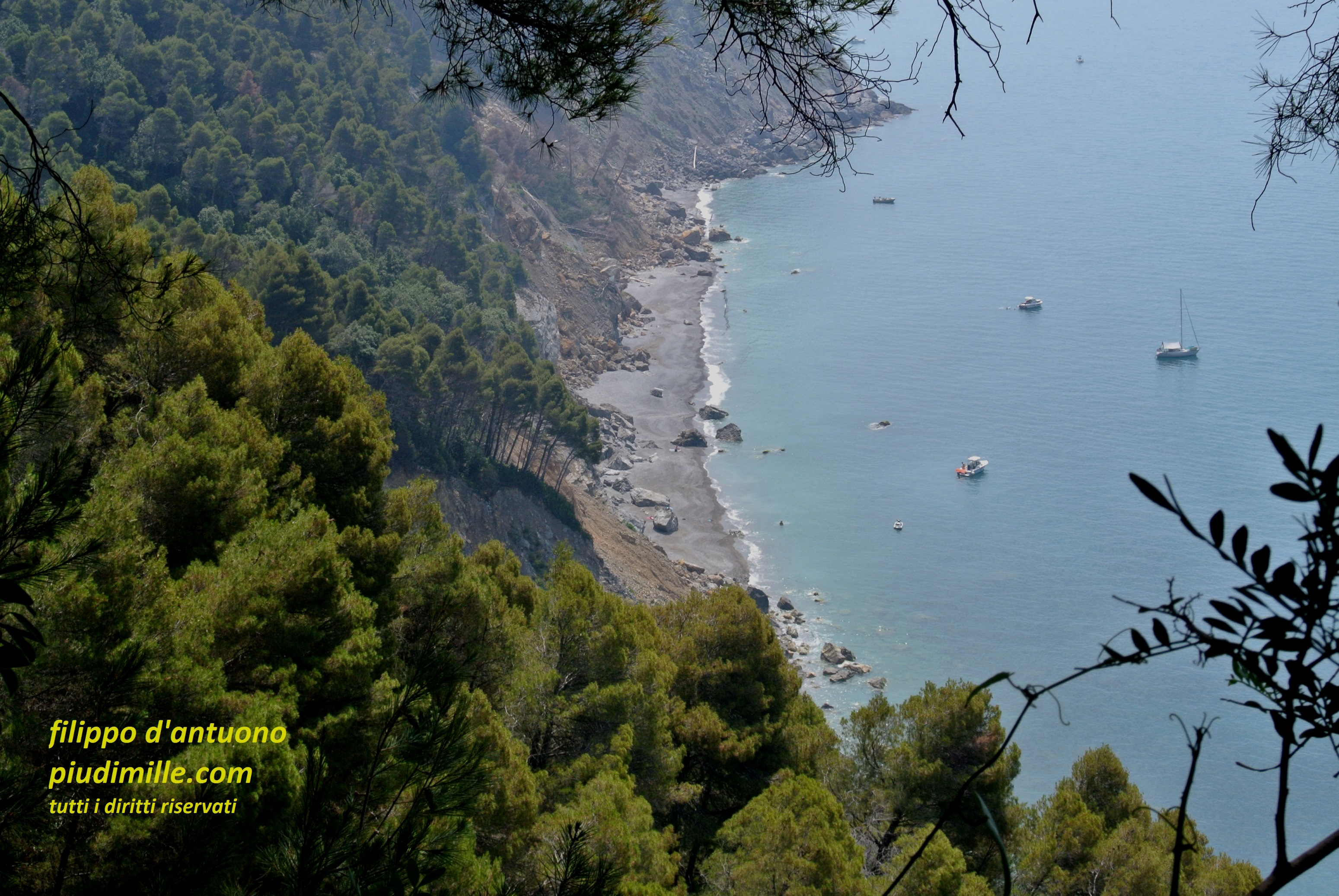
The morphology of this area is rather complicated. The valley of Sestri is shallow and not well defined. On the contrary, the Petronio valley goes west, inland of Sestri, generating another ridge, again almost parallel to the coastline. Between Sestri and Riva Trigoso, however, abruptly raises the punta Manara cape, with several beautiful trails, even if somewhat ruined because of the high frequentation.
Between Riva Trigoso and Moneglia the coastal ridge runs very close o the sea, to which it descends with steep flanks, covered with Mediterranean shrub vegetation, with the two capes of punta Baffe and punta Moneglia. Mount Moneglia is the highest summit of this part, beyond which the ridge almost coincides with the Aurelia road, to the pass Bracco.
Descending from punta Manara to Sestri Levante
The coast to the east, until punta Mesco, from punta Baffe
Ligurian east coast: between Moneglia and La Spezia, with le Cinque Terre
Between Moneglia and Levanto
The coastal ridge turns around the valley of Moneglia, bordered, to the east, by the other ridge descending from mount San Nicolao, and ending into the sea at punta Rospo, on the limit between the provinces of Genova and La Spezia. Along this whole stretch the coastal ridge is a bit set apart from hiking itineraries and marks the south limit of the Vara valley, then of the Levanto, and finally of poi the Cinque Terre, to the doors of the valley of La Spezia.
From starts a diverse and interesting area, with trails going up and down the dividing ridges of the valleys, between the towns of Moneglia, Deiva Marina, Framura, Bonassola and, finally, Levanto. These are towns very close to each other, along the coast, but connected by long winding roads: a situation already reminding the one of the Cinque Terre, even if in a very different context. And indeed, this area has been sometimes called “the small Cinque Terre”; in my opnion, wrongly, since it has its own well evident personality, with the olive coated valleys of Moneglia and Deiva, the rough coastline of Framura, the Mediterranean bush to Bonassola, with its nice hamlets and the buttress of mount Rossola, between Bonassola and Levanto. Levanto is a nice and welcoming town, with several interesting paths going up and cross its valley, through ancient hamlets, and olive groves.
The bay of Bonassola
The village of Legnaro, in the valleys of Levanto
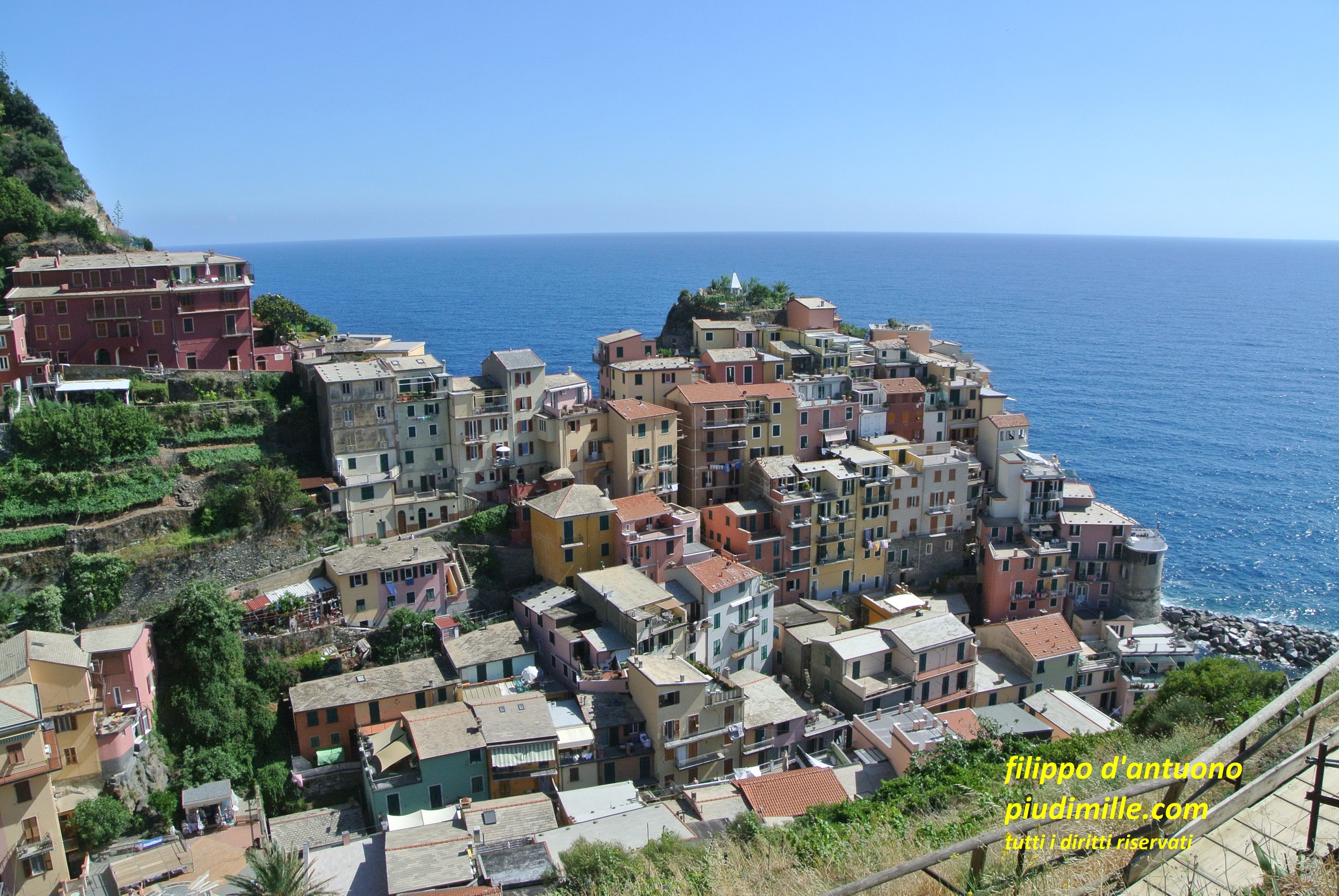
The Cinque Terre
Levanto is also the door to the Cinque Terre, which entry point is the trails passing on punta Mesco. The names of the five towns are perhaps too renowned: Monterosso, Vernazza, Corniglia, Manarola, Riomaggiore. The Cinque Terre are for sure unique, but also so renowned to be often overcrowded. For sure, they are a must: people who still do not know them,, may remain fascinated; the incredibly steep coastline, shaped with stone terraces, many of which still cultivated with vineyards, represent a world class landscape. However, for a hike-style visit, I suggest to plan something somewhat out of season and to not neglect the less beaten paths.
In summary, after doing the classic “coastal path”, seen some of the sanctuary and the unbelievable sight of the Volastra vinayards, find your way also to the forests of the top ridge, with views of the Apennine, that will engage you. Then, if you have time end mood, also descend the north side of the ridge to visit the old, almost neglected inland hamlets. In this way, you can have the complete overview of this area, where the life of the coastal towns, nowadays proudly claiming their touristic uniqueness, comes from a past, now forgotten, when their economy was integrated, and basically depending on, the resources coming from inland.
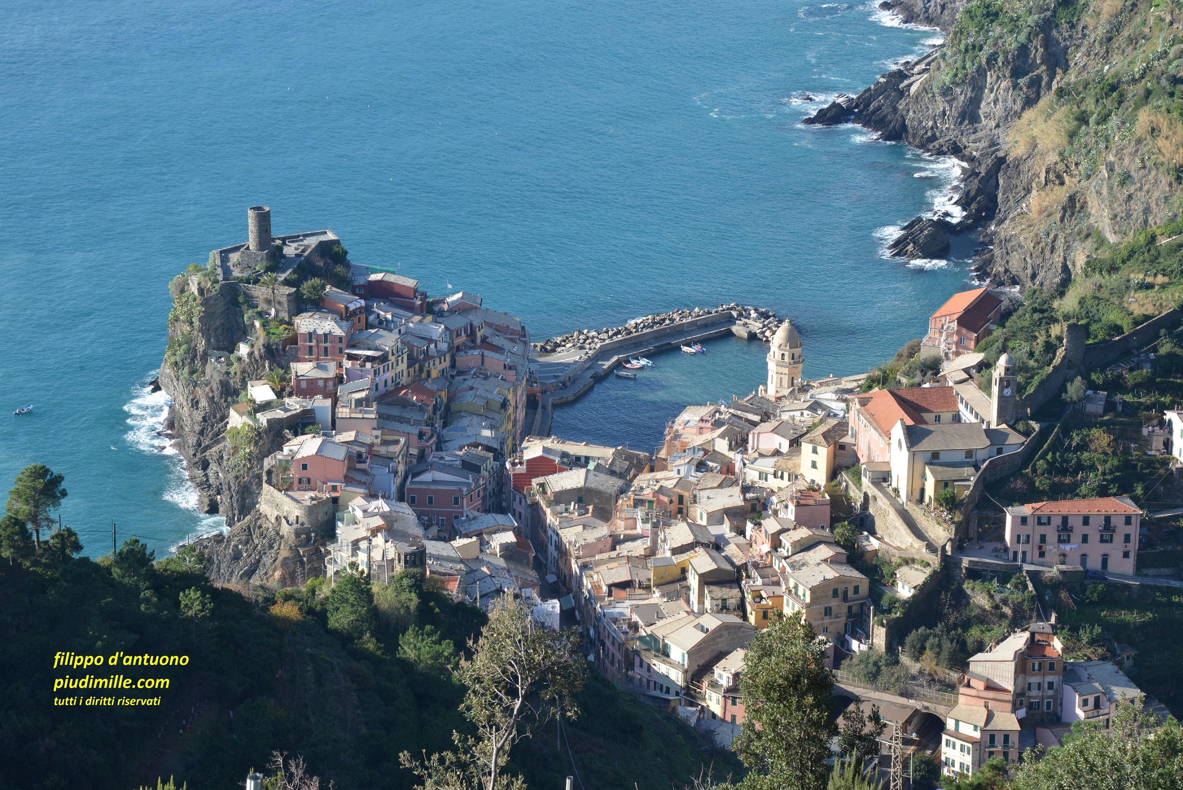
Vernazza, descending from the sanctuary of Reggio
And here one of the classical images of Manarola
Carpena, one of the villages of the inland side of the Cinque Terre
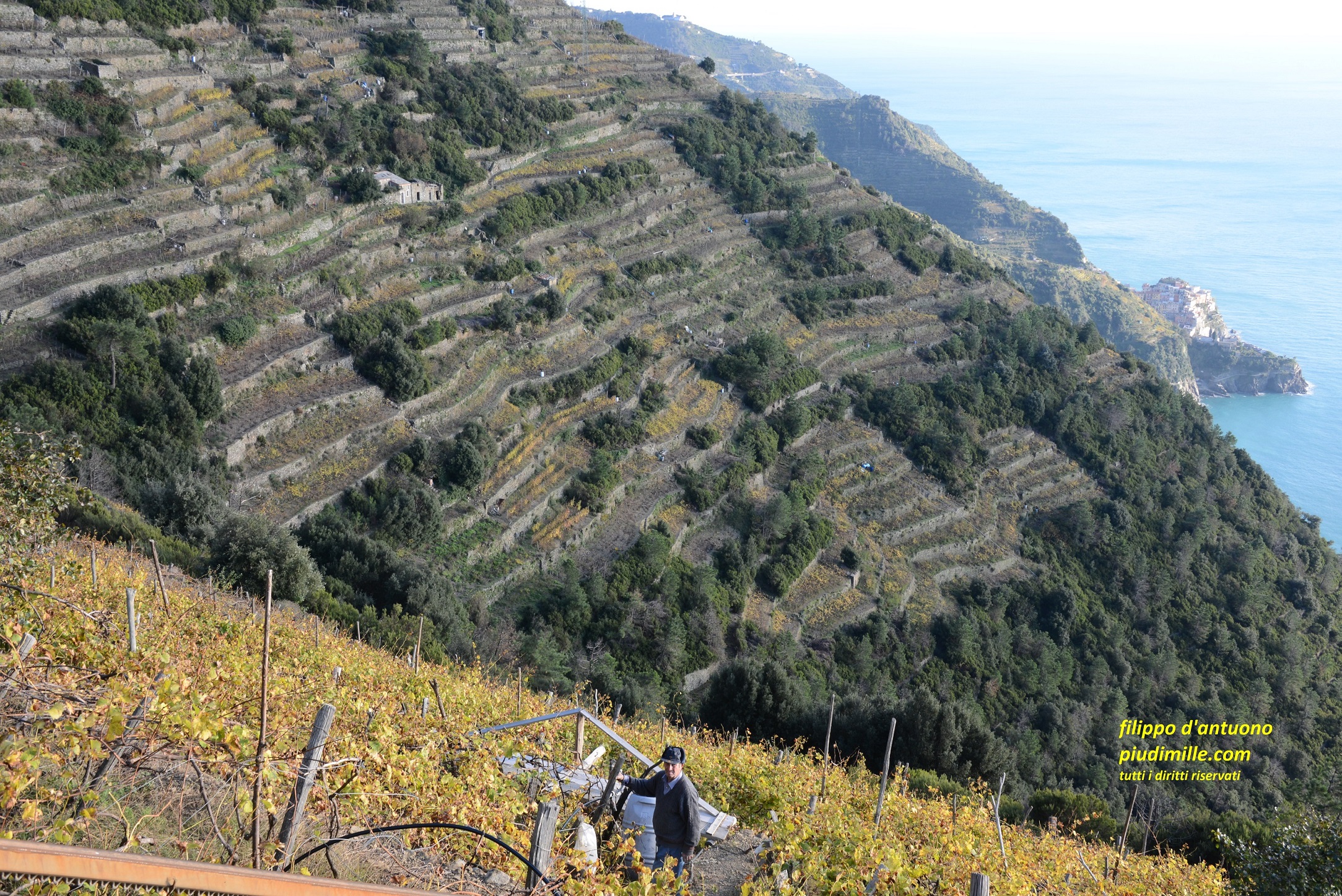
The terraced vineyards around Volastra, in vew of Manarola
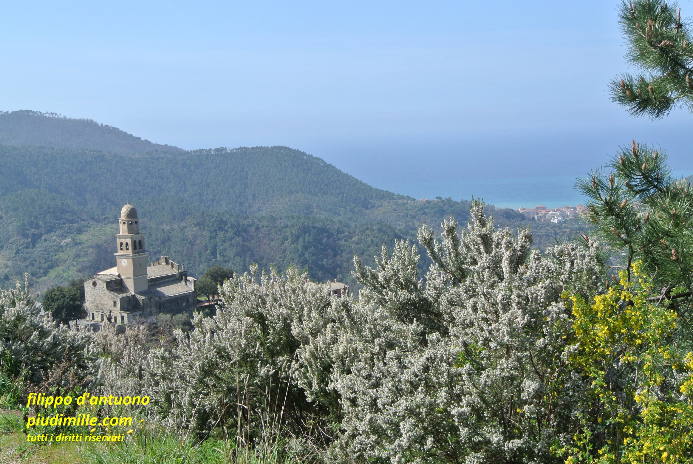
Tramonti and Portovenere
More or less at the east end of the Cinque Terre, from the coastal ridge, turning around the gulf of La Spezia, starts the rocky and rugged ridge ending into the sea at Portovenere. This is the extraordinary area Tramonti, with an initial stretch still with terraces, but flanks so steep that the small hamlets look as pasted to the mountains, until the small centre of Campiglia, on the top of the ridge. Further on, the coastline is so steep that any settlement was impossible, and plunges into the sea, until Portovenere; this is a town again not to be missed, but also again a better target for an out of season visit. An interesting option, with nice trails, is island Palmaria.
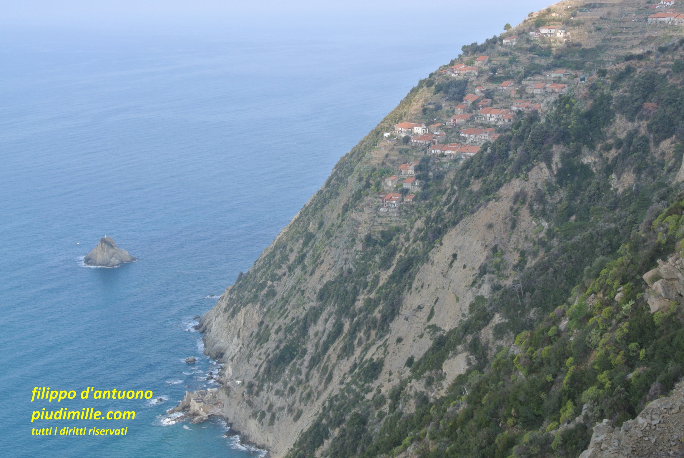
The village of Schaira, pasted to the cliff of the coast of Tramonti
The coastline between Campiglia and Portovenere
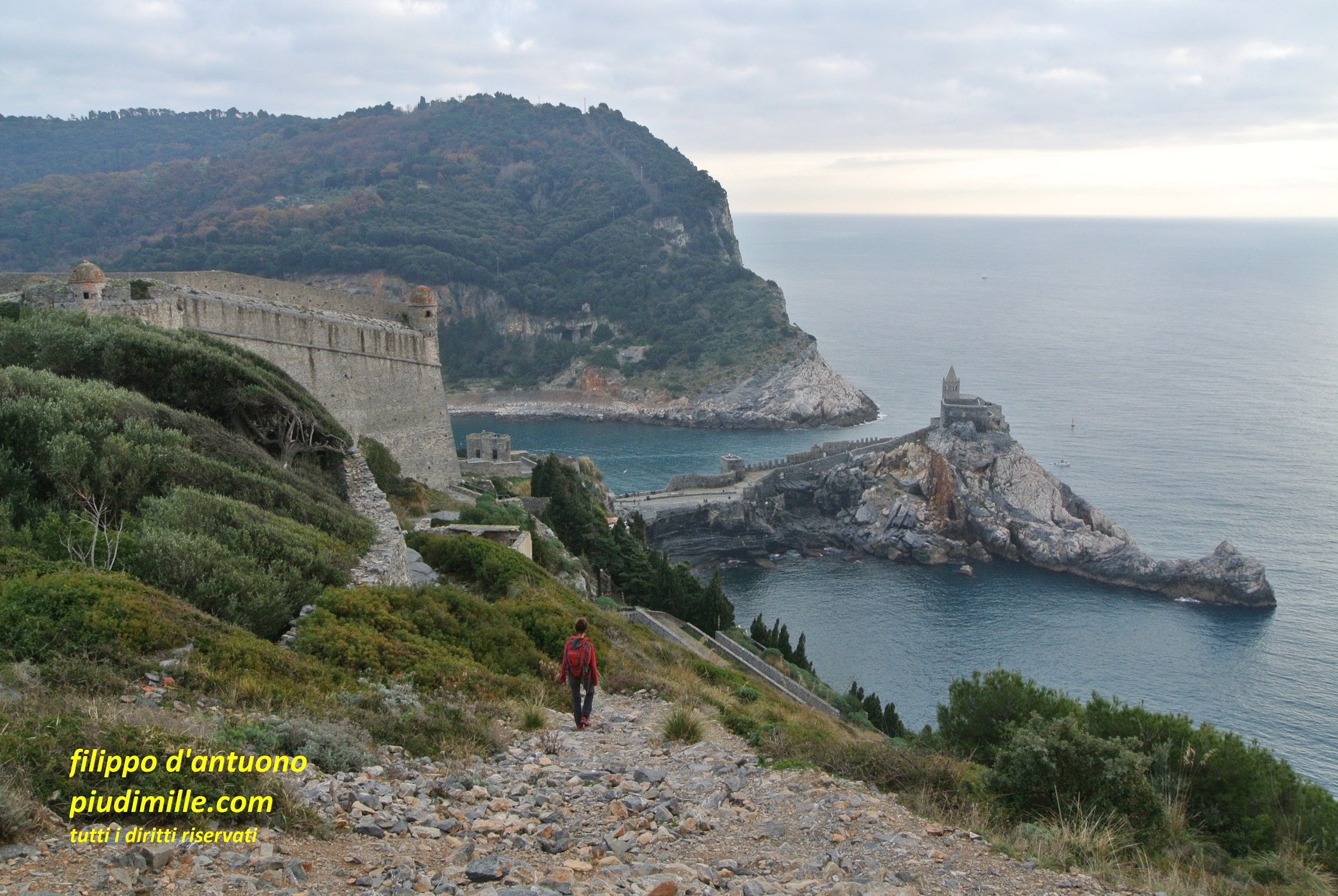
The spectacular descent to Portovenere
Ligurian east coast: bewteen La Spezia and the river Magra mouth
Around La Spezia
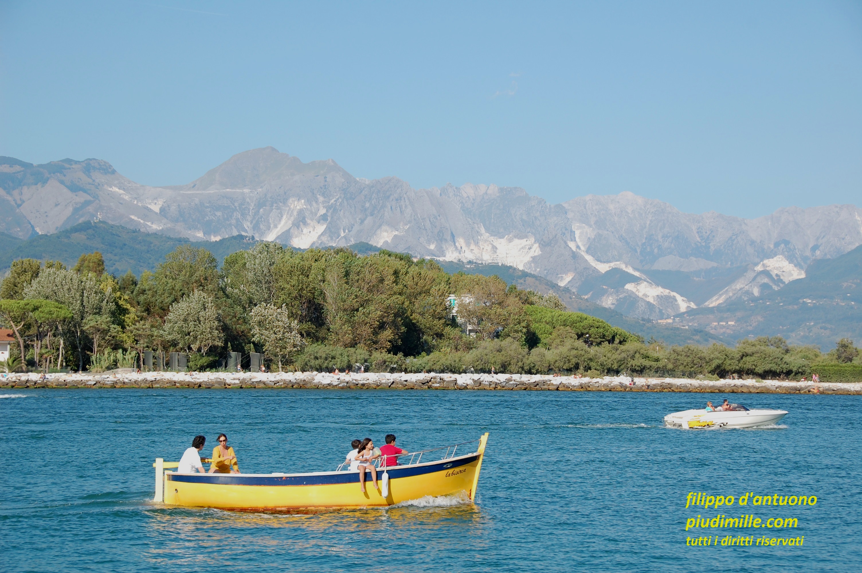
For as much it could sound unsusual, and it will be a surprise, do not neglect the path network starting just from the city of La Spezia, or from its hamlets, on the side of Portovenere. Many of these trails are old mule tracks, that connected the city to its uphill hamlets, among olive groves, continuing further to cross the coastal ridge, to the Cinque Terre or Tramonti, in the west part of the gulf; or, they headed to the centre of the Vara valley, in the central part or, again, they ran along the smooth ridge between the Magra valley and the sea, to the Caprione promontory, in the east part. Walking along the paths around the gulf of La Spezia will, certainly reserve something unexpected, with stunning views of the Apennine and the Apuanian Alps and, of course, the harbour and the sea.
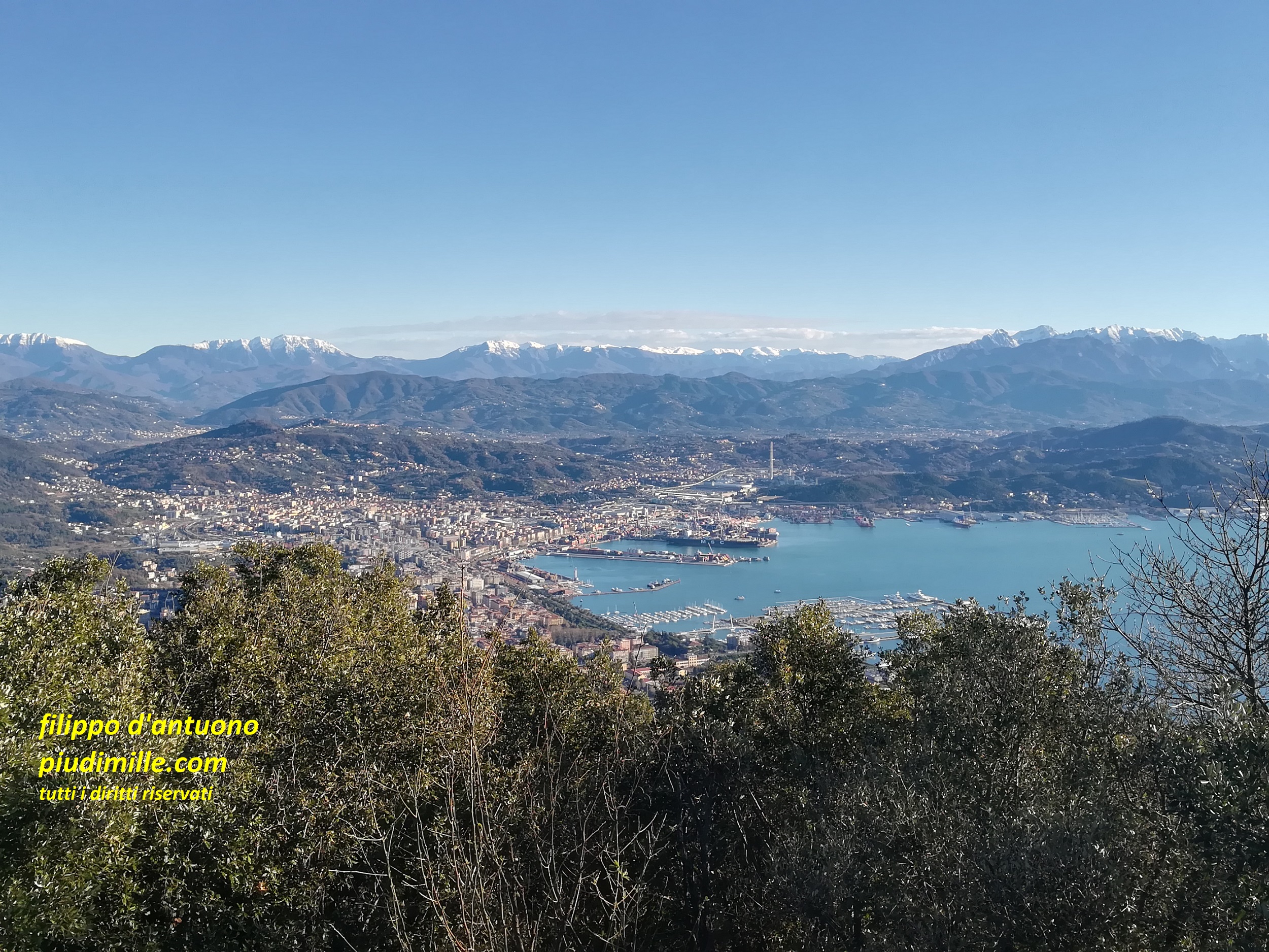
View of the city of La Spezia, from mount Santa Croce, with the background of the Apennine and the Apuanian Alps
One of the historical lanes, ascending from La Spezia, to cross the coastal ridge
The promontory of Caprione, to Bocca di Magra
But it is not finished yet. Beyond the city, the paths pass inland of Lerici, where you could be tempted to descend, unless you just came from there. Beyond the shallow pass of Pugliola the least part of this trip starts. The promontory of Caprione, dividing the river Magra valley from the sea, e il mare, is covered by a nice path network, again with views over the sea, the Apennine and the Apuanian Alps. The side overlooking the sea is steep and little accessible, with Tellaro, the last coastal town, reminding a lot the Cinque Terre, with nice terraced olive groves. There are then the fascinating villages of La Serra, at mid height and Montemarcello, on the topo of the ridge; the cape is covered, by a nice and unique Aleppo pine forest and also has some secluded and out of time places, on the mount Rocchetta plateau.
View towards island Tino, through the lanes of La Serra
On the other side of the promontory there are the ancient town of Ameglia and Bocca di Magra, at the river mouth, still fascinating, even if not as much as it was before it was partially transformed into a touristic harbour. Between these places you can find all kind of paths, including some demanding ones. And, again, stone terraces, abandoned settlements, olive groves, Mediterranean bush, pine forests and views over the sea.
One of the hardly accesible beaches along the coast of the Caprione promontory
The classical view of the Apuanian Alps, from Bocca di Magra