Places in the Apennine of Parma and Lunigiana: an overview
Introduction
This page considers the part of the high Apennine between passes Cisa and Lagastrello.
It therefore corresponds to the oriental part of the Apennines of the Parma province and to central Lunigiana. As usually, establishing limits is quite difficult, and most needed for convenience reasons. This stretch of Apennine is however relatively short and well characterised even if with great differences, as usually, between the north and south sides.
Apennine of Parma and Lunigiana: between passes Cisa and Cirone
Even if we are not yet at the higher altitudes, a part of this area is renowned, being crossed by the via Francigena.
So, although I am not really a fan of organised “cammini”, let’s start just from this ultra-popular long run trial. In our area, the via Francigena starts, on the Parma side, from Berceto, a fascinating little town. Then it start ascending, without any particular highlights, toward pass Cisa, that it however does not directly reach.
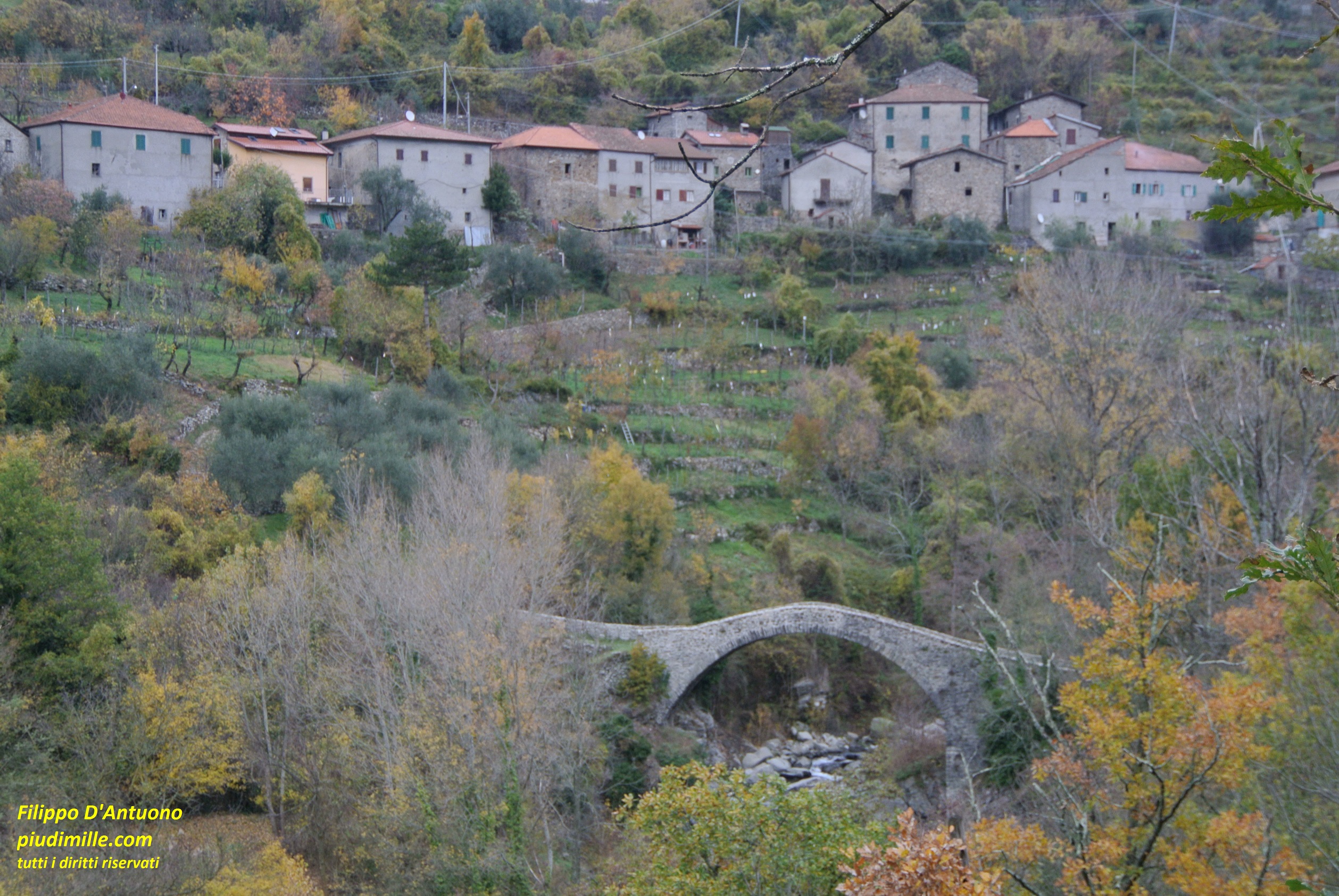
In fact, the via Francigena reaches the dividing ridge close to mount Valoria, in an open and really panoramic place, with the views of mount Orsaro and the sea. It seems that some documentation states that the “original” via Francigena really passed from there; I do not know, could be, but certainly the sight there magnificent. The way then turns left, descending to pass Cisa. To avoid following the asphalt road, it crosses the pass and makes a long turn with up and downs inside the forest, exiting on the road again at pass Righetto. From there, it runs along the panoramic ridge of mount Cucco, then descending and winding across some of the ancient villages of the Antena and upper Magra valleys: Cavezzana d’Antena, Groppoli, Previdè, going to cross river Magra at the ancient bridge of Groppodalosio; beyond this point, the via Francigena ascends to Casalina, from where also the road to Prati di Logarghena starts, the it exists from the limits that I set for this page.
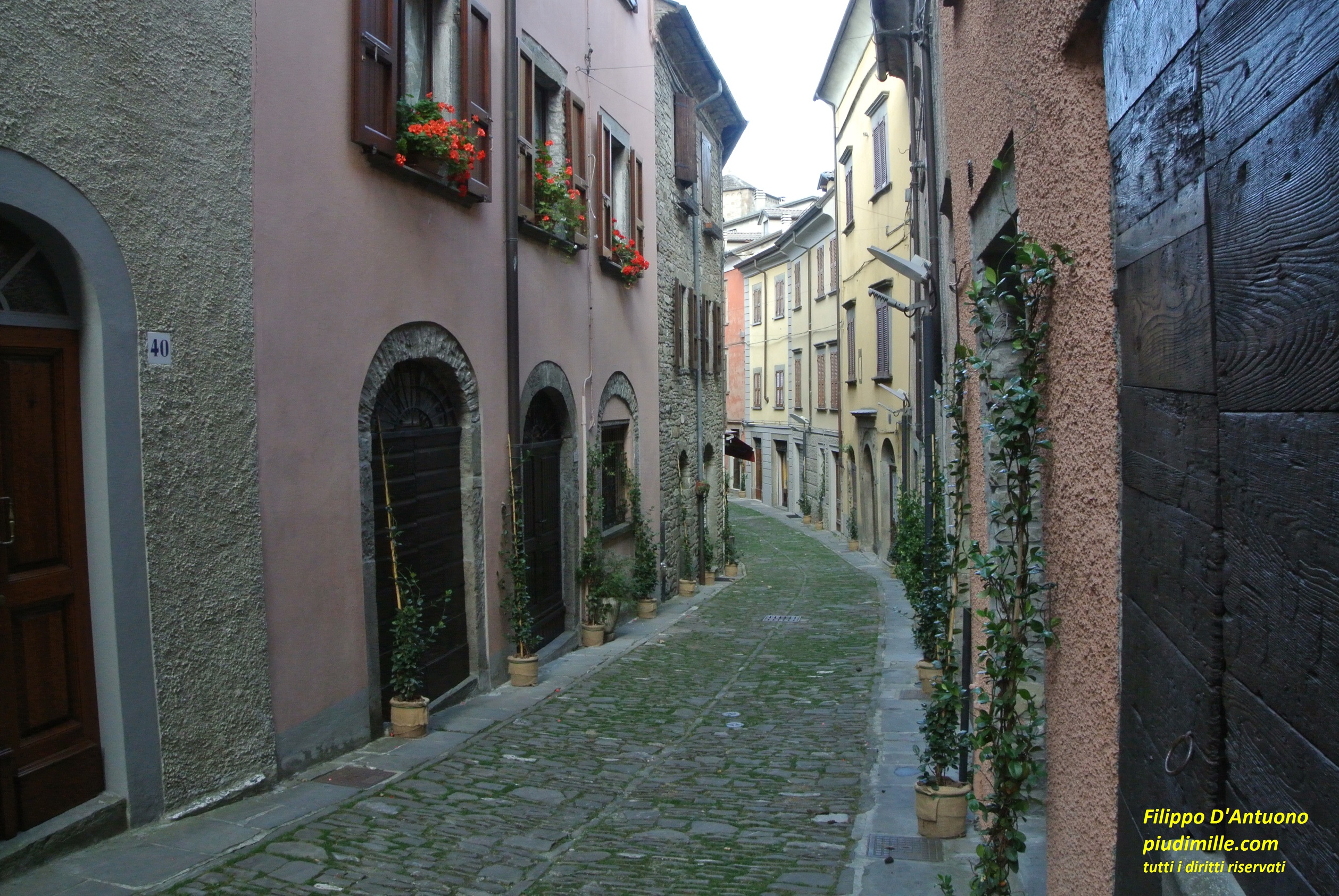
A road in the Berceto historical centre
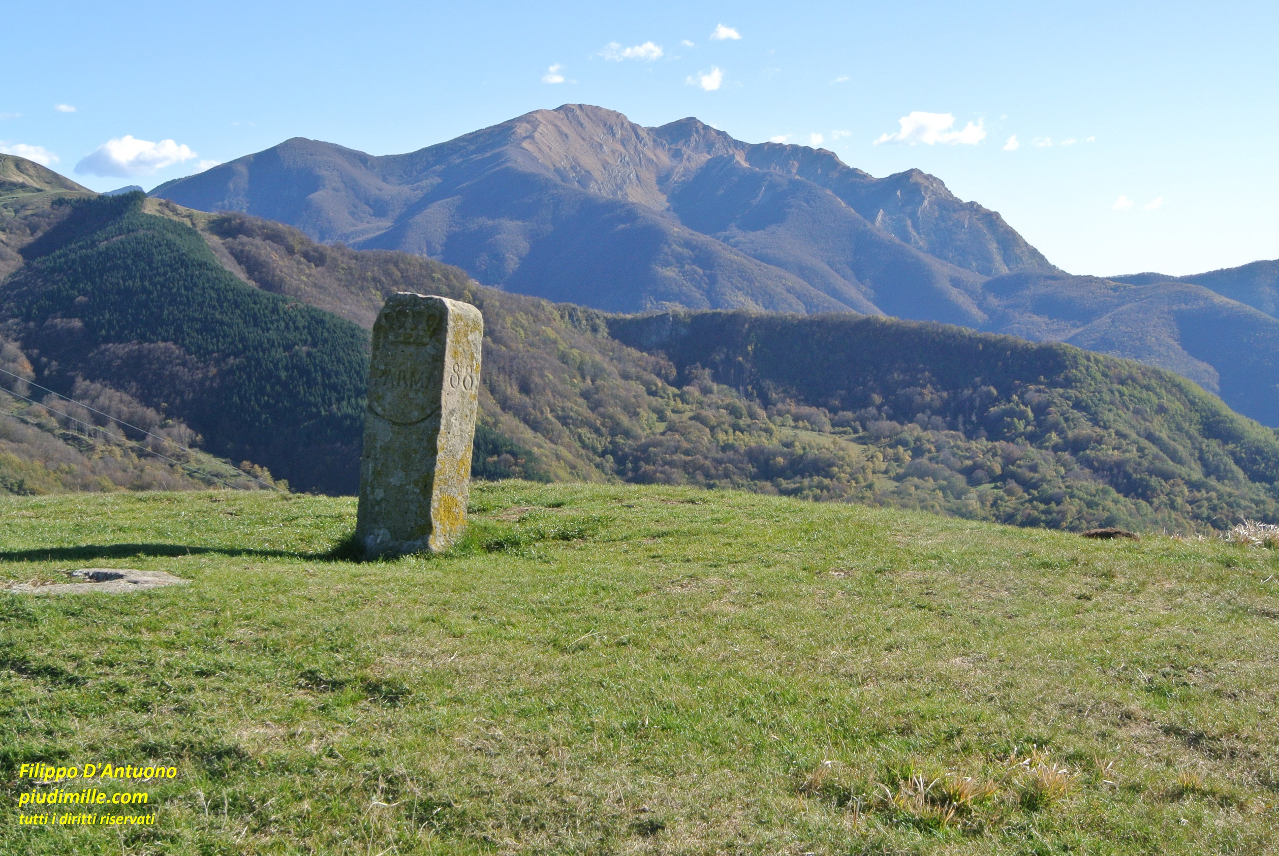
A view from mount Valoria ridge, where the via Francigena heads to pass Cisa
Well, after talking of via Francigena, do not forget the other fascinating places of this area. Let’s list some of them.
Also visit the other villages of this part of upper Lunigiana, not touched by the via Francigena and, maybe, use them as starting points for hikes to the main ridge, some of which already anticipate the great ascents of the next part, also using neglected and not signed paths.
Groppo del Vescovo is a remarkable, easily accessible, piece of rock, with the beautiful area of Piano del Monte, on the Lunigiana side, also reachable by car.
The old bridge across river Magra, at Groppodalosio
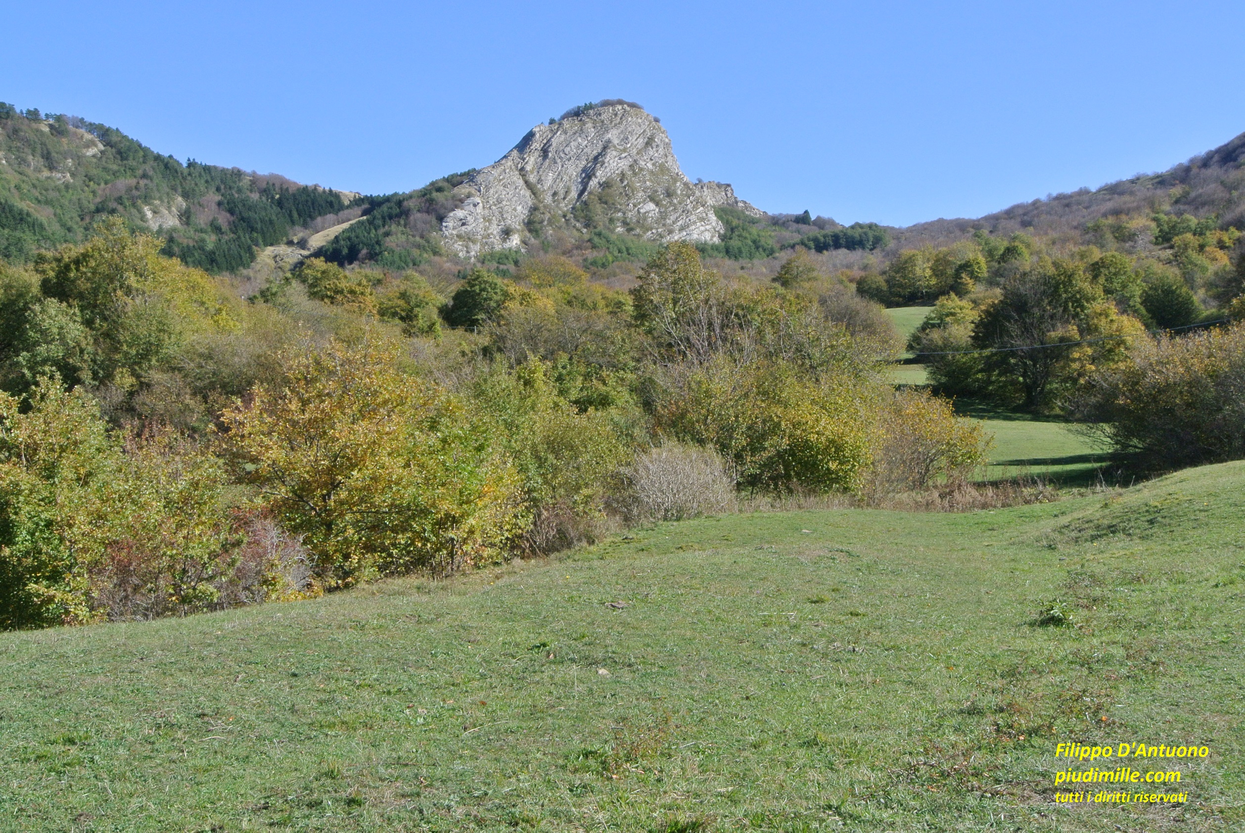
The meadows of Piano del Monte and Groppo del Vescovo
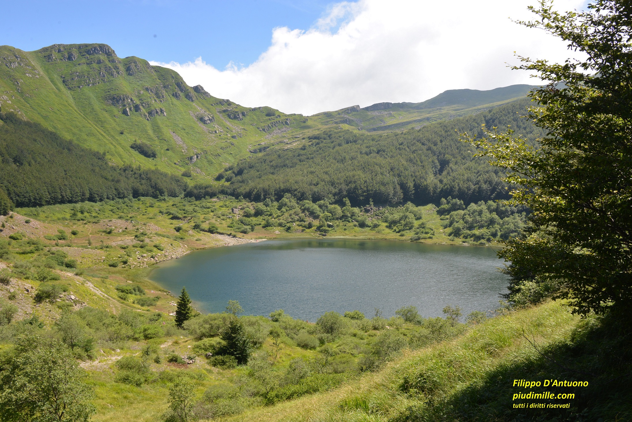
Groppi Rossi are a lesser known and beaten place, one of the volcanic mountains still quite common in these areas; together with the nearby tiny lake Bozzo, they represent a very suggestive area.
The main ridge, between mounts Fontanini and Beccaro, is open and panoramic, even if the ground is a bit ruined by erosion, and is easily accessible from pass Cirone.
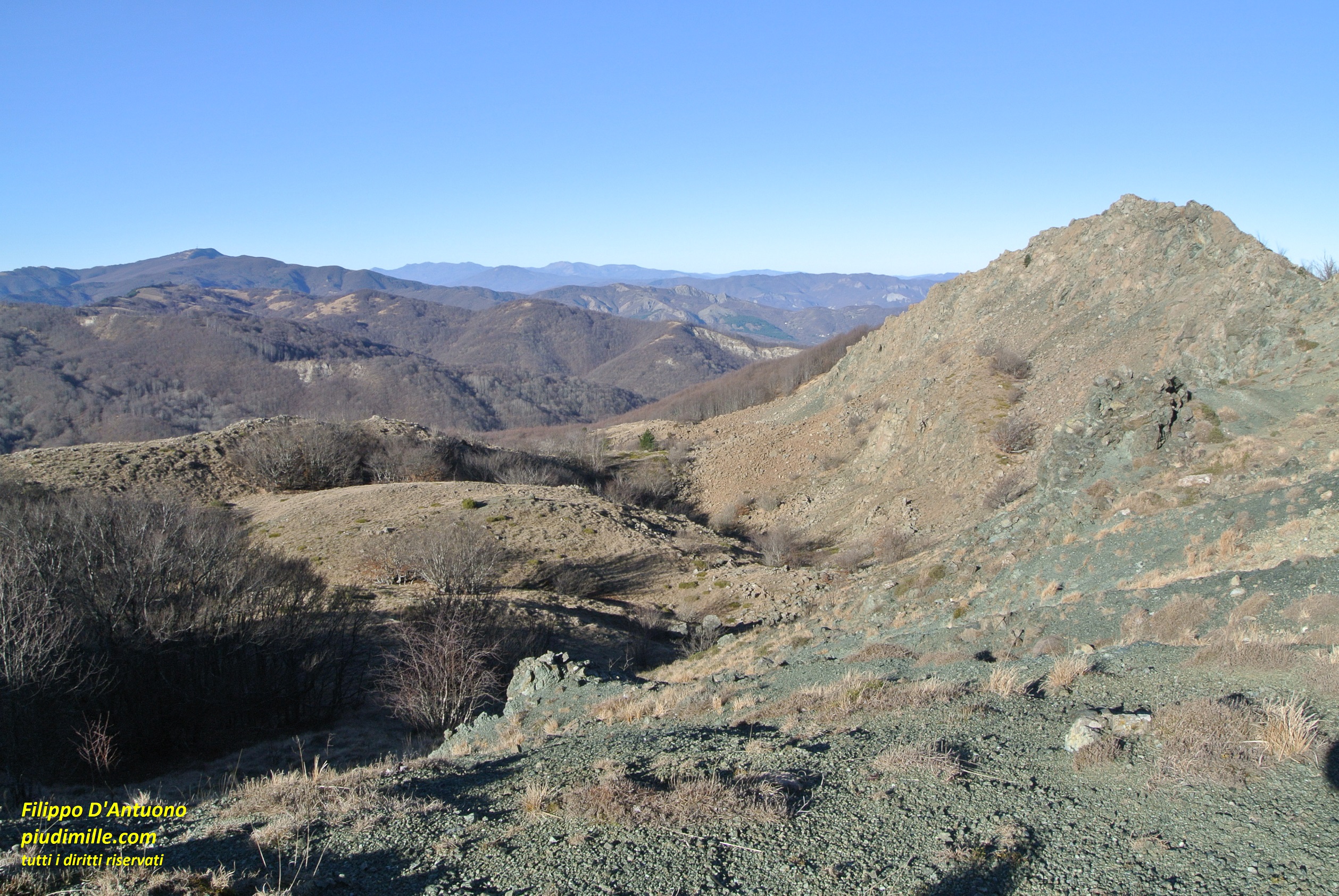
The evocative environment of volcanic rocks of Groppi Rossi
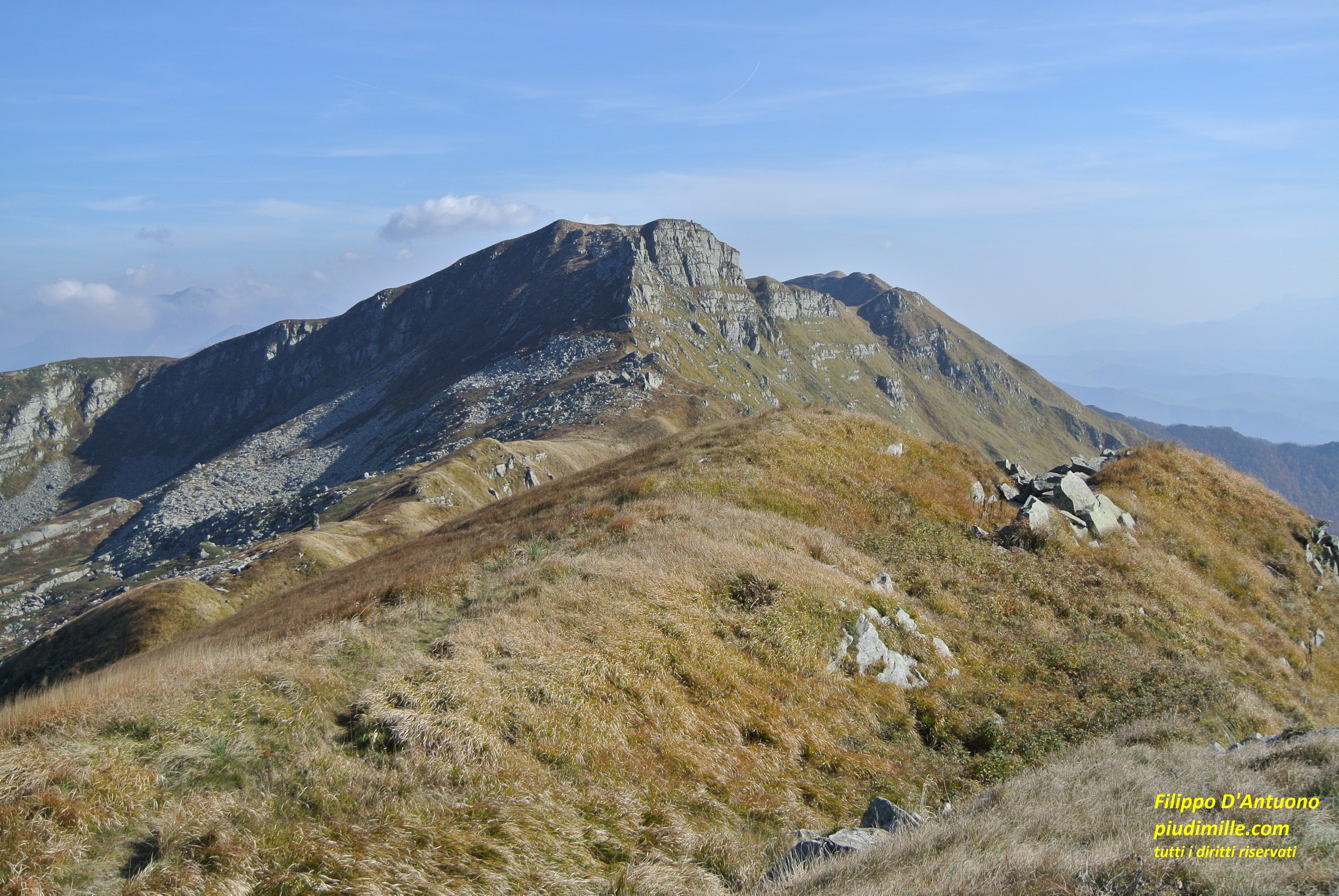
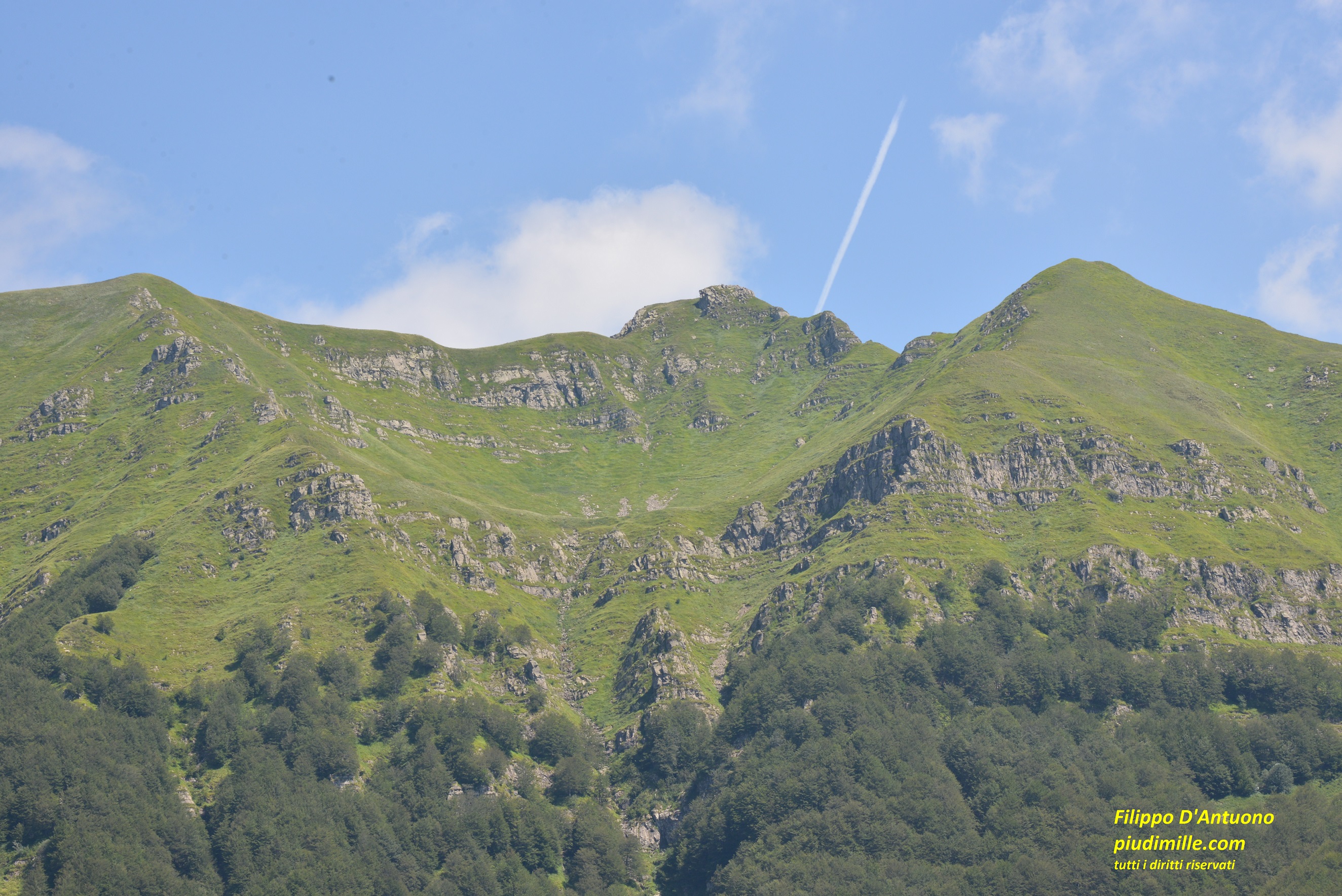
The ridge of mounts Fontanini and monte Beccaro, with the view of mount Orsaro
Apennine of Parma and Lunigiana: the Parma side of the main ridge
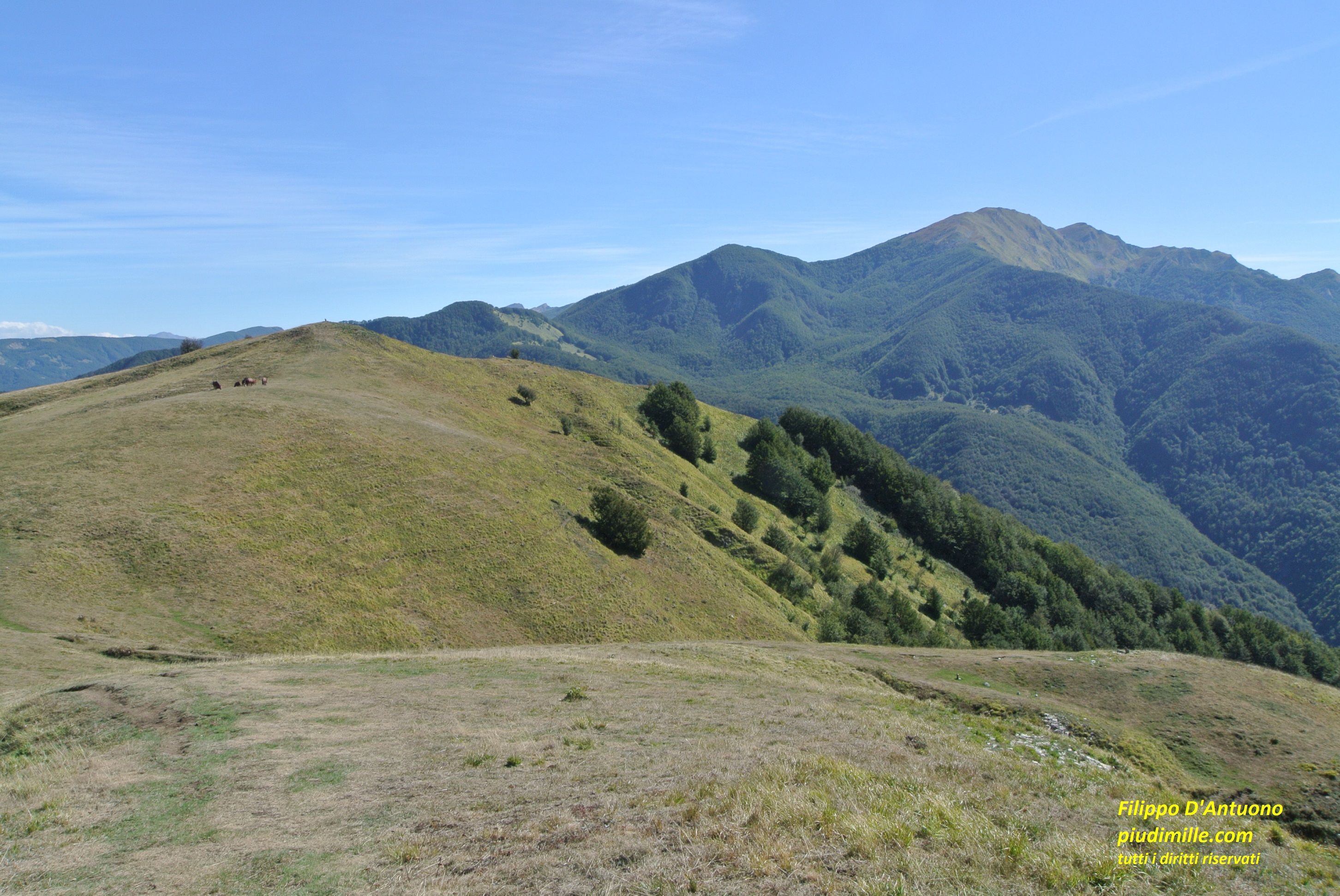
Between passes Cirone and Lagastrello, the main ridge raises to the first of the highest Apennine peaks, starting from the west. These are the mountain where the typical summit vegetation, with extended blueberry bogs, and abundant traces of the glacial morphology, with glacier valleys and lakes, are massively present. These features are however typical of the north side, that is also the more easily accessible as starting point for hikes. In fact, beyond the road passes Cirone and Lagastrello, other four point, all very popular, are reached by roads.
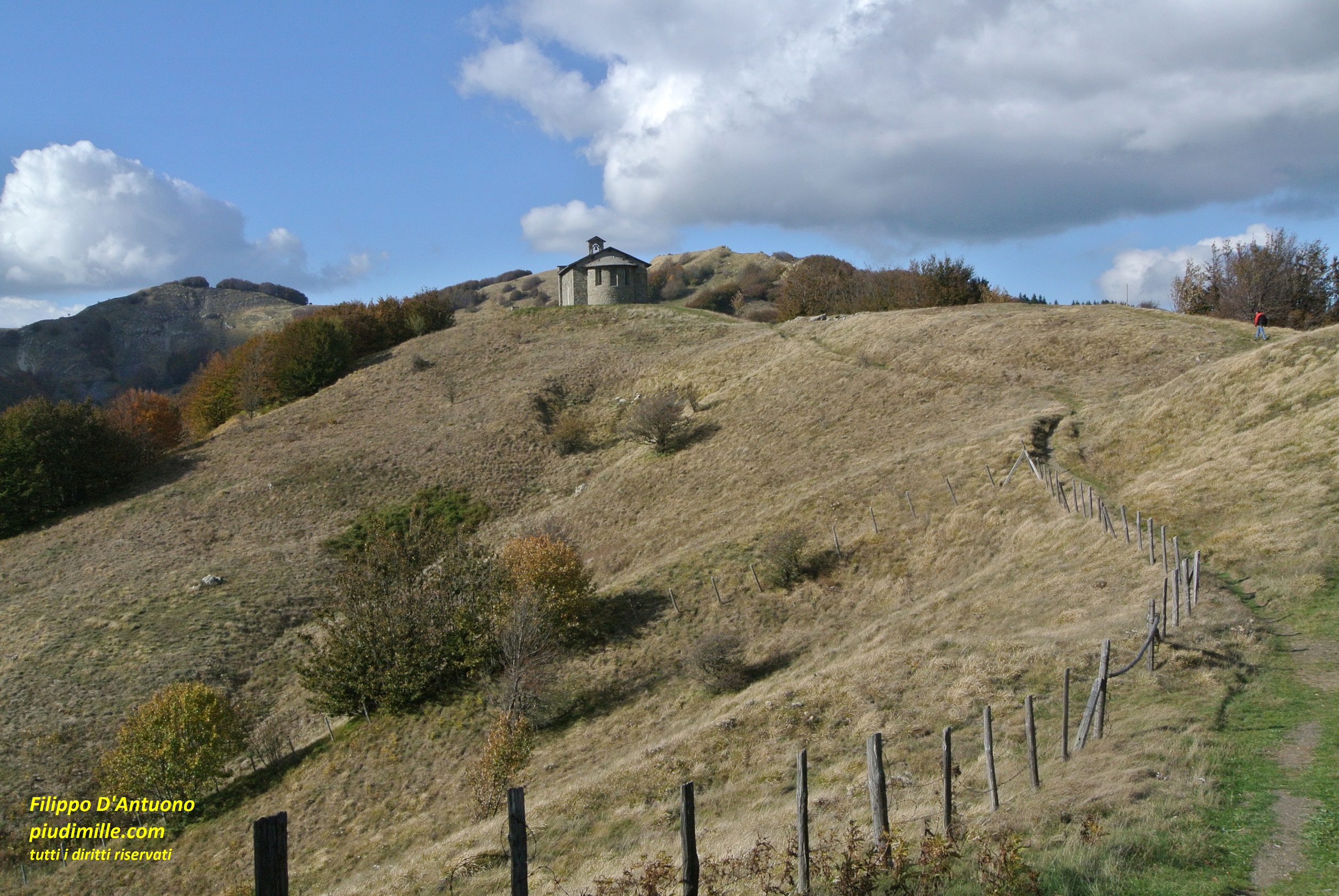
The meadows and the church at pass Cirone
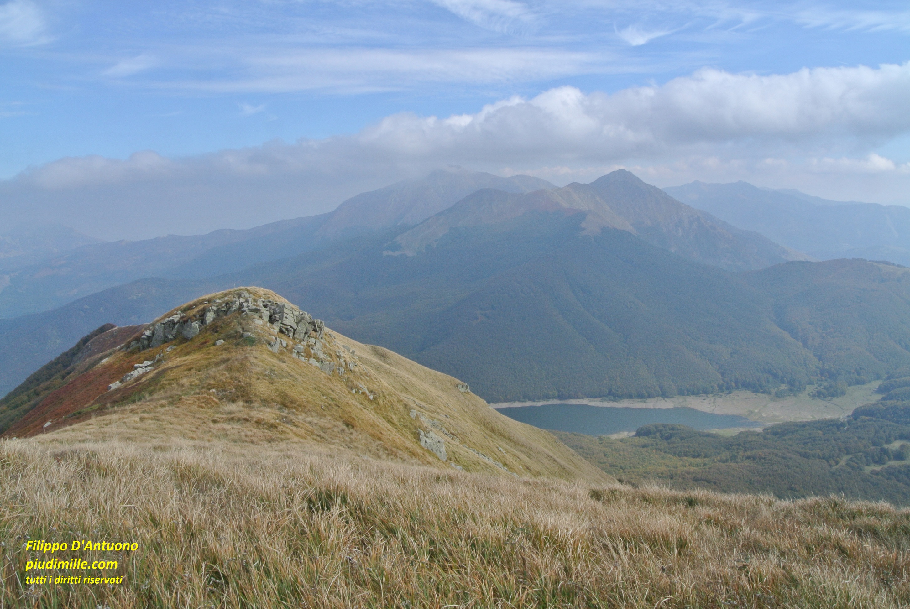
Lake Santo, in a autumn image, taken from the main ridge
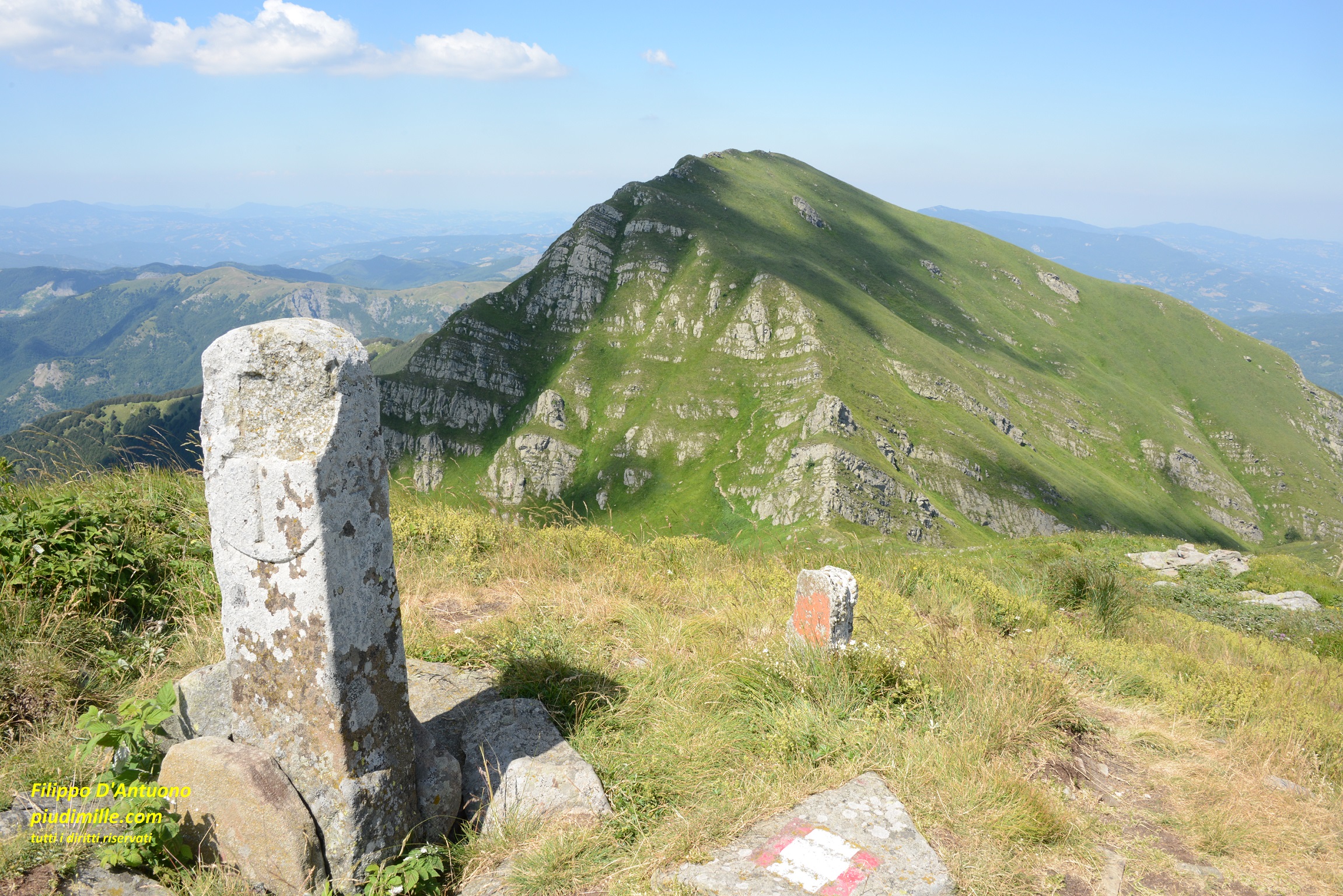
Mount Orsaro, from the top of mount Braiola
Lagoni, for mounts Matto, Paitino, and also to mount Sillara, and the glacial basins of Capanne Guadine and lake Scuro.
Lagoni, from the ridge of Rocca Pumacciolo
Mount Sillara, from mount Paitino
The dividing ridge between valleys Parma and Cedra is crossed by a track connecting Lagoni and Valditacca, but it is not always affordable by ordinary cars.
On the side of the Cedra valley then we find two other access points.
Lake Ballano, reachable by a narrow road, a starting point for hikes to mount and lakes Sillara, to mount Losanna, to lake Verde.
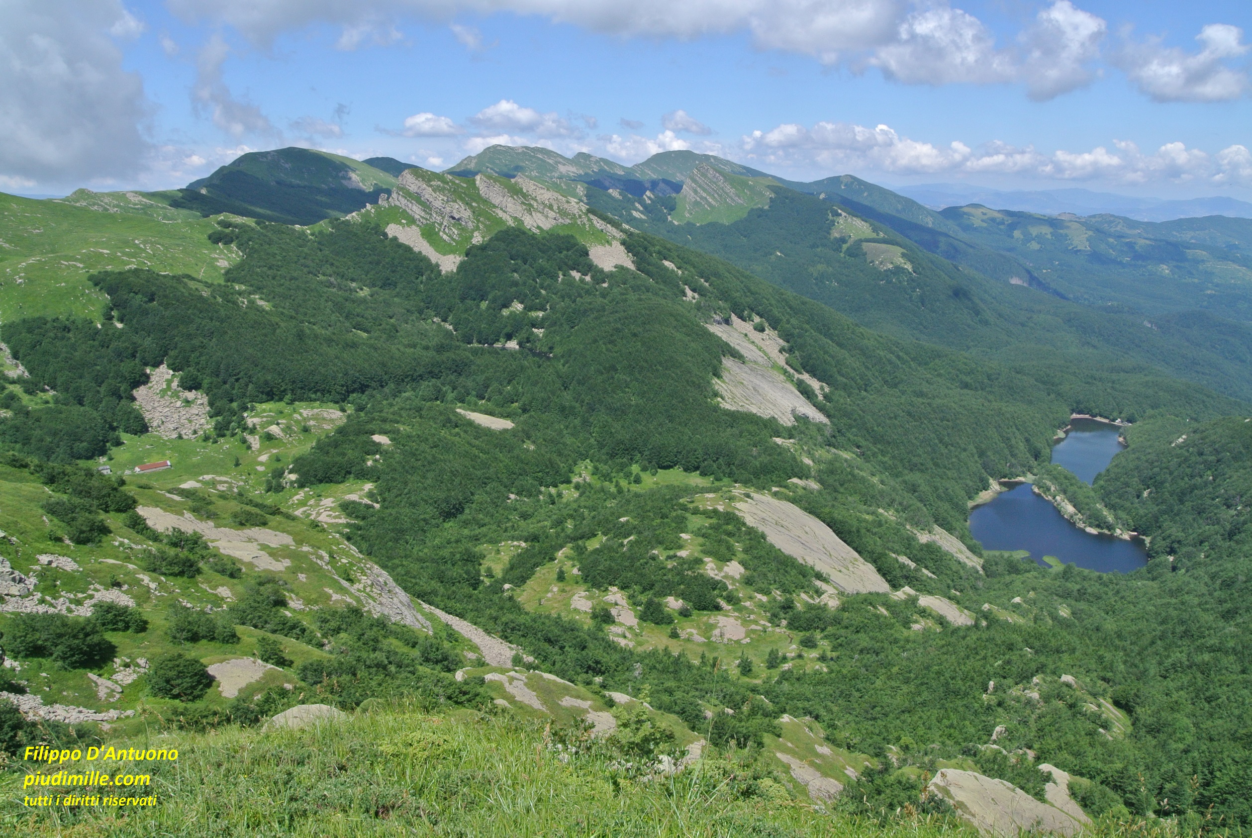
The glacial basin of lakes Sillara, with the background of the Reggio Apennine and the Apuanian Alps
The lake Verde basin
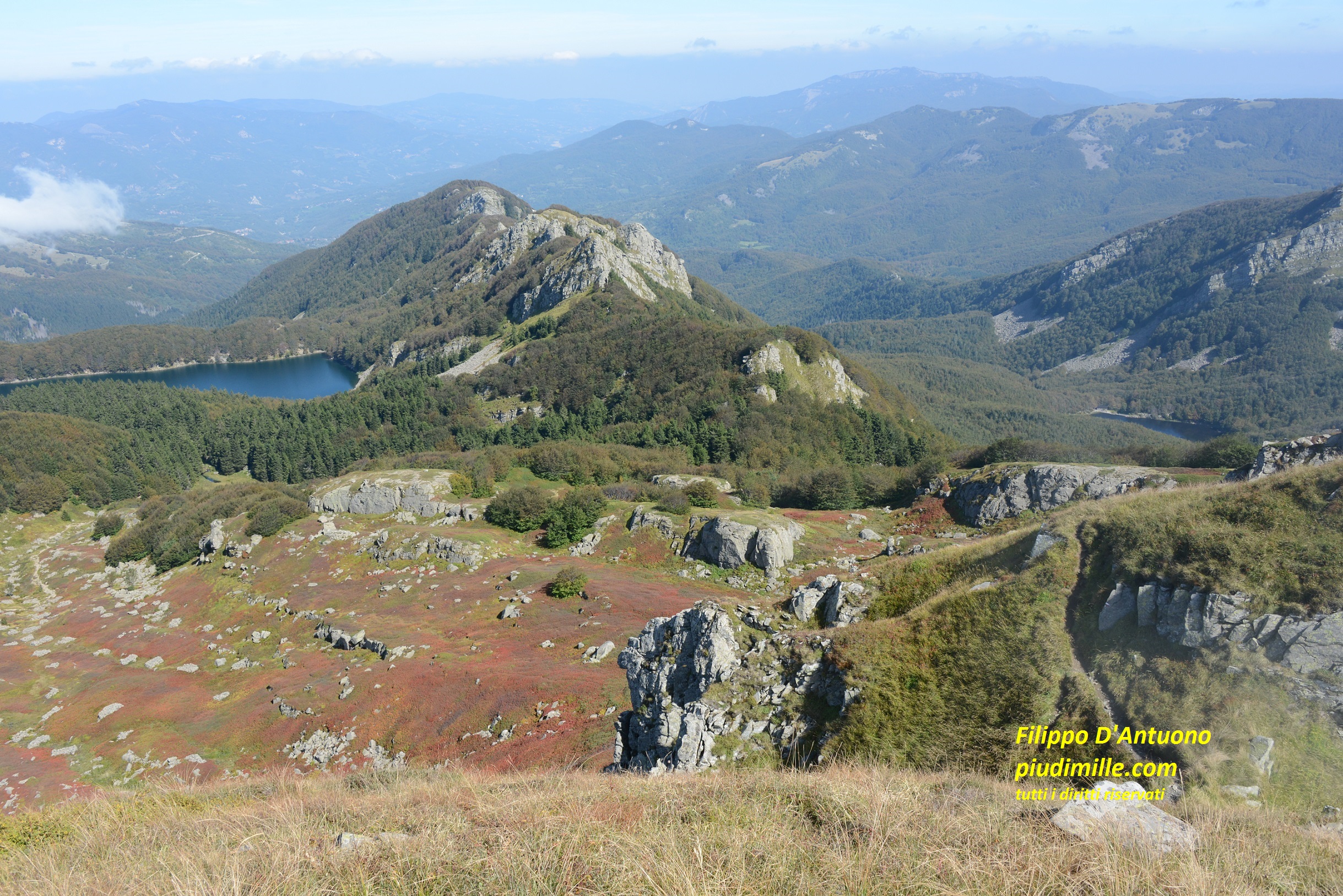
Prato Spilla, with its (former) ski plants, to access to the beautiful basins of lakes Palo, Verdarolo and again Scuro and to the oriental, lesser known but very beautiful part of the ridge, with mounts Malpasso, Cima Canuti and mount Bocco.
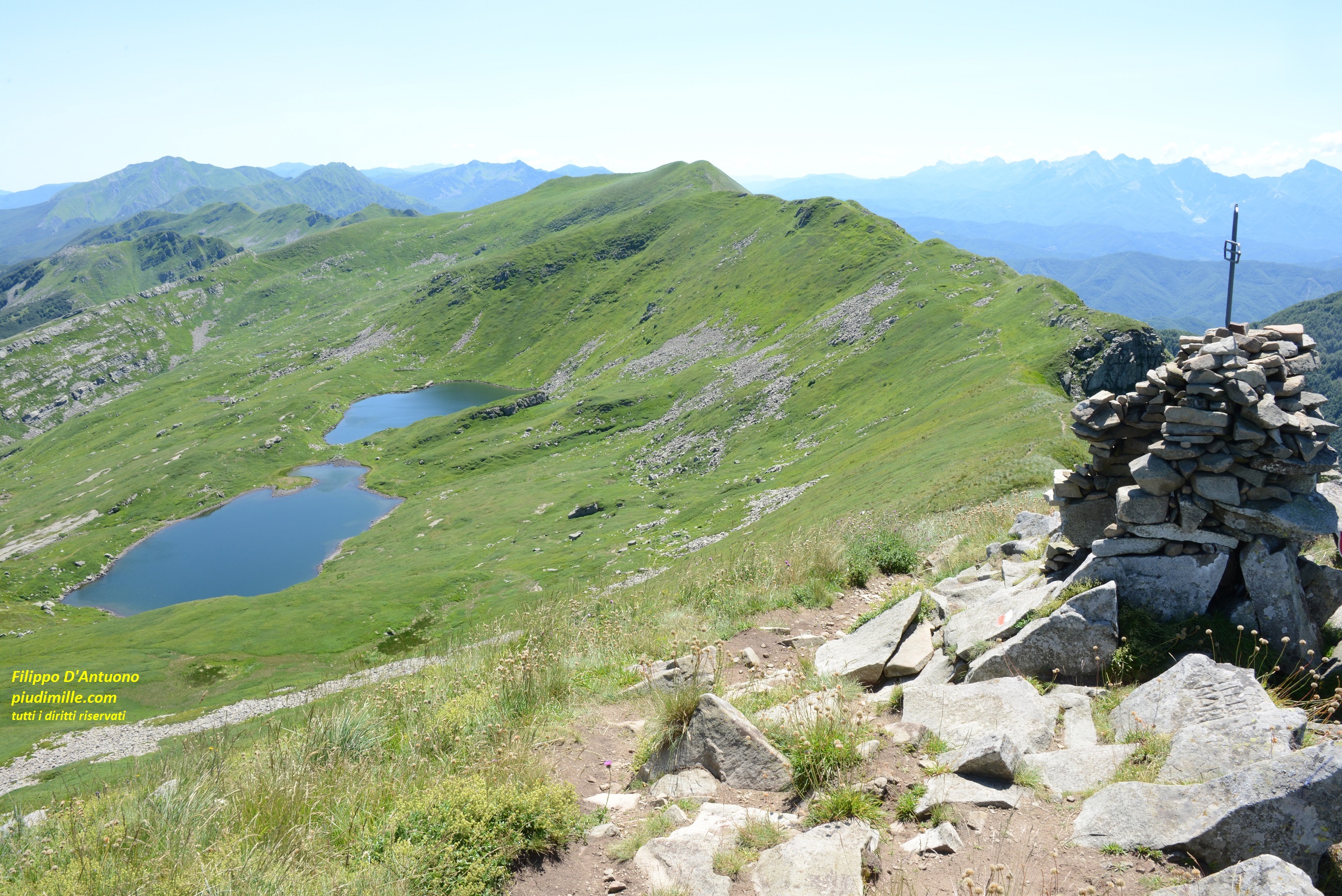
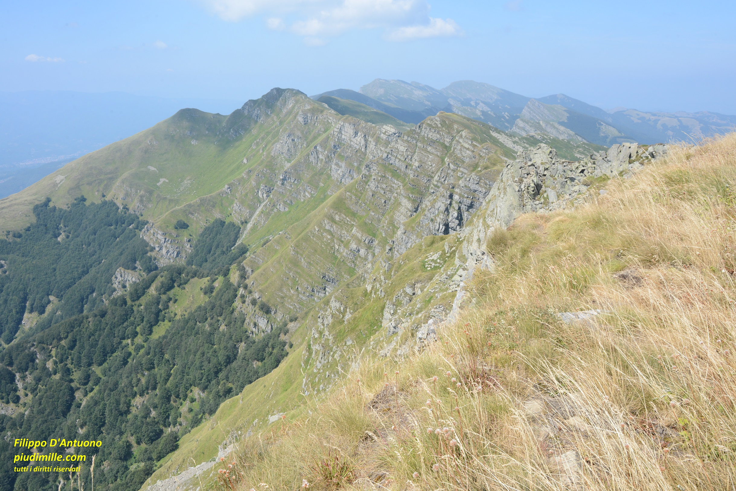
The ridge of cima Canuti
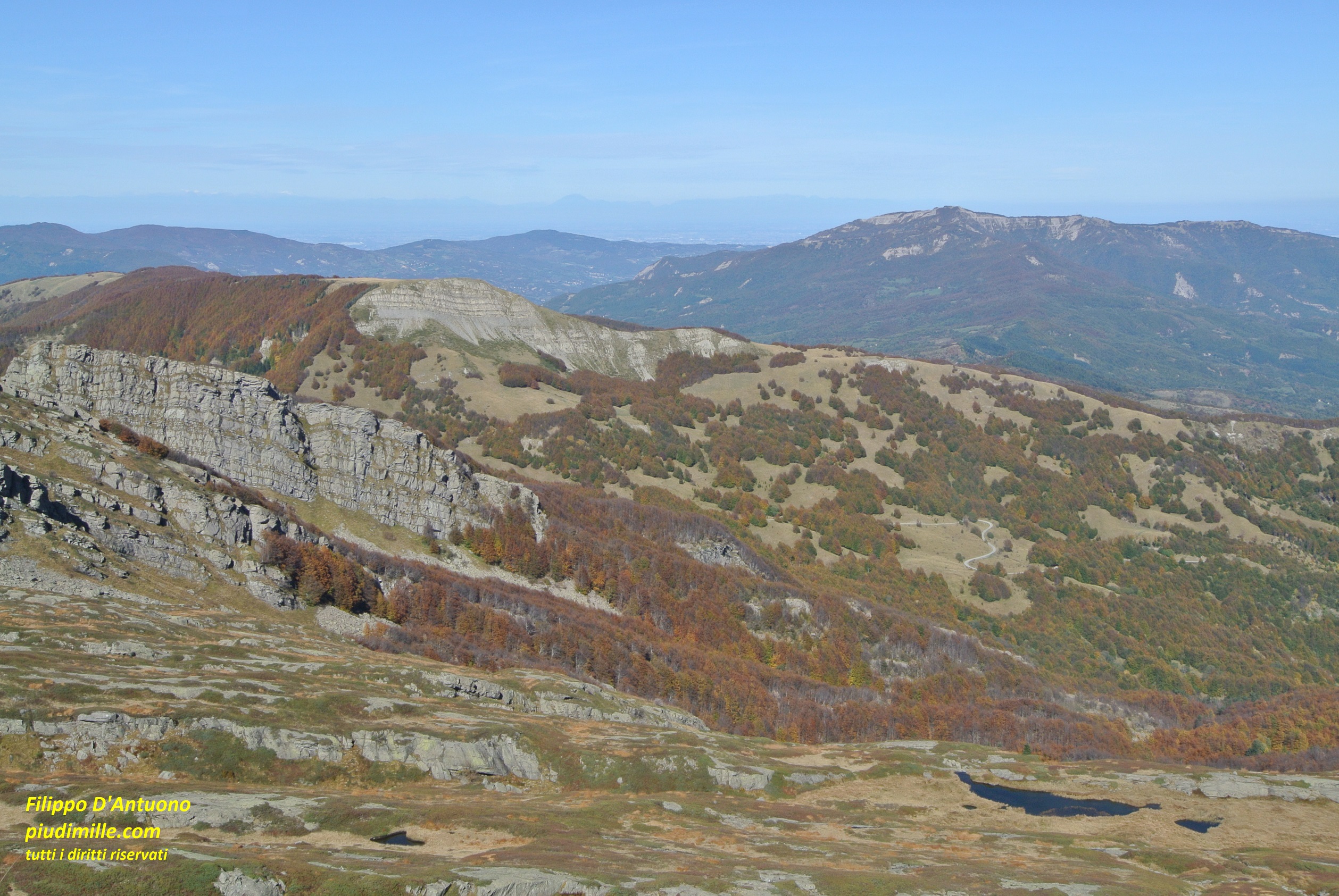
Lake Paduli and pass Lagastrello, from mount Malpasso
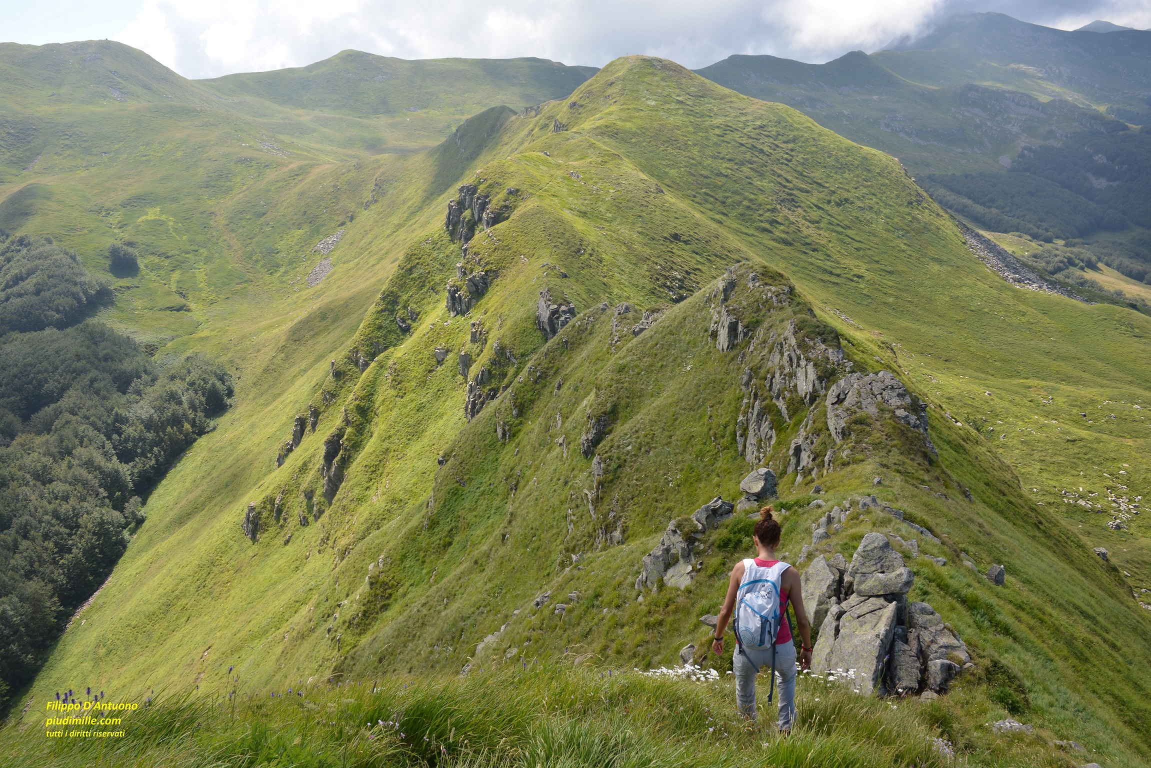
All these places are connected by the main ridge trail, but also by many transversal paths, that can be combined in many ways. The glacial morphologies, bogs, lakes, the views over the sea from the top ridge, all this attainable without overdoing, cannot of course leave disappointed.
The above listed access points are touristic., so they do not coincide with the villages of the upper Parma and Cedra valleys, laying at a bit lower altitude. Can I give a suggestion: visit them and stay also there a bit, to sustain their economy.
Apennine of Parma and Lunigiana: the Lunigiana side
Here things change; the south sides are extremely steep. There are no access road to approach the tops, apart the two road passes, the track to Prati di Logarghena and some forest tracks, however not open to traffic.
The Prati di Logarghena can be reached by two small roads, turning into dirt tracks in their upper parts, which affordability by ordinary cars is not for granted. Getting to Prati di Logarghena is an approach to mounts Orsaro and Braiola. Otherwise, to reach the top ridge, it is necessary to start from the villages and, in this case, well over 1000 metres gradient are waiting for you, raising to much more if you add some ups and downs across the top summits and descend by a different way. Starting from the Lunigiana villages, sometimes still among olive groves, and progressively getting to the main ridge, with views opening along the way, is however an adventure not to be missed.
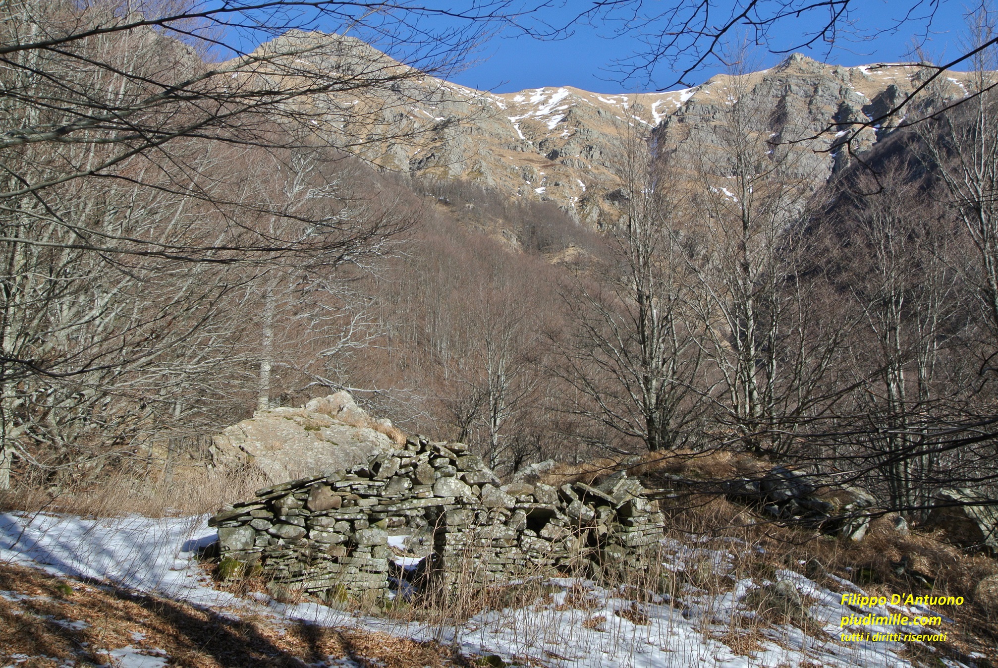
Along these very steep sides, still grazed by animals until not so long ago, we still find evocative signs of the former pastoral, charcoal makers and chestnut grove life.
The steep Lunigiana sides of mounts Matto and Paitino
The remains of Capanne di Curtiglia, with the rough side of mount Brusà
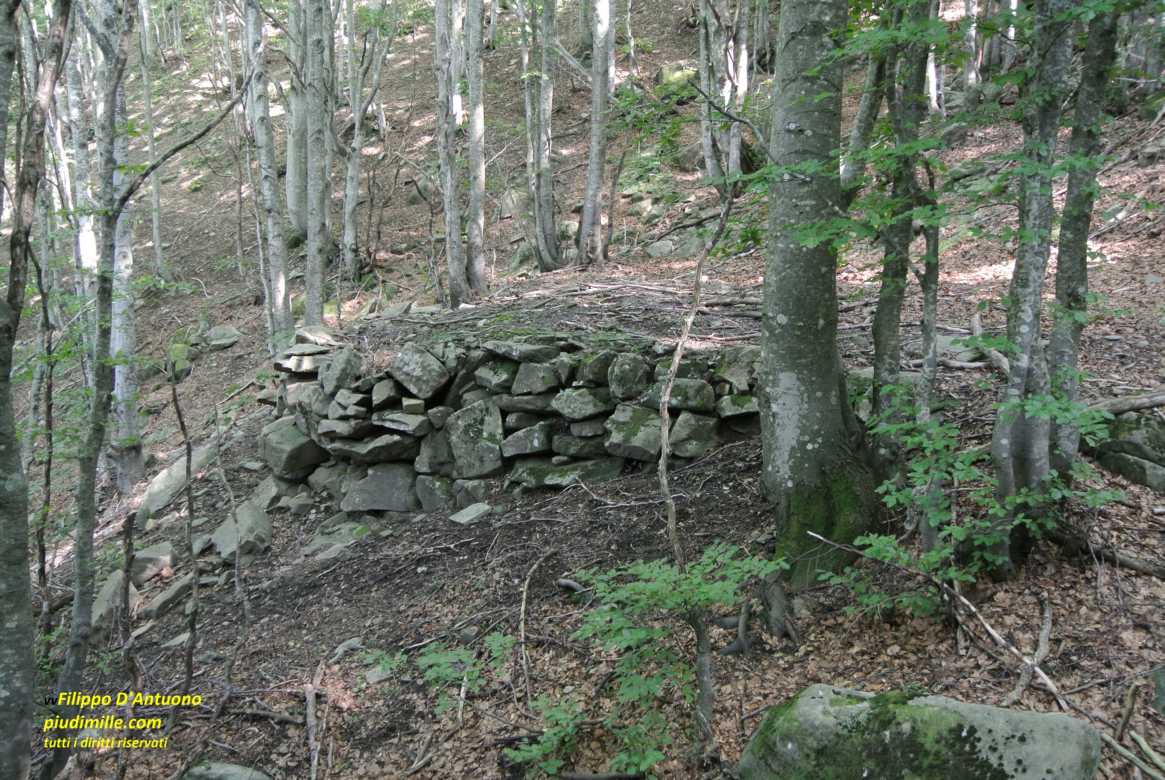
Remains of charcoal makers huts, on the sides of Tecchio dei Merli
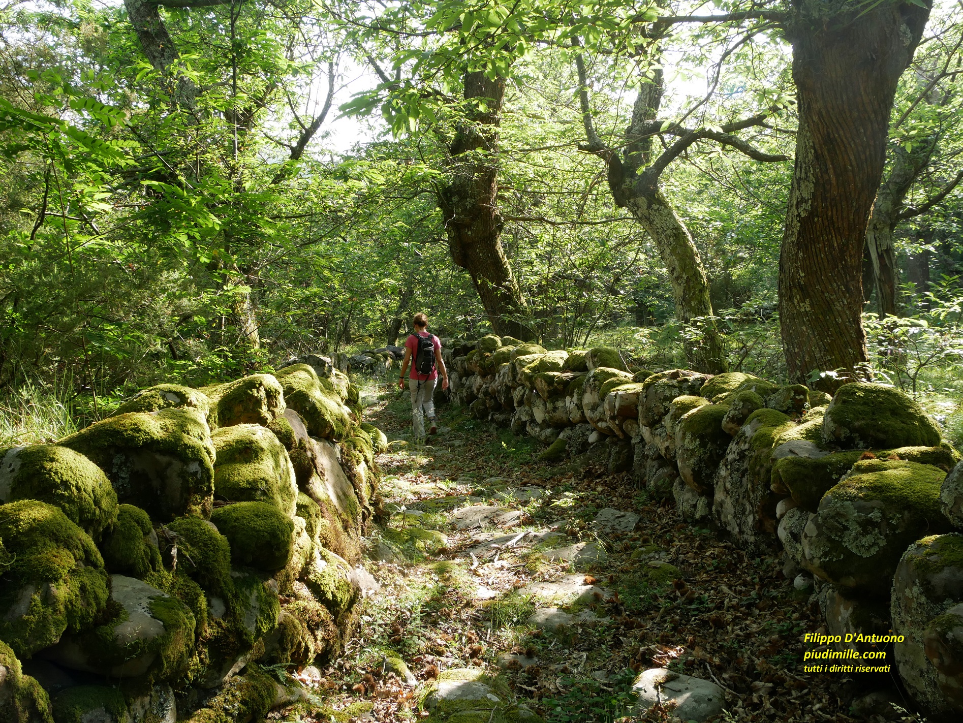
Old property boundary walls, in the Iera chestnut groves
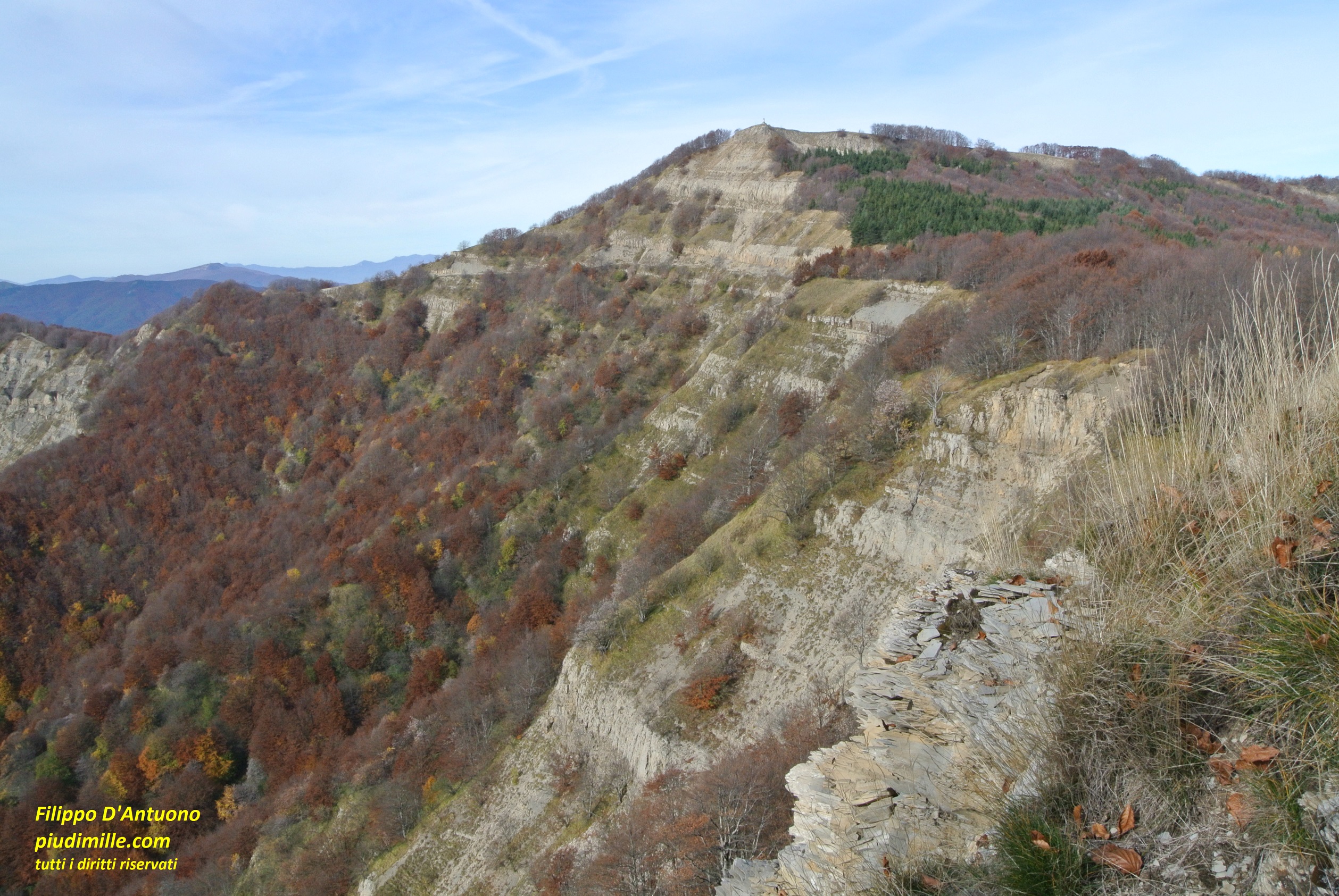
The morphology of the Lunigiana sides in not however uniform. The western part, with between mounts Orsaro and Aquila, is very rough, and with few accesses to the high ridge. In the central part, east of the monte Dongo ridge, there are the parallel valley of the stream Bagnone tributaries, with some trails ascending along the ridges between them. The mountain sides become rougher again rougher and not easily accessible east of mount Losanna, where there is also the beautiful side ridge of Tecchio dei Merli.
The traces of glacial morphology is visible also on this side, close to the top ridge; there are no lakes there, but the small circuses of Borra del Sale, mount Matto and Prati di Losanna tell that ice descended also on this side.
Finally, the villages. In case you decide to start hiking from this side, you can hardly neglect them, since trails start from there.
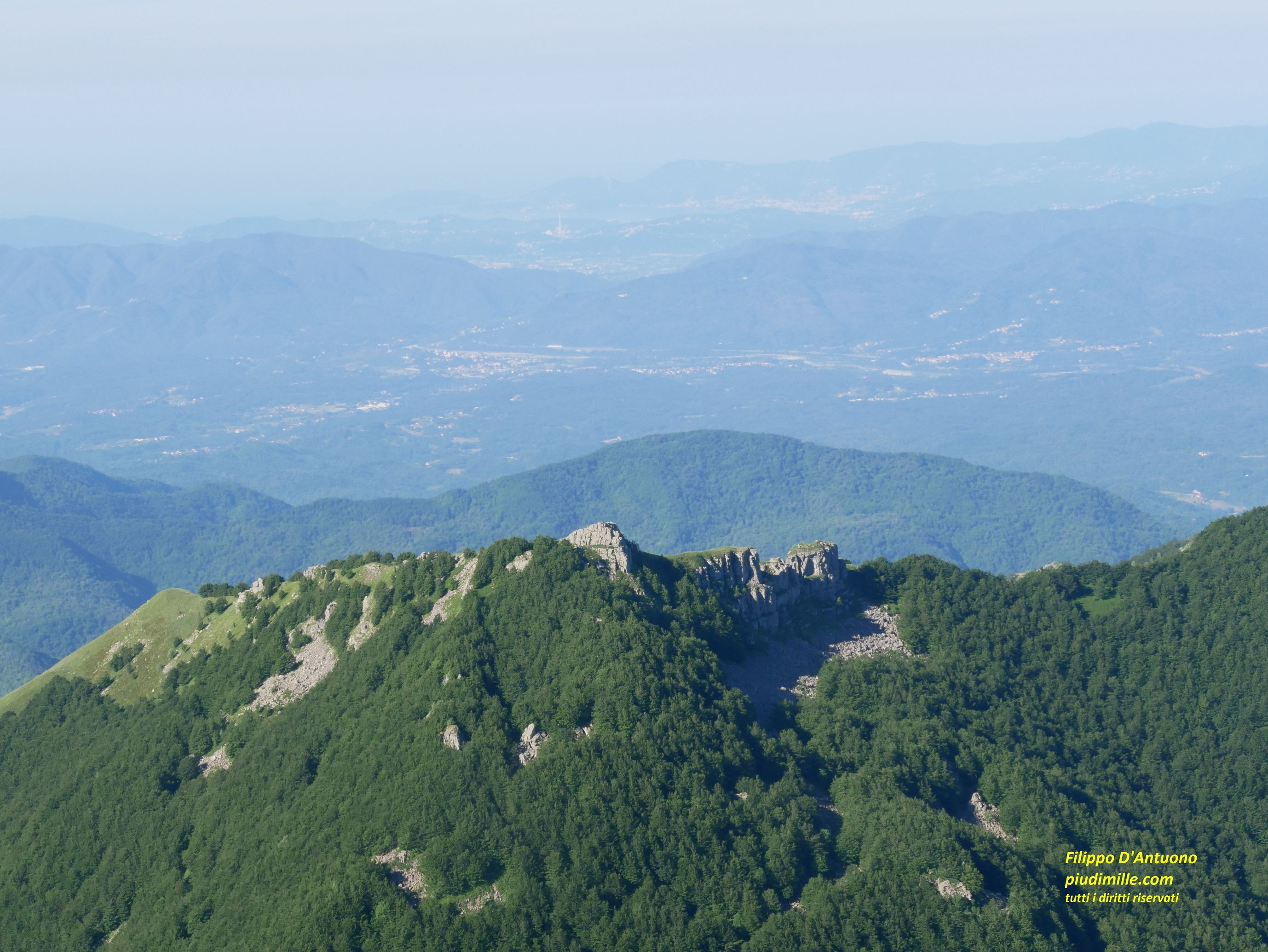
Tecchio dei Merli, with the sea in the background, seen from the main ridge
There are plenty of villages: Rocca Sigillina, Vignolo, Vico and its hamlets, Treschietto, Iera and Compione, immersed into chestnut groves, Tavernelle, Taponecco, Apella. But, once more, do not just pass through in hurry. Visit them, catch their atmosphere, sometimes a bit of neglect and, where some shops or other services do still do exist, use them.
The glacial circle of mount Matto, on the Lunigiana side
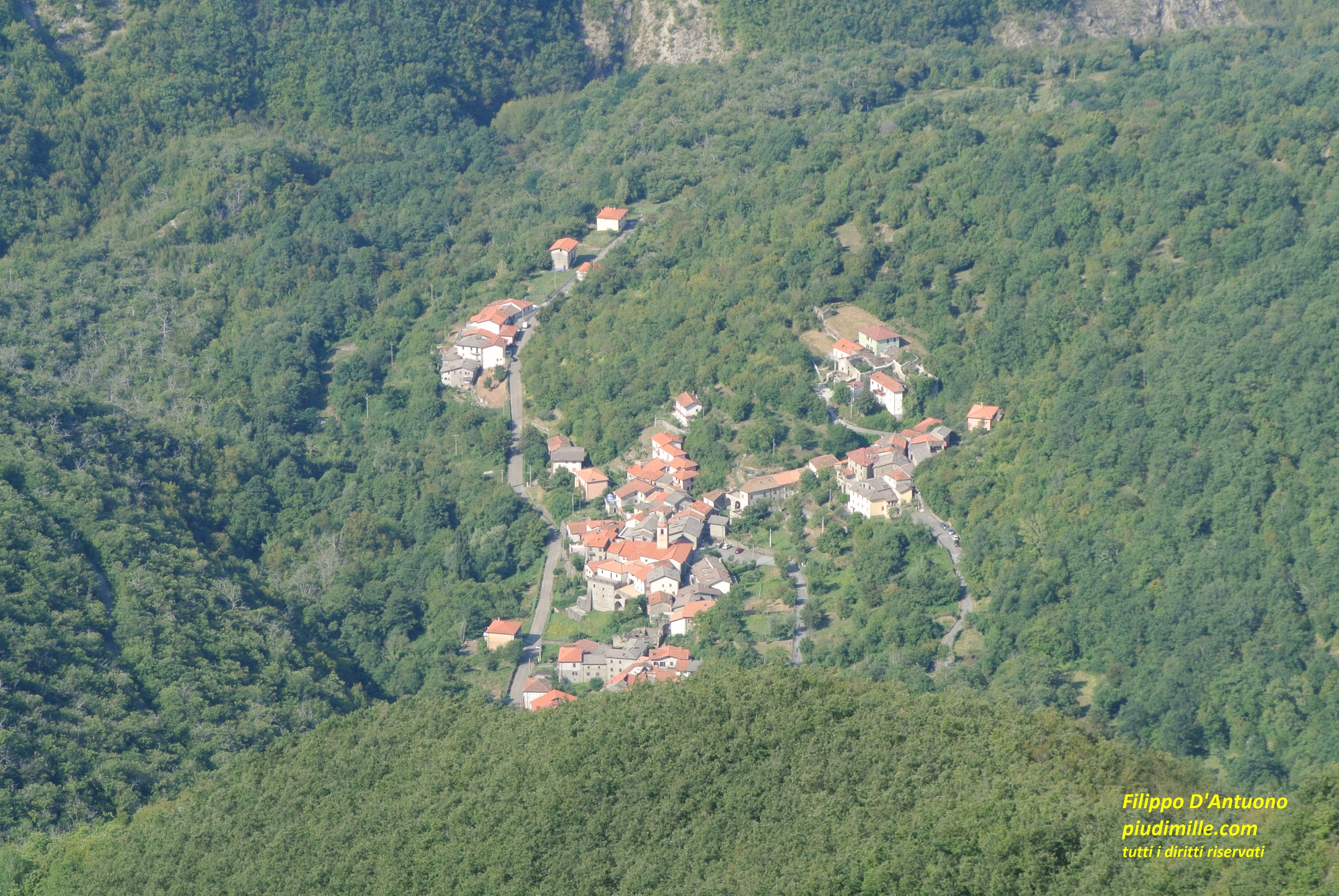
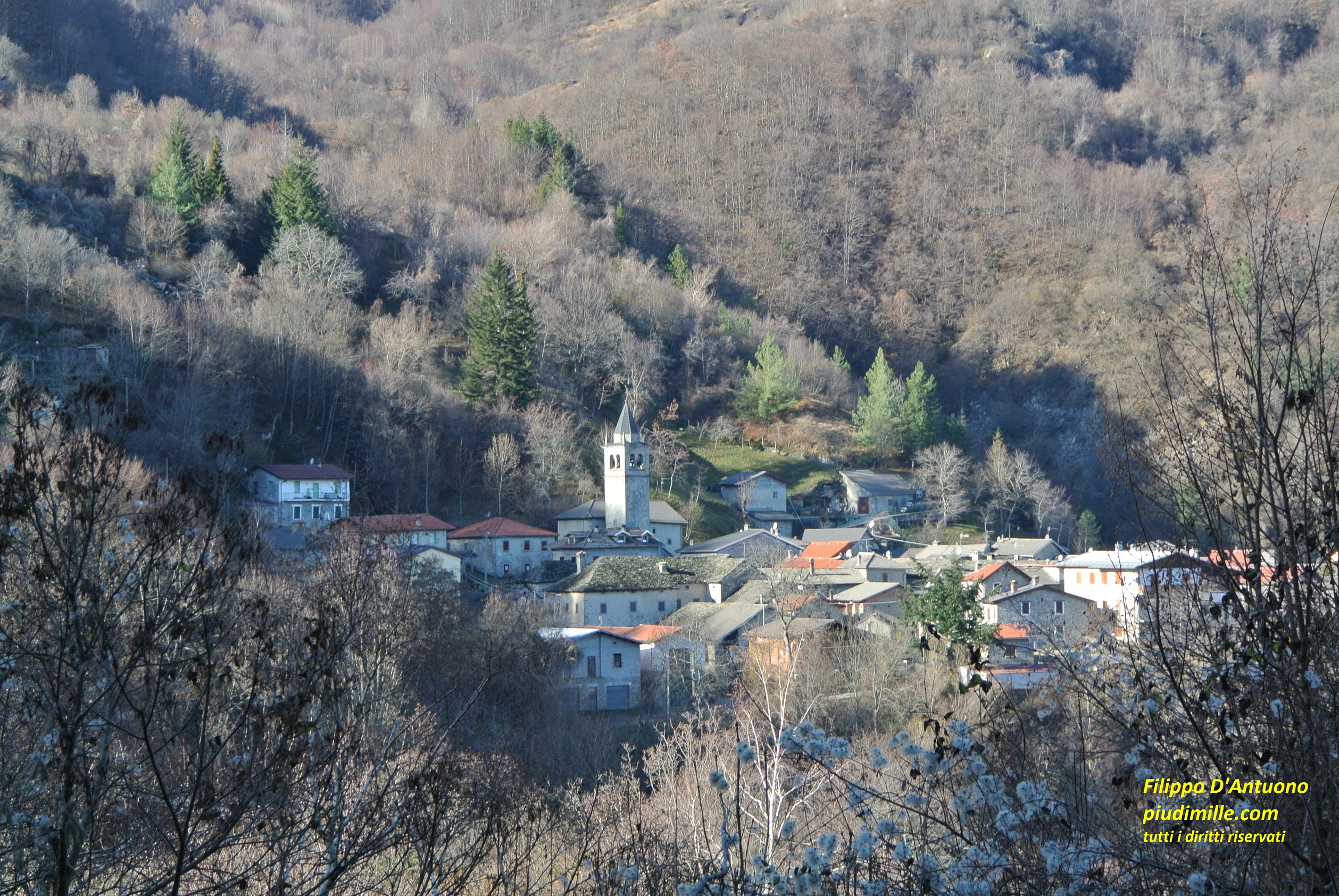
The village of Iera, immersed into chastnut groves
Apennine of Parma and Lunigiana: the upper Bratica valley, with mounts Navert and Caio
Somewhat above I mentioned the ridge dividing the Parma and Cedra valleys: its starts from mount Paitino, continues with Rocca Pumacciolo and Pumaccioletto, descends to pass Colla Valditacca, ascends again to mount Navert and finally continues as its right hand ridge, to mount Caio, through pass Ticchiano.
A second ridge originates however from the left side of mount Navert and, together with the right side one, enclose the Bratica valley. And. hiking along these two ridges it is possible to do the whole curcle of mount Navert, between the villages of Grammatica and Casarola.
Mounts Navert and Caio, from the main ridge
Navert is indeed a beautiful mountain, with its large flattish top, open o the main ridge and still used form grazing. It is possible to ascend to mount Navert also from the Colla Valditacca pass or, by local and almost non signed forest tracks, from Valditacca, Pianadetto and Riana.
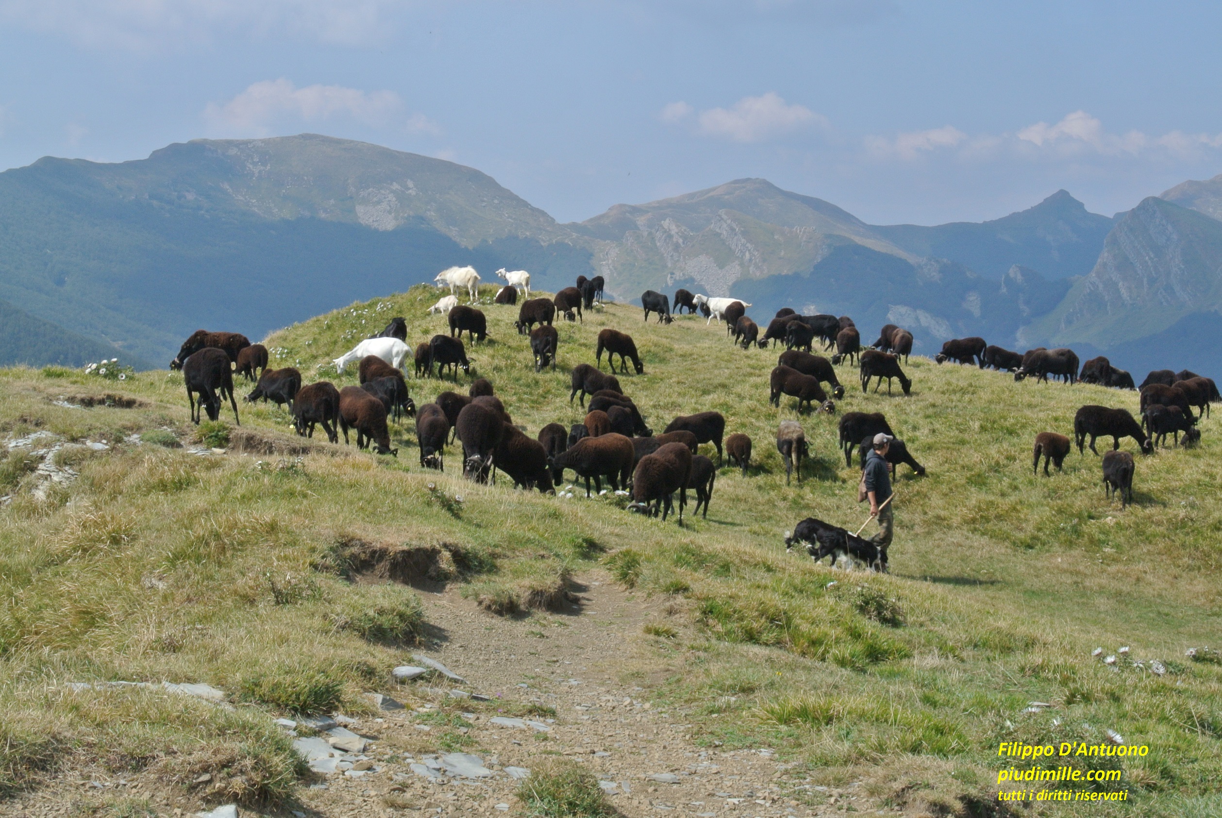
Sheep grazing on mount Navert summit
Riana, in the upper Bratica valley
Mount Caio is a peculiar peak, with a forested and accessible north side, where is the centre of Schia, created in a period when skiing plants and vacation houses seemed to be a solution for the problems of mountain territories. Nowadays Schia survives, trying to find a new identity, but is also an accessible place to rather easily reach the ridge between mounts Caio and Corno di Caneto, two first class panoramic points. The south side of this ridge is, on the contrary, steep and rough, solitary and almost neglected. It is possible to ascend from this side, but with more demanding hikes, along scarcely marked, although very beautiful paths.
The south side of mount Caio