Places of the Apennine of Reggio, Lunigiana e Garfagnana: an overview
Introduction
This page deals with a rather long stretch of the Apennine dividing ridge, and some important side ridges. On the north side, it is almost entirely comprised in the Province of Reggio Emilia, between the two road passes Lagastrello and Radici,
with the river Enza and Secchia basins. On the south side we find instead the upper oriental Lunigiana, in the province of Massa Carrara and upper Garfganana, in the province of Lucca.
So, let’s see some highlights of this part of Apennine, that includes, among other things, three of the four peaks higher than 2000 m in the northern Apennine, with many others approaching this limit.
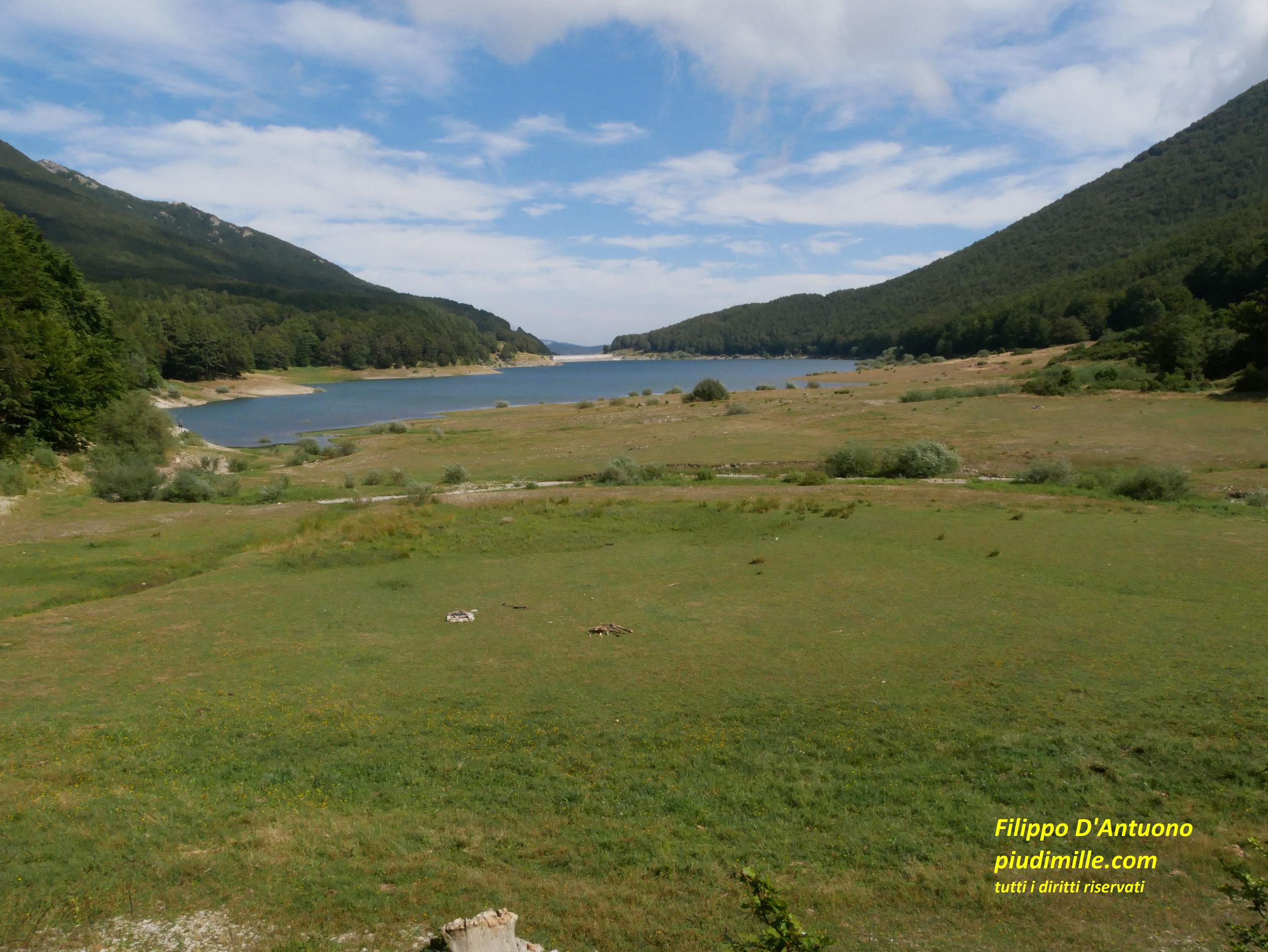
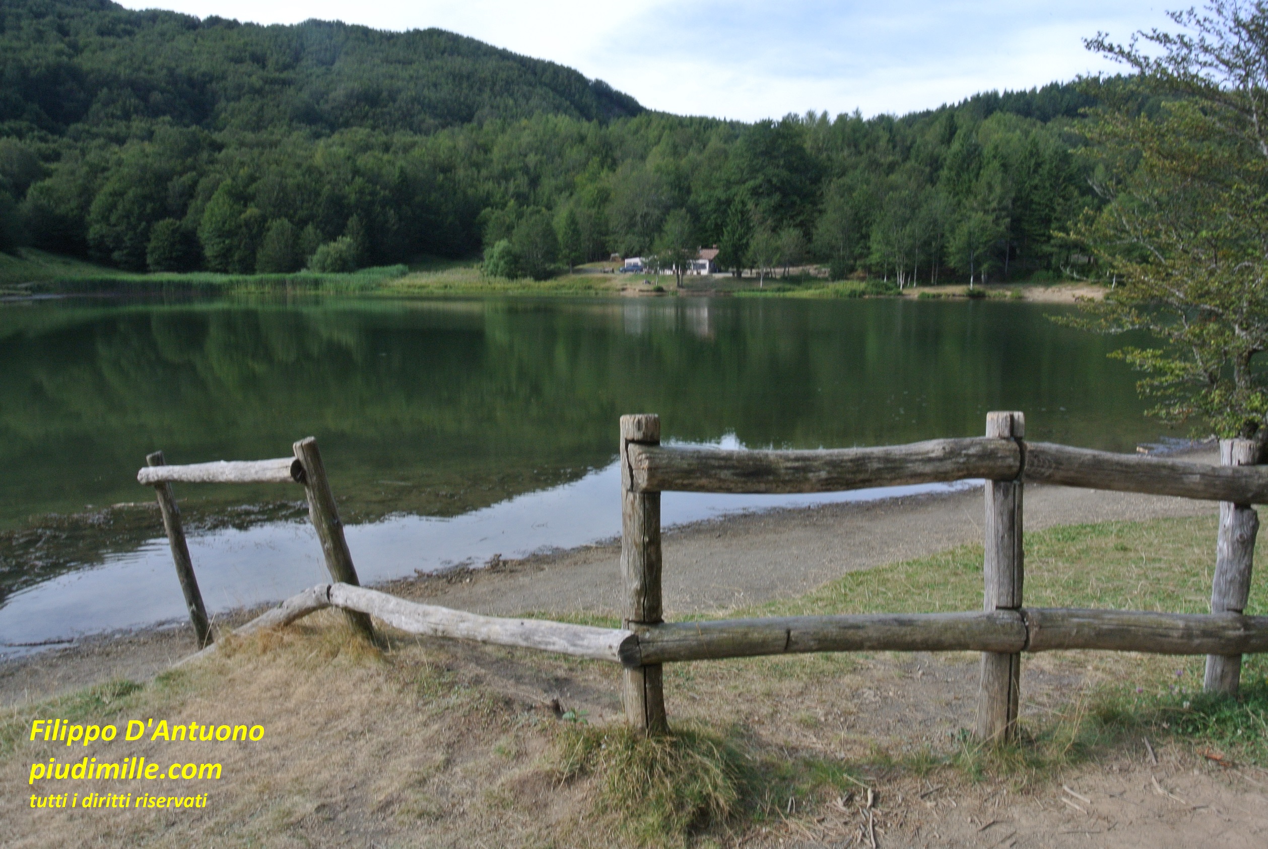
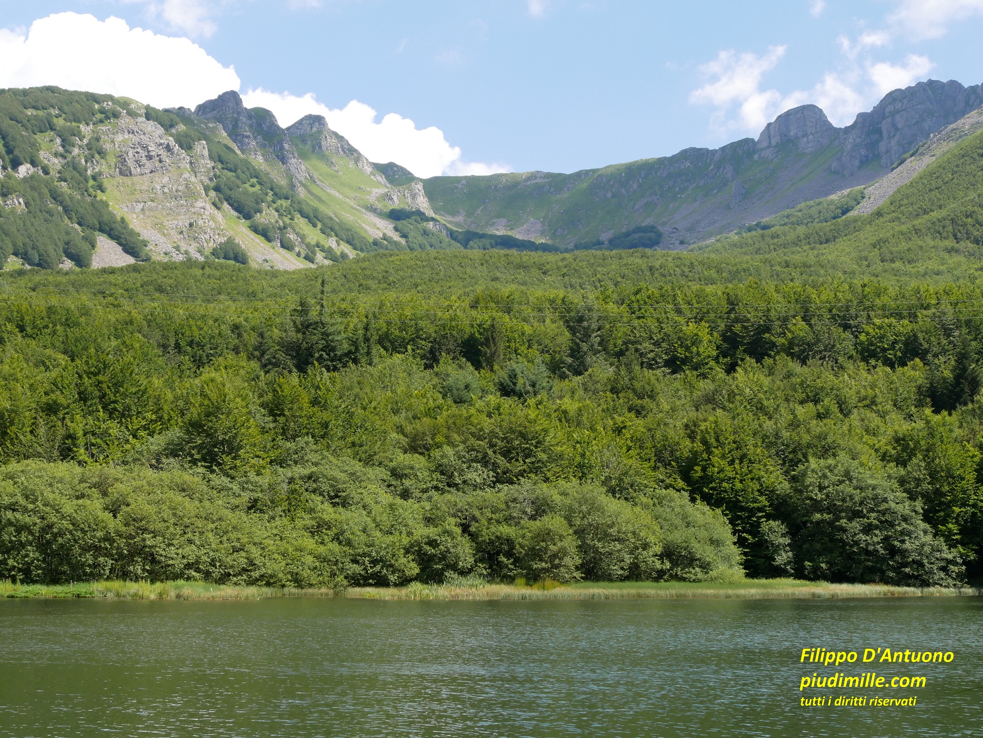
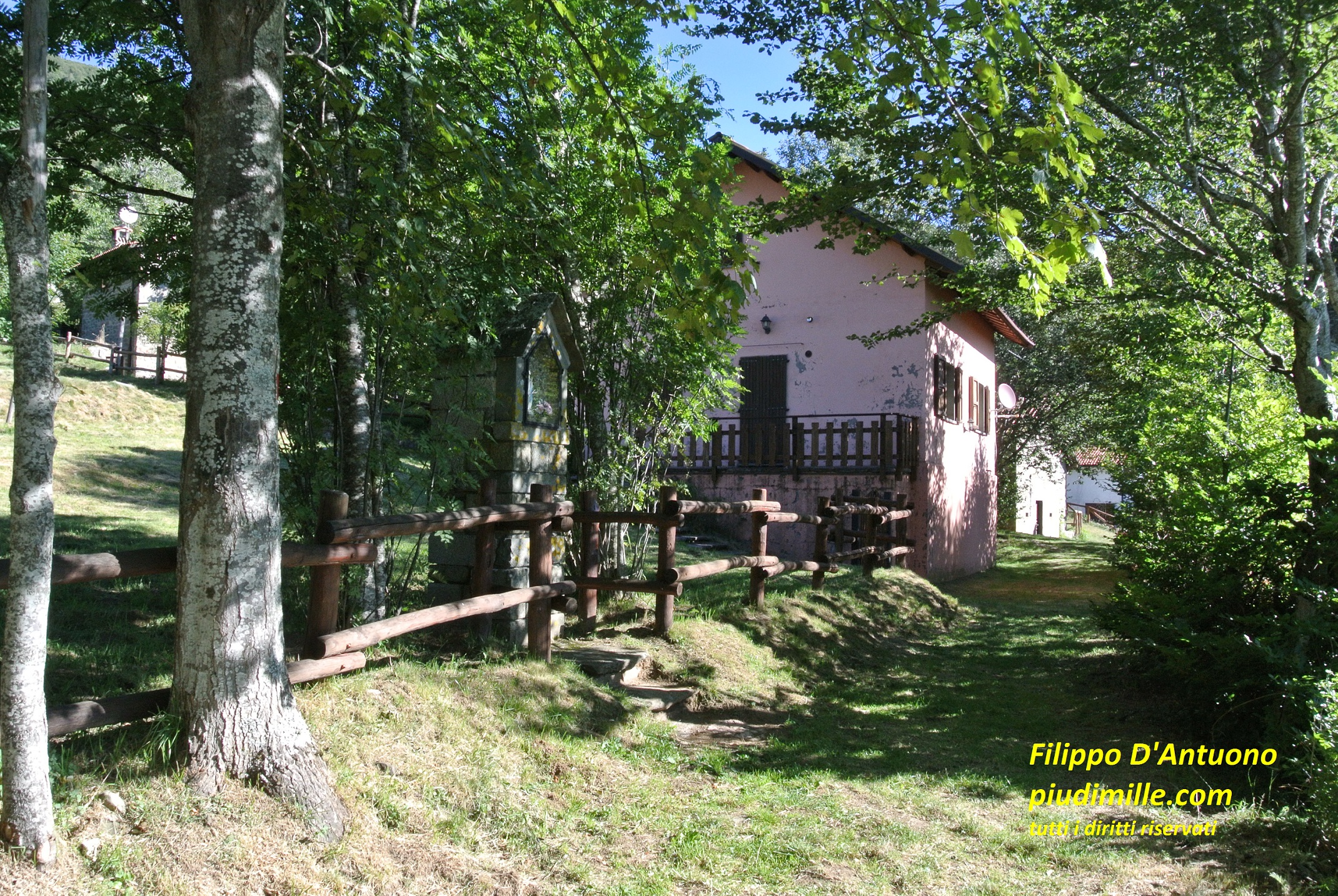
The relaxing environment of river Enza springs, upstreams lake Paduli, at pass Lagastrello
Apennine of Reggio, Lunigiana and Garfagnana: between passes Lagastrello and Cerreto
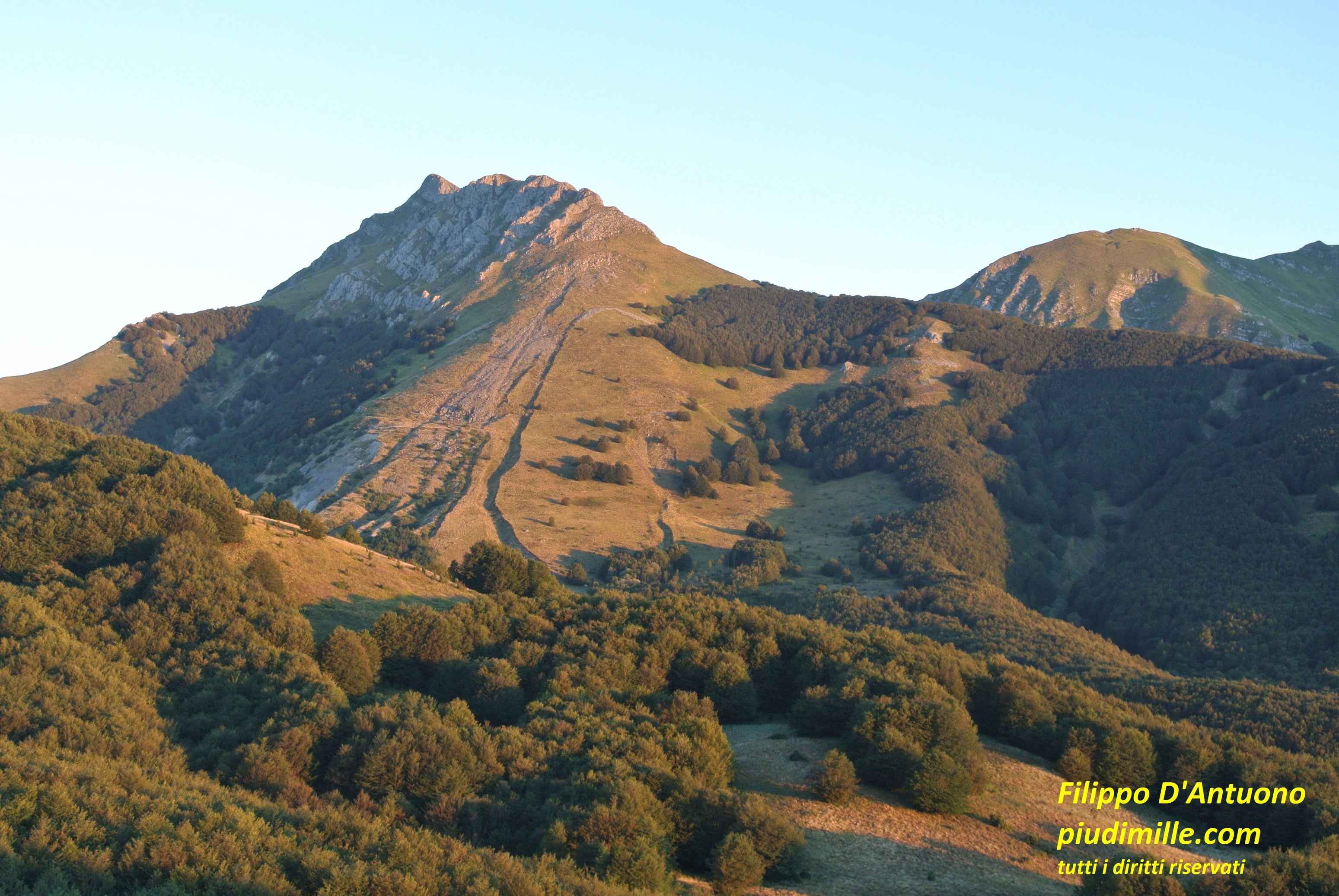
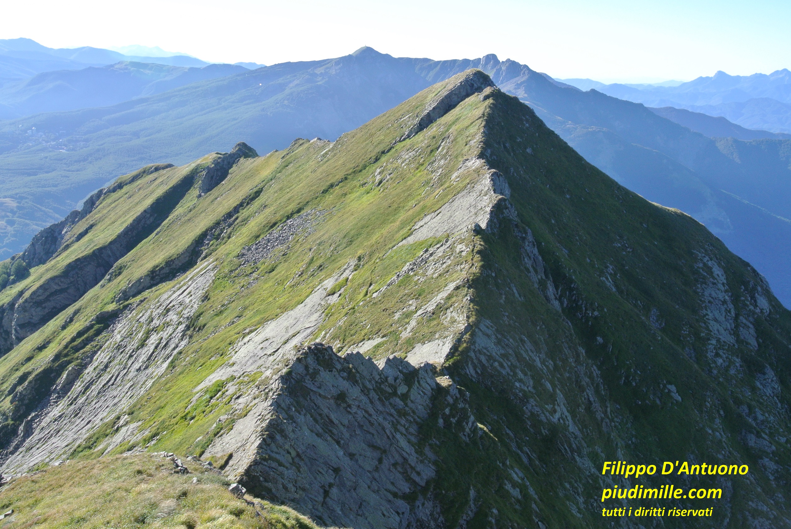
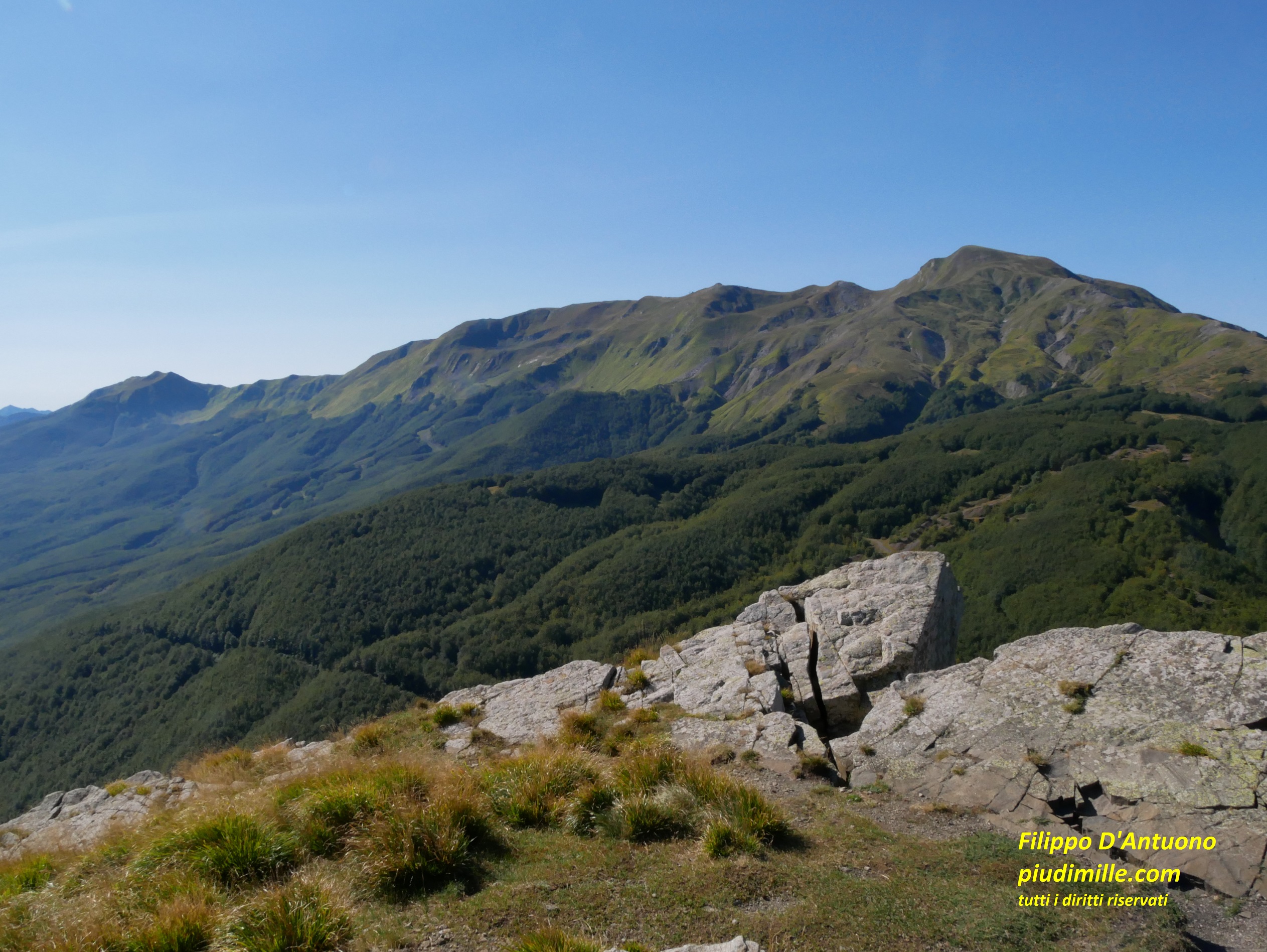
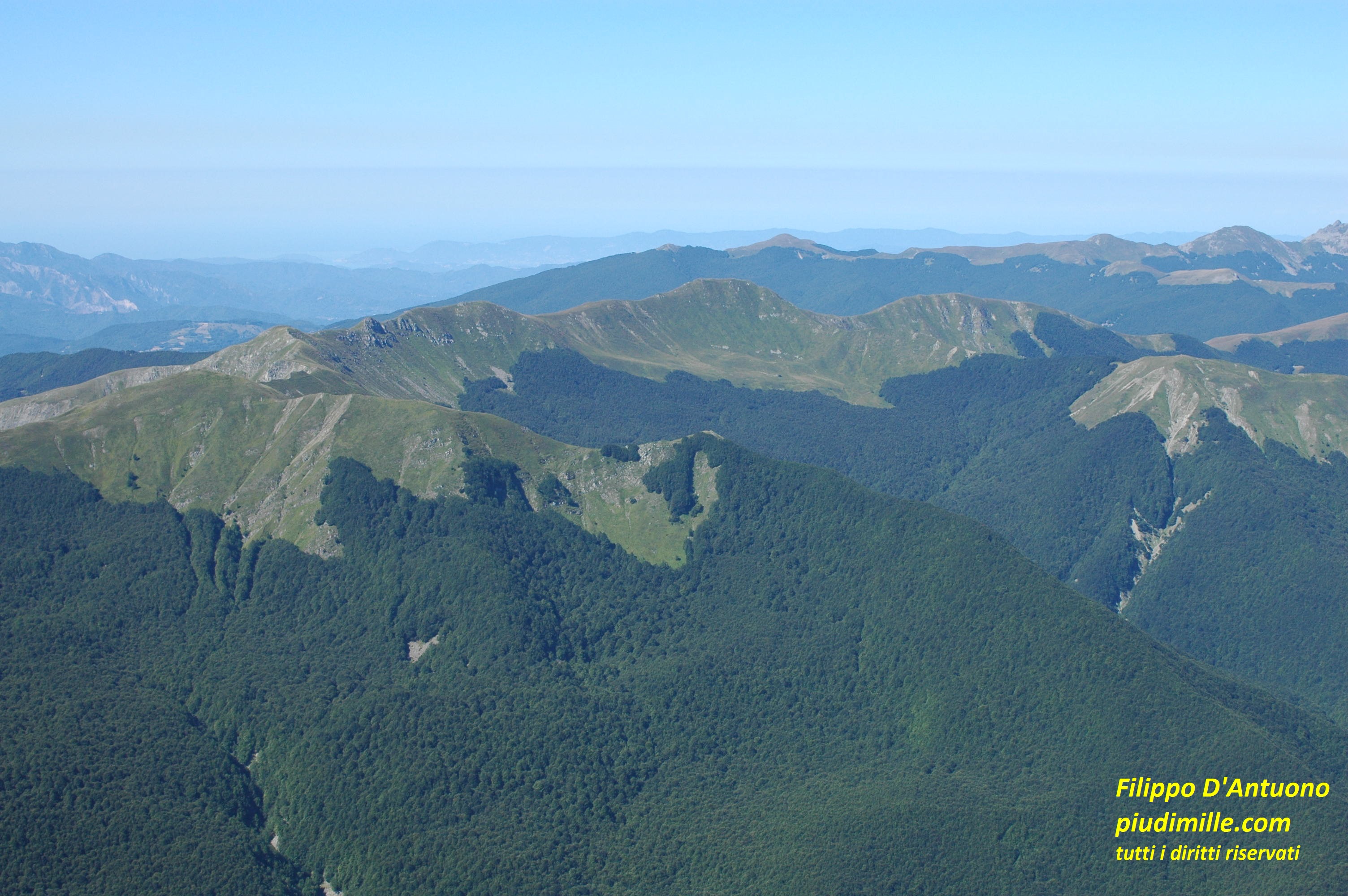
The Groppi di Camporaghena ridge
Camporaghena is a tiny village at the foot of the mountains. “Groppi” is a word indicating, in this area, something rugged, little accessible, at least from one side. And so you can imagine the Groppi di Camporaghena. It is a rather mythical ridge, since the longest assisted trail of this part of the Apennine. The ridge starts at pass Lagastrello and ends at pass Ospedalaccio, near pass Cerreto. Its “doors” at the two sides, are mount Acuto and mount Alto, with Punta Buffanaro in the centre.
The north side of the Groppi is characterised by extended beech forests, blueberry moorlands and huge rock slabs, near the mountain tops. But, especially, by three remarkable glacial basins, inside which some other smaller ones are contained. West, the basin of mount Acuto lake descends with several thresholds and moraines, with interesting peat bogs, like lakes Gora and Gonella. In the central part, lays the huge valley of Ghiaccioni, between the Groppi and the Alpe di Succiso, with many smaller circles on the north side of the Groppi. Finally, on the east side, there is the flattish basin of river Secchia springs, a wonderful and very popular place. All these places are accessible by some trails from the two road passes, or from the north side.
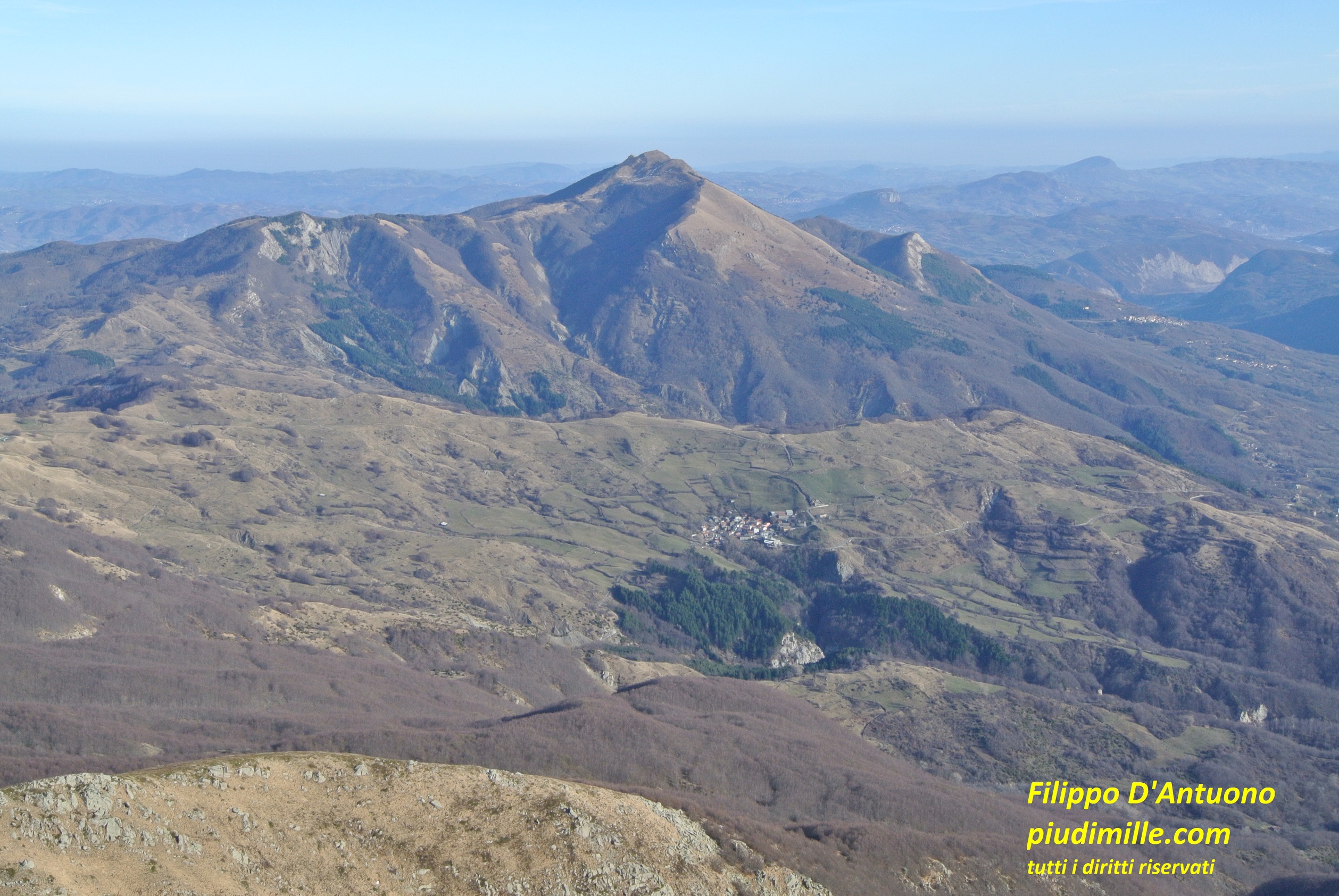
Punta Buffanaro and Groppi di Camporaghena, from Comano Castello
Mount Acuto lake, seen from mount Acuto, with Alpe di Succiso and mount Ventasso in the background
Things are different from the Lunigiana side, where the Groppi show the shape explaining their name. Two old pathes directly heading to the ridge, from the tiny centre of Torsana ora Camporaghena are now almost completely neglected; in any case, they would be reserved to people really wanting to afford some challenge, since they are solitary and have some exposed and frankly dangerous crossings. The access to the ridge remains possible from the two opposite ends, starting from Comano, Camporaghena oe even Sassalbo, along less beaten and interesting trails.
The view of the Groppi di Camp0raghena, from the path haeding from Torsana to mount Acuto
Mount Alto, from pass Ospedalaccio
Let’s see now the three main peaks of the ridge.
Mount Acuto is apparently less showing, although is very interesting and panoramic. It can be quite reached quite easily from pass Lagastrello or from the dam, or from pass Groppo, or by some of the trails of the north side. The tiny on its north side is a very beautiful place.
The west saddle of Punta Buffanaro is reached by a trail running among sandstone boulders, starting from the dividing ridge between the basins on lake of monte Acuto and Ghiaccioni, accessible by some of the paths of the north side. The final part, to the summit, is short but not trivial, because the gradient and the exposition along a very steep mountain side.
The only way to reach mount Alto without substantial challenges is through pass Pietratagliata, at the top end of the Secchia valley. All the other accesses are rather demanding.
The ample grassy ridge of mount Alto summit, with the view of Punta Buffanaro and mount Acuto
The river Secchia springs valley, viewed from the descent from mount Alto to pass Pietra Tagliata
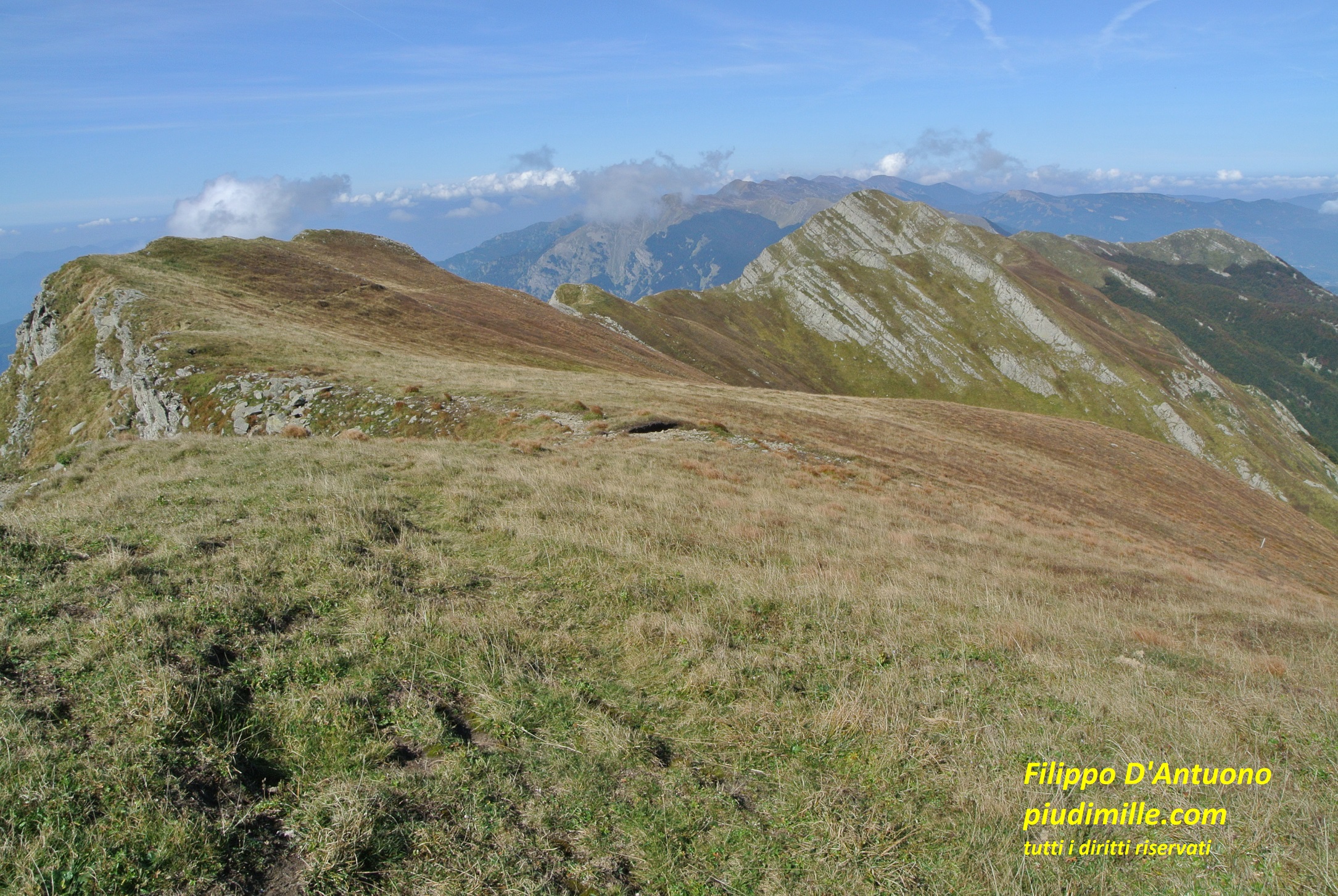
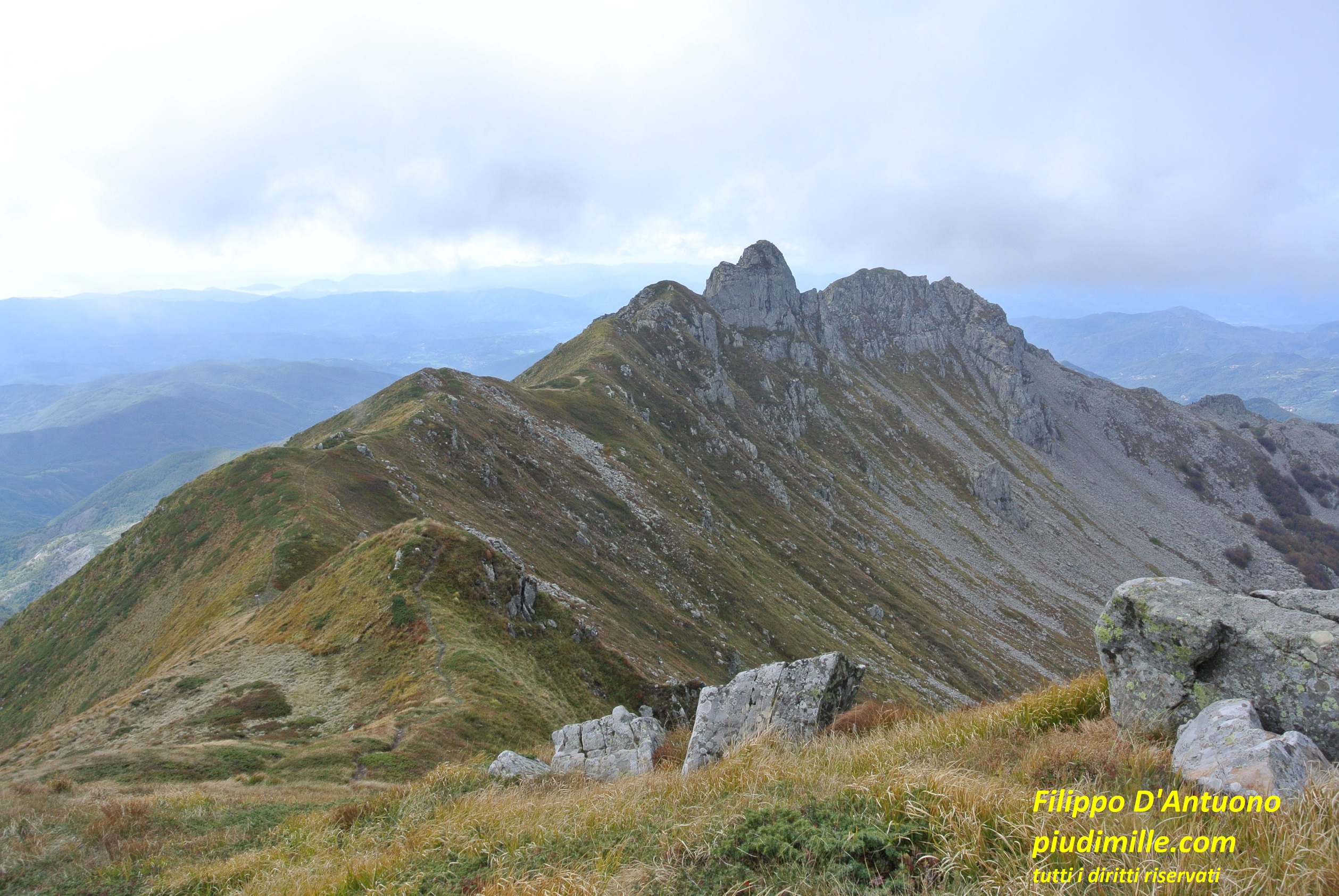
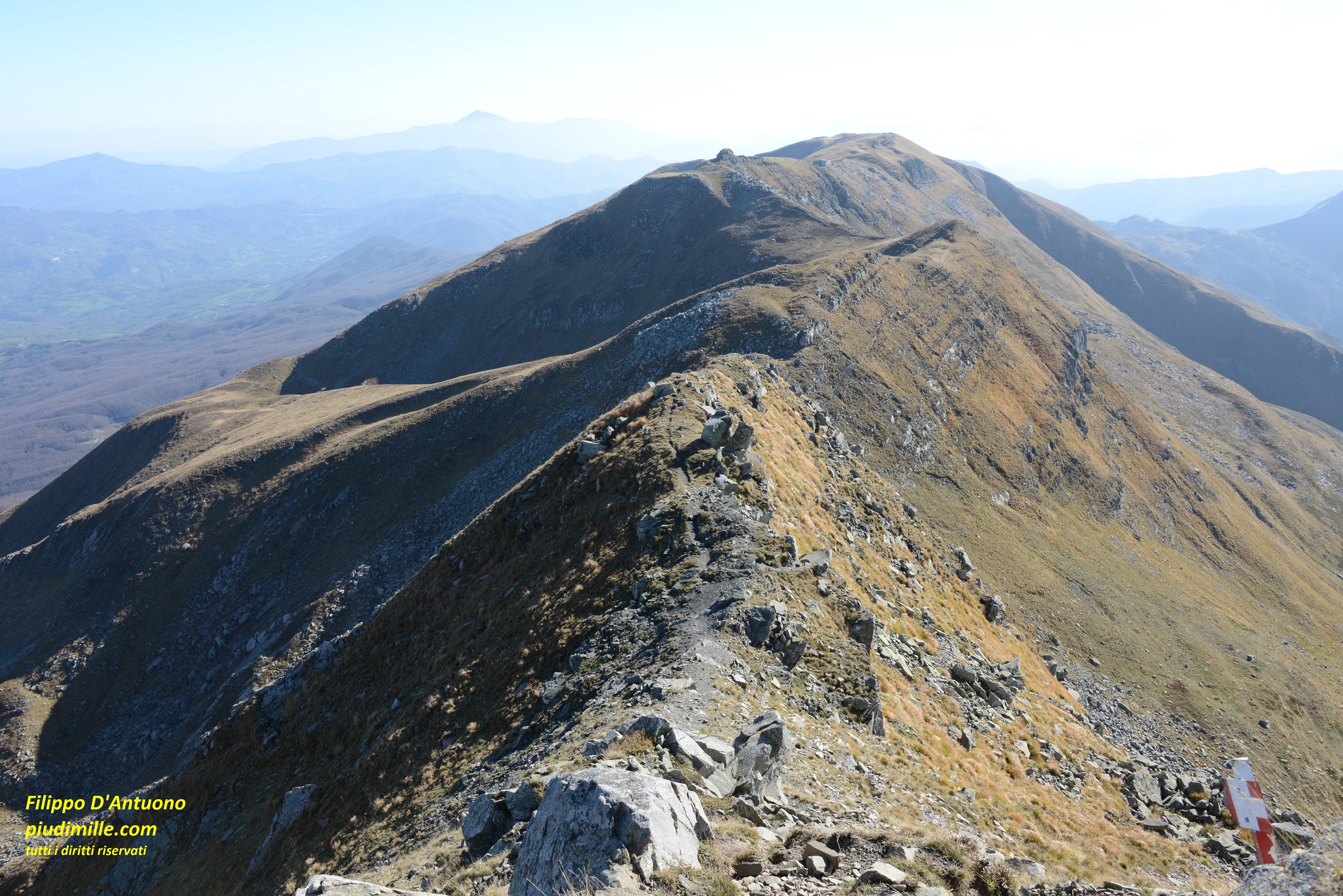
Finally the mythical ridge of the Groppi di Camporaghena. In reality, the trail runs along its north side, definitely less steep that the Lunigiana side. The more exposed and difficult stretches, especially in winter, are equipped with steel cables. Afforded with adequate gear it is not therefore particularly difficult, and is of great satisfaction.
The Lunigiana sides of the Groppi: view from Punta Buffanaro towards mount Alto
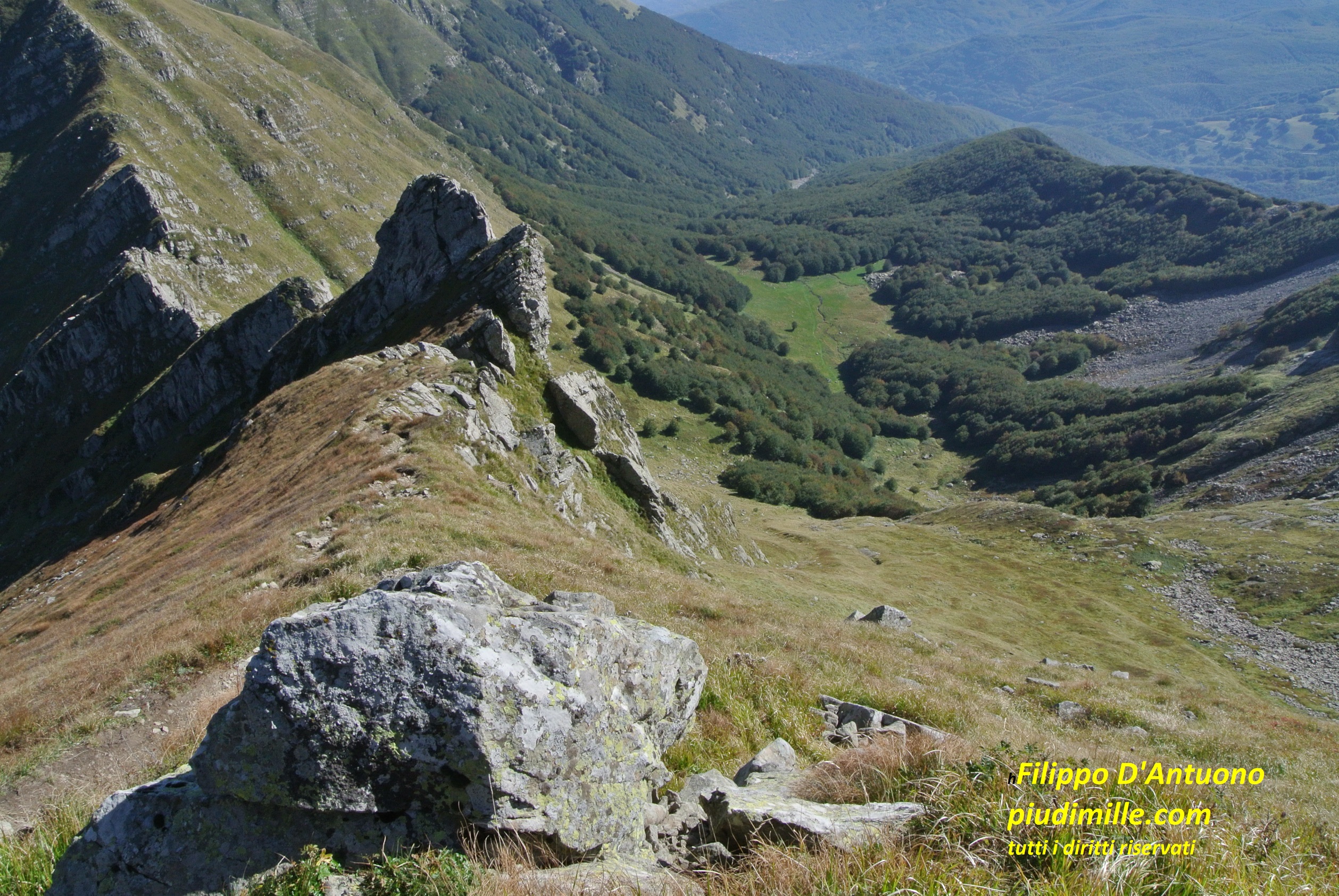
A particularly diffiult part of the ridge ascending to mount Alto; but it is possible to bypass it
Alpe di Succiso and mount Casarola
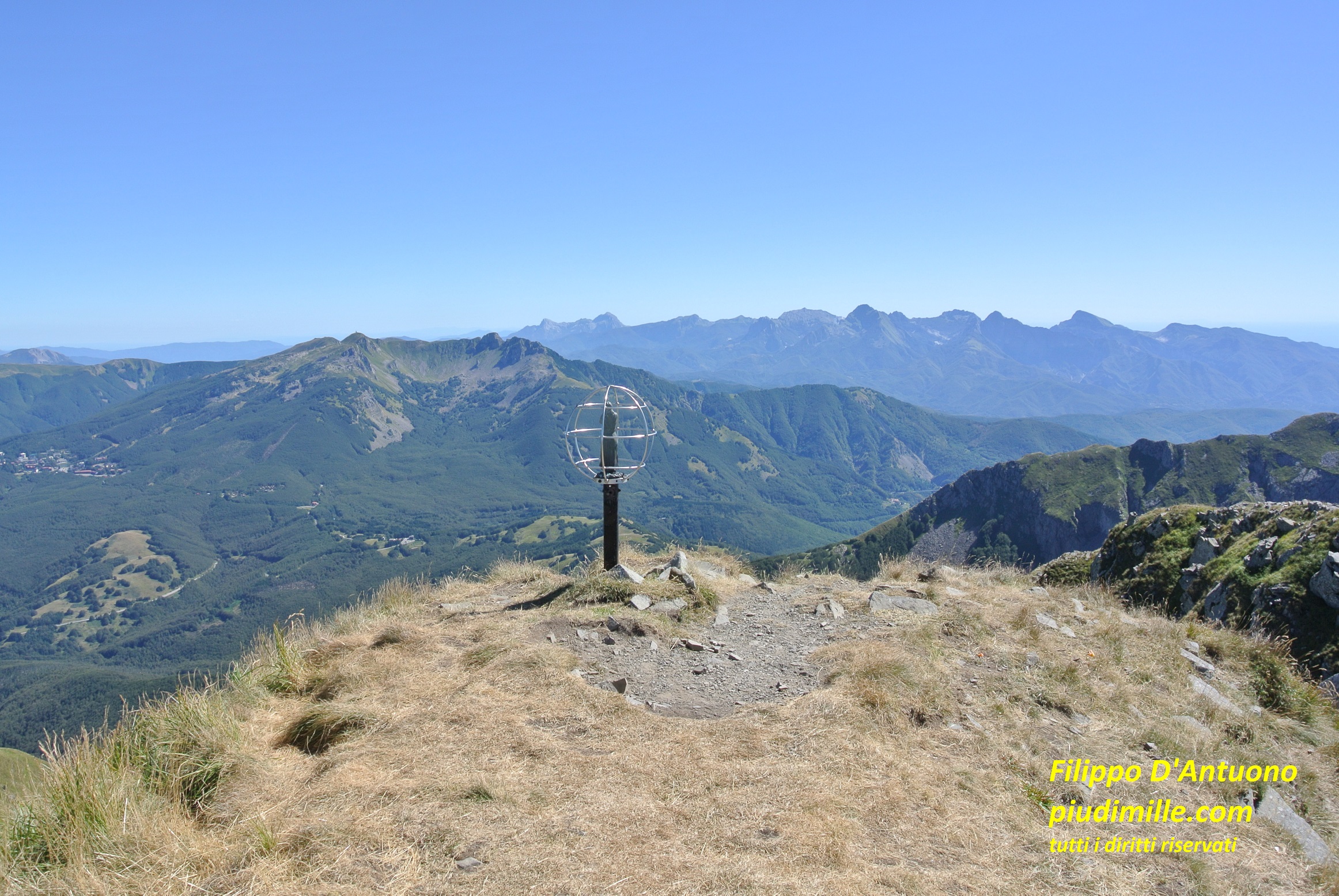
And here is the first “over 2000”: Alpe di Succiso
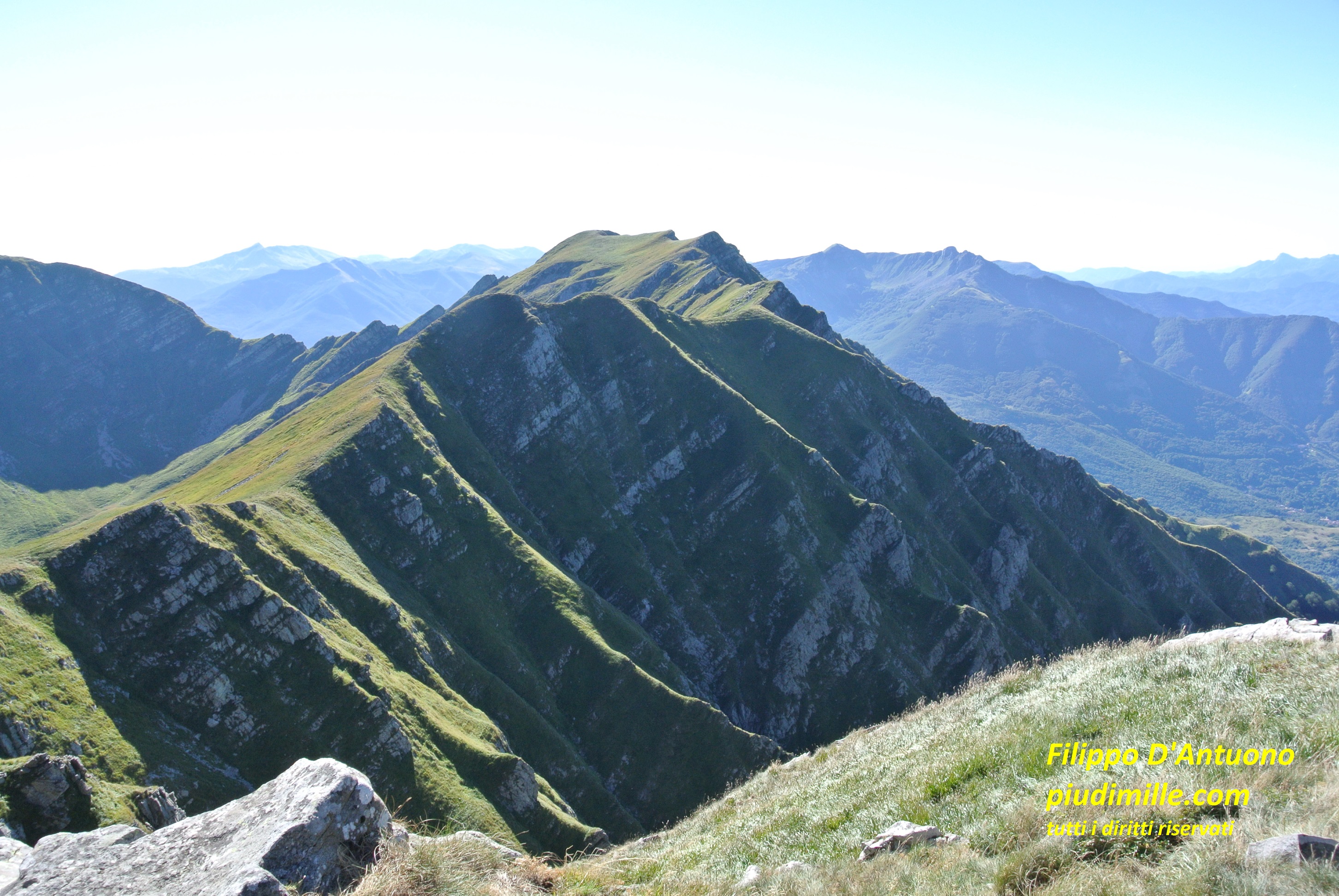
is the first peak of the long ridge heading north-est, from mount Alto, and ending with mount Ventasso. From the Secchia valley the Alpe di Succiso has the aspect of a simple, elegant, prominence of the ridge, well different from the mighty mass of mount Casarola that, indeed misses the 2000 for only few metres. From the Enza valley, or from the Parma Apennine ridge, the Alpe di Succiso, on the contrary, looks as an imposing mountain. It is a very frequented mountain, even since it is reachable without significant difficulties. The view from the top is really extraordinary, with the Groppi di Camporaghena ridge just in front, with its glacial circles, the sea, behind mount Alto, the huge glacial valley of mount la Nuda, beyond pass Cerreto, and many other mountains, of a substantial part of the Apennine.
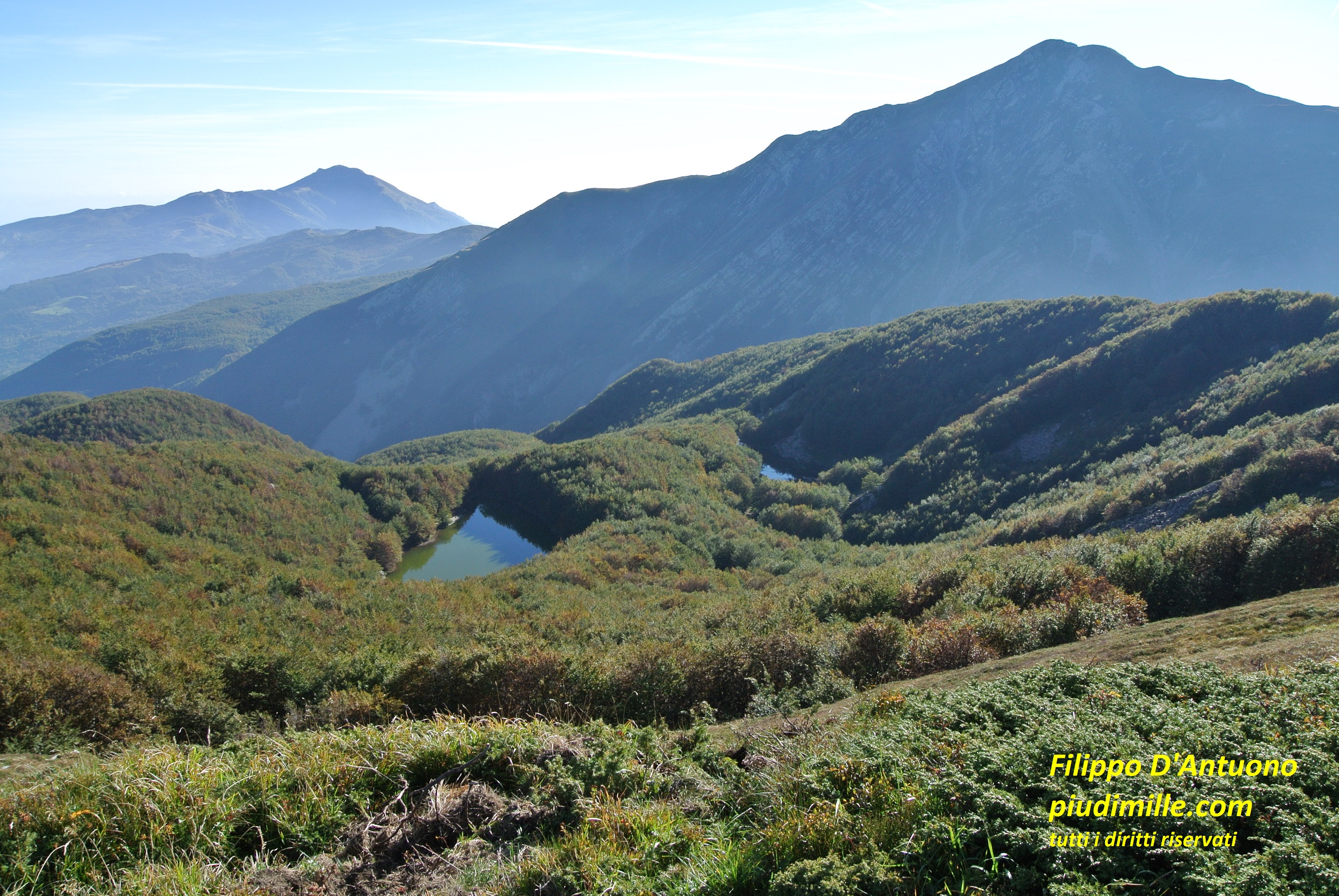
The glacial circle of mount La Nuda and the Apuanian Alps, from the Alpe di Succiso summit
Mount Casarola raises for almost 1000 metres from the Secchia valley and therefore it is a very visible mountain. From mount Casarola passes one of the most popular paths to Alpe di Succiso, that is very close. Casarola is however an excellent target by its own, also as a part of circular itineraries.
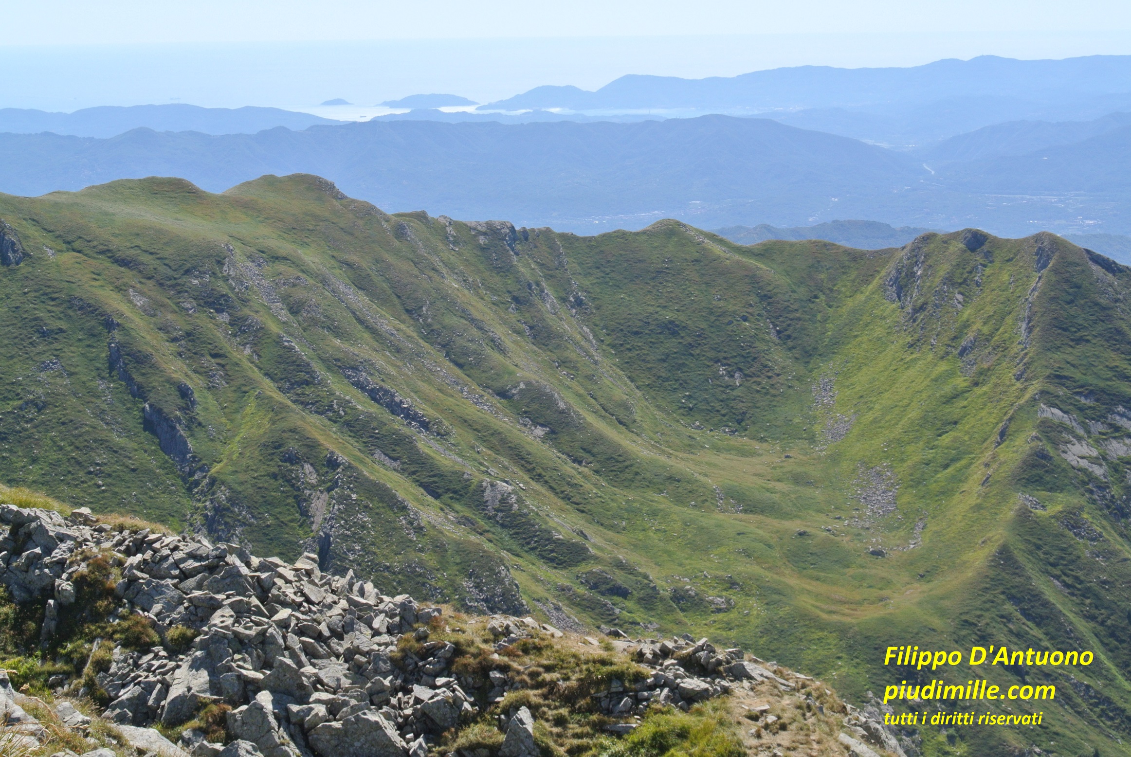
A glacial valley of the Groppi di Camporaghena, with the background of gulf of La Spezia, from Alpe di Succiso
Mount Casarola summit, with the background of mount Ventasso
Mount Ventasso
The ridge of mount Casarola descends to pass Scalucchia, a crowded starting point to the mountain, then continues, in an environment of meadows and forests, to pass Pratizzano. The grazing area of Valbona is magnificent, with the view of all the mountains around.
Beyond pass Pratizzano, the ridge rises again to muont Ventasso. which unmistakable shape can be seen from all around; it is a very beautiful mountain, easily reachable from the touristic settlement of Ventasso laghi or, with longer, very little beaten itineraries, from some of the Secchia valley towns, Cervarezza, Busana, Vallisnera, Nismozza or from Ramiseto. Lake Calamone, at the base of the mountain top, is very beautiful, although it can be incredibly crowded on peak days.
The unmistakable shape Ventasso and the Valbona pastures
Lake Calamone van be a very pleasant palce, outside peak holiday days
Appennine of Reggio, Lunigiana and Garfagnana: between passes Cerreto and Pradarena
This is a comparatively short part of the ridge, marking however the limit, on the south side, between the Lunigiana and Garfagnana valleys, with some rather relevant changes.
Between mount La Nuda and Cima Belfiore
Monte la Nuda, with its huge glacial circle, dominates the area of pass Cerreto. Cerreto Laghi is one of the several somewhat decaying ski resort that, however, still attracts a huge amount of people, since it has some shops, restaurants, hotels. As a consequence, the trails to mount La Nuda are very frequented. During summer, the chairlift can bring crowds close to the summit, But it is enough to go a bit further, in the direction of Cima Belfiore, that everything turns quiet again. Also the walks among the forests, between the attractive ancient village of Cerreto Alpi, the pass and the tiny glacial lakes of the area, like lakes Pranda and Padule, are very pleasant.
The classic view of Gendarme, from the summit of mount La Nuda
The Apuanian Alps, from Cima Belfiore
Lake Padule, with the background of the upper Rosaro valley
Mount Tondo and its Lunigiana and Garfagnana sides
Once more, reaching the ridge ascending from the Lunigiana side is all but a trivial thing. A path still does exists, starting from the road to pass Cerreto, but its final part is very demanding, not for everybody.
The Mommio stream valley has some forest tracks and paths, also passing through very scenic places, not reaching however the top of the ridge; is it anyway worth to wander a bit around.
From Cima Belfiore starts the dividing ridge between Garfagnana and Lunigiana, that reaches pass Carpinelli, passing through mount Tondo. This is a beautiful and panoramic mountain, the last high Apennine summit, on the ridge heading to the Apuanian Alps.
Its Garfagnana side is less rough, but still solitary; its appeal also depends from the many old villages scattered between pass Carpinelli and Sillano, many of which has nothing to offer anymore, except the suggestion of the places, and that’s not nothing.
Mount Tondo, with the backgound of mounts Cavalbianco and Cusna
The evocative environment of prati di Massiciano, in the Mommio valleys
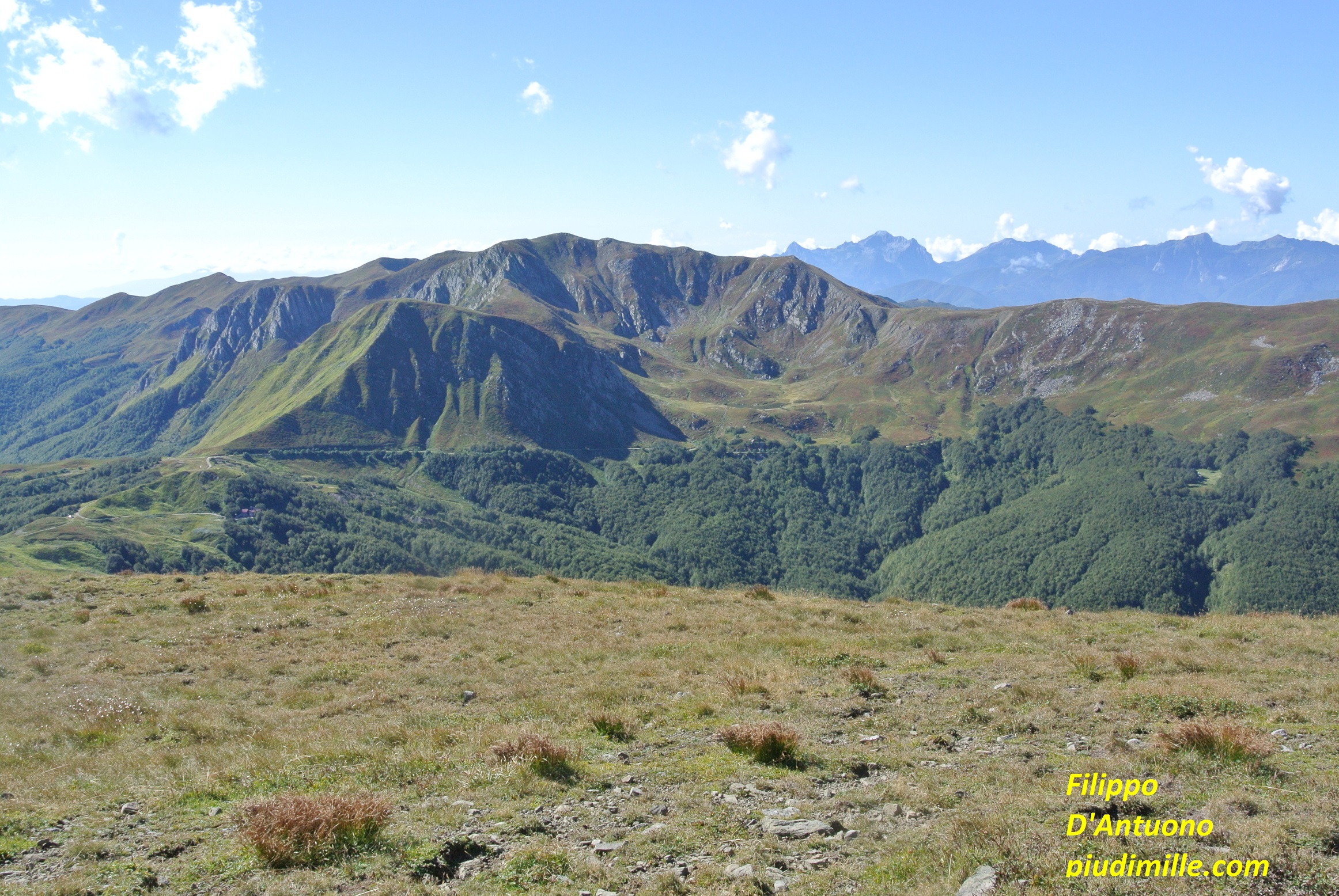
Mount Cavalbianco
I devoted a short paragraph to mount Cavalbianco, one of my favourites. It raises north of the main ridge, close to pass Pradarena, from where it can be reached by a short hike. And, in fact, it is reached by many, there and back, along the same path. But mount Cavalbianco also has two spectacular glacial circles and a sinuous top ridge, worth to visit by a ring itinerary. Seen from the river Secchia valley, it is an imposing mountain, with an unmistakable silhouette, raising 1000 metres from the valley floor.
The view of mount Ventasso, from the ridge of mount Cavalbianco
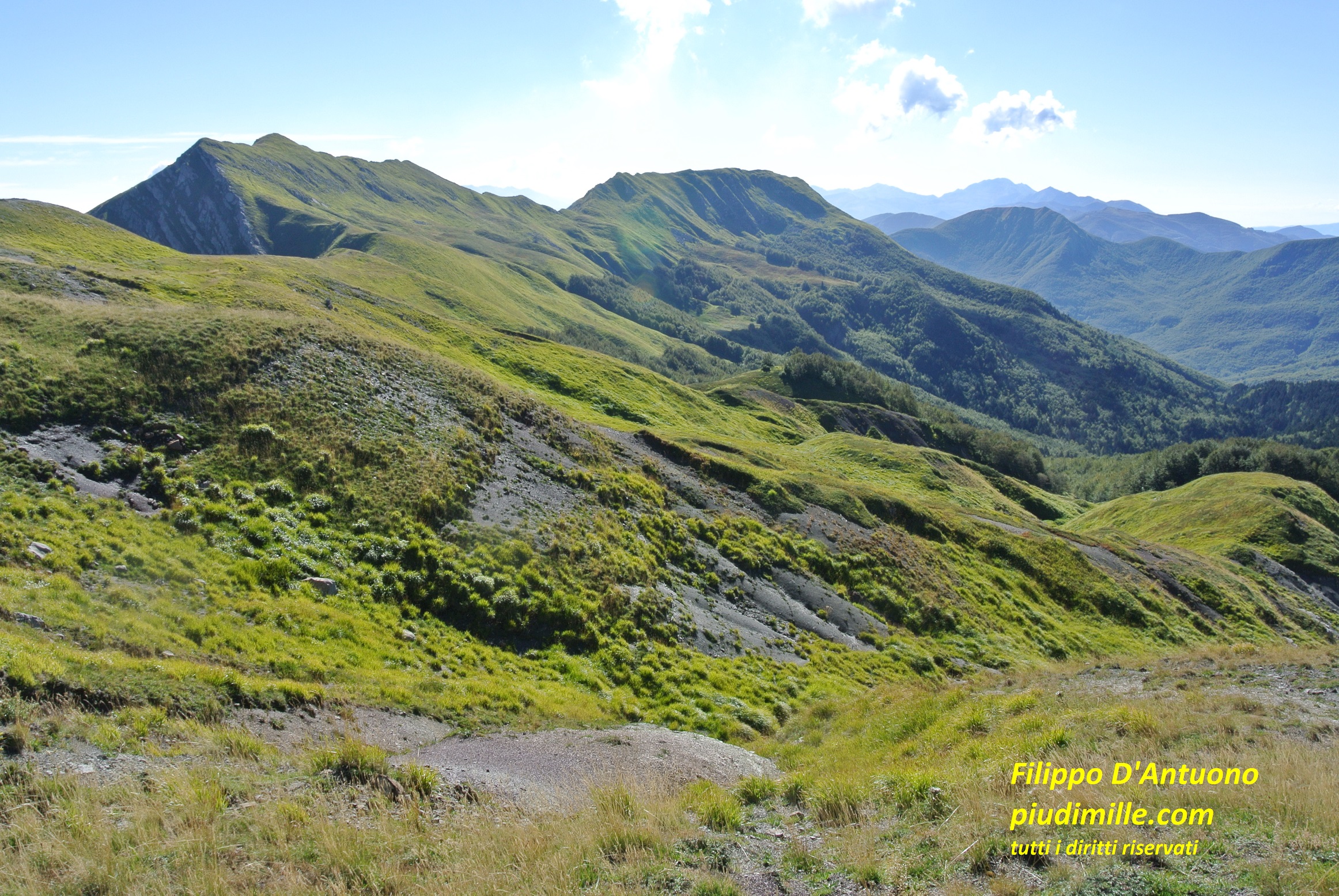
Apennine of Reggio, Lunigiana and Garfagnana: the group of mounts Cusna, Alpe di Vallestrina and Ravino
Mount Cusna is the second highest peak of the northern Apennines. It is a part of a complex ridge, starting from the dividing ridge at pass Lama Lite. Further on, beyond the Passone, it branches in two parts: the western one includes mount Cusna at its northern satellites, mounts Cisa and Prampa; the eastern part raises to mounts Alpe di Vallestrina and monte Ravino. The upper valleys of streams Ozola and Dolo lay between these mountains and the main dividing ridge.
Useless to say that mount Cusna has the appeal of its over 2100 metres. And indeed, it offers a spectacular view over the main ridge, the Apuanian Alps, just behind and aa glance of the sea, when the air is clear enough. Mount Cusna can be approached by several ways, requiring variable effort: you can start down from the villages, Ligonchio, Casalino, Febbio, Civago, or from the approach points of Presa Alta or passo Cisa; so that, coming back several times will hardly be boring.
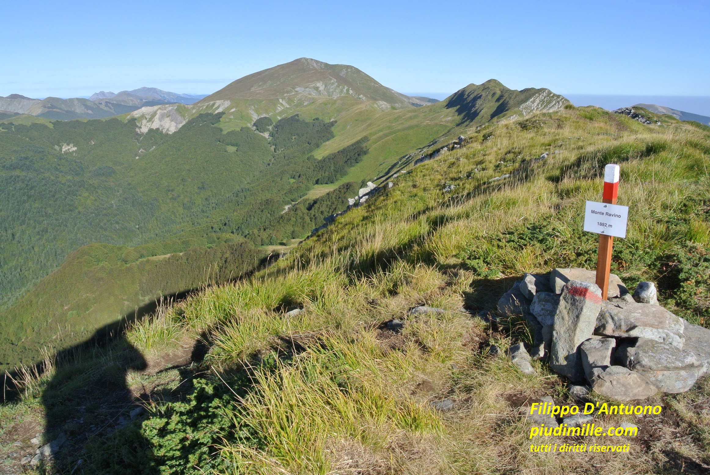
Mounts Ravino and Alpe di Vallestrina are a little lower and somewhat more secluded; just because of this, they have a special appeal, also due to the nice and remote glacial circles on both sides: beautiful hikes, through solitary places and less beaten trails.
The characteristic shape of mount Cusna, seen from mount Cisa
The descent along the top ridge of mount Cusna
Alpe di Vallestrina and mount Ravino, from Passone
Mounts Cusna and Alpe di Vallestrina, from mount Ravino summit
Apennine of Reggio, Lunigiana and Garfagnana: between passes Pradarena and delle Radici
This rather long stretch ends already inside the province of Modena. Find here the only “over 2000” summit of the main ridge, and the “surprise” of the Pania di Corfino side chain.
Mount Sillano and the Porraie
Should I rank the more neglected mountain, with respect to what it could offer, I would say mount Sillano. It is panoramic, over mount Cusna, the Apuanian Alps, the upper Secchia valley; it has two spectacular glacial circles on its north side; it can be rather easily reached from pass Pradarena or, with somewhat longer but very nice trails, from Ligonchio, or, by means of more solitary itineraries, from some villages of the Garfagnana side. Nevertheless, mount Sillano is not very popular.
The ample glacial circle of mount Sillano
Mount Sillano continues with the nice and sinuous ridge of the Porraie, descendig then to passes Romecchio and Focerella, two “doors” to the upper Ozola valley from the Garfagnana side.
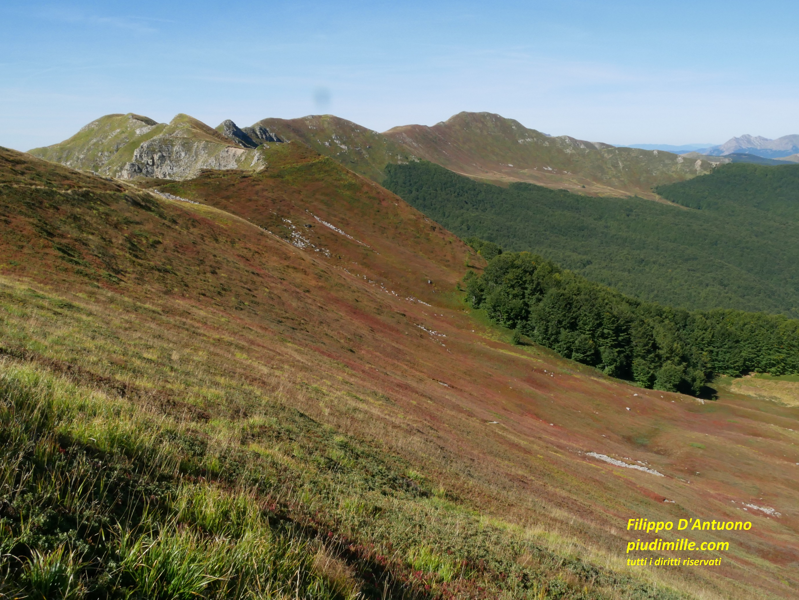
The ridge of Porraie and mount Sillano
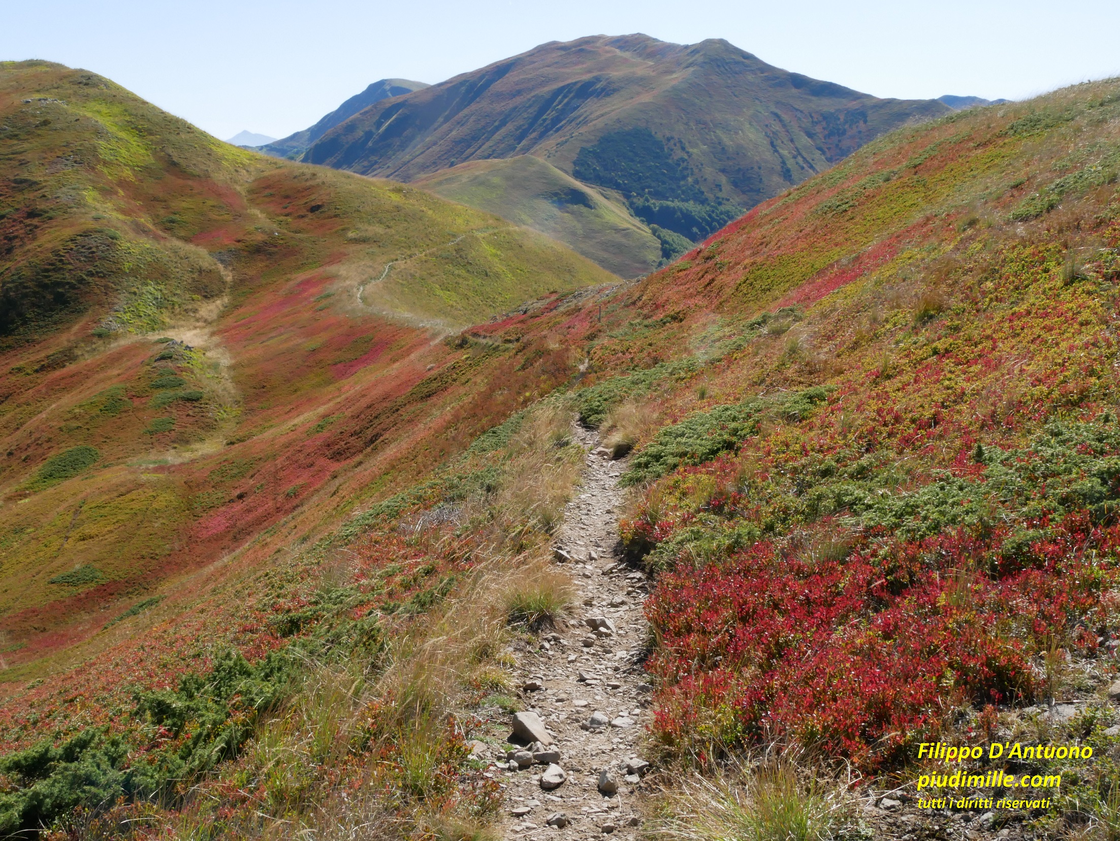
Autumn colours of the blueberry moorlands towards pass Romecchio
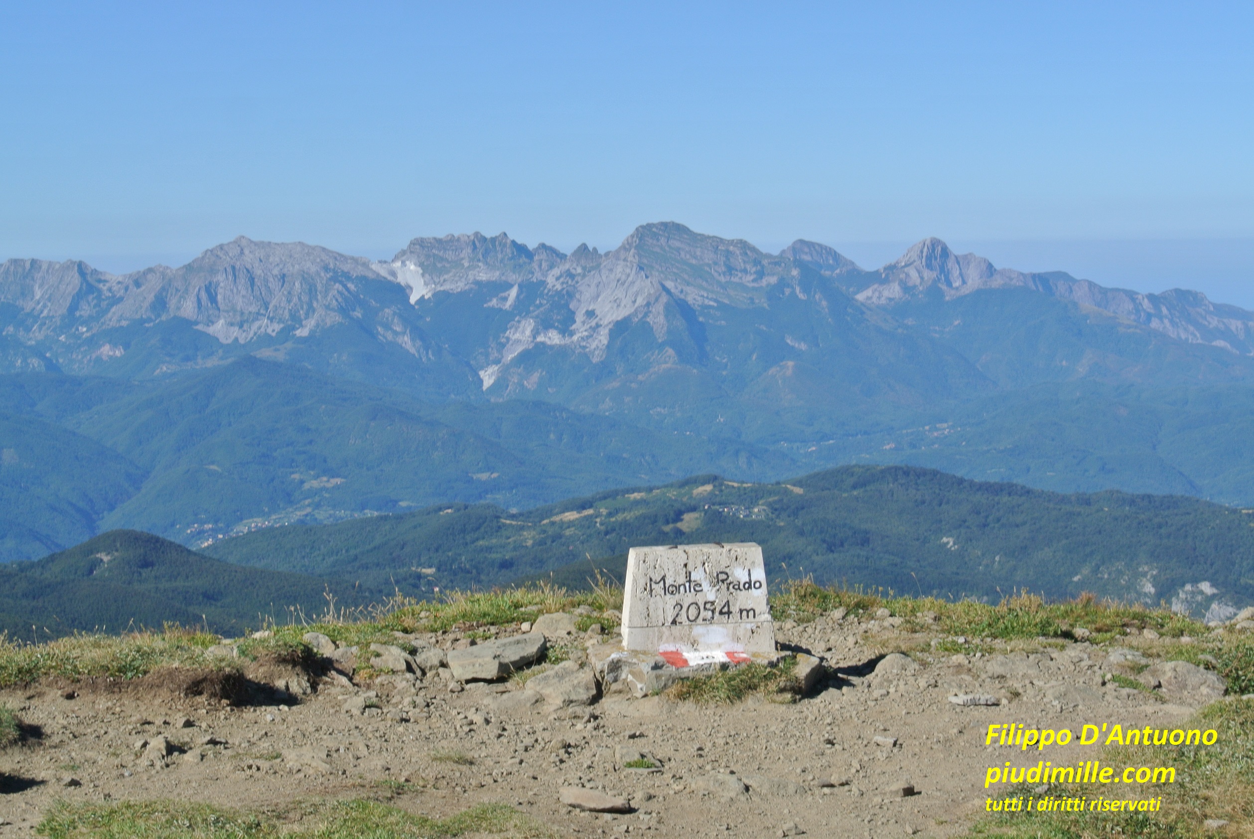
The group of mount Prado, to pass delle Forbici
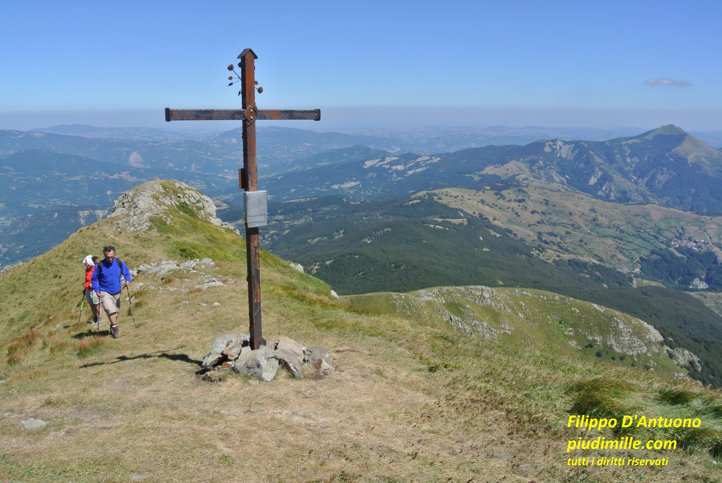
Beyond pass Focerella the ridge raises to mount Castellino, then continues wide and with little quote variation, finally ascending to mount Prado, the only “over 2000” of the main ridge. from its top, you have the Apuanian Alps just in front, and mount Cusna on the other side, the Garfagnana valley and the Pania di Corfino below you, and you see many mountains of the Apennine. Therefore, it is really a beautiful mountain, requiring however some effort to be reached.
Beyond mount Prado, the dividing ridge continues, still high, to mount Vecchio, where it meets the ridge that heads south, to mount Bocca di Scala, then descends to the saddle of Campaiana, one of the closer points to access the ridge.
Mount Prado, seen from the ridge of mount Cusna
Further on, the ridge starts descending, with several ups and downs, to the last forested stretch, reaching pass delle Forbici, where the track from the area of Casone di Profecchia arrives. Casone di Profecchia is also another good starting point to hike to the ridge and then to mount Prado, through pass Bocca di Massa.
On the other side, in the upper Dolo valley, you can find a lot of paths that, starting from the interesting mountain village of Civago, reach pass Lama Lite by different ways, from where it is possible to reach mount Prado, also passing by the tiny lake Bargetana.
View of the Apuanian Alps, from the summit of mount Prado
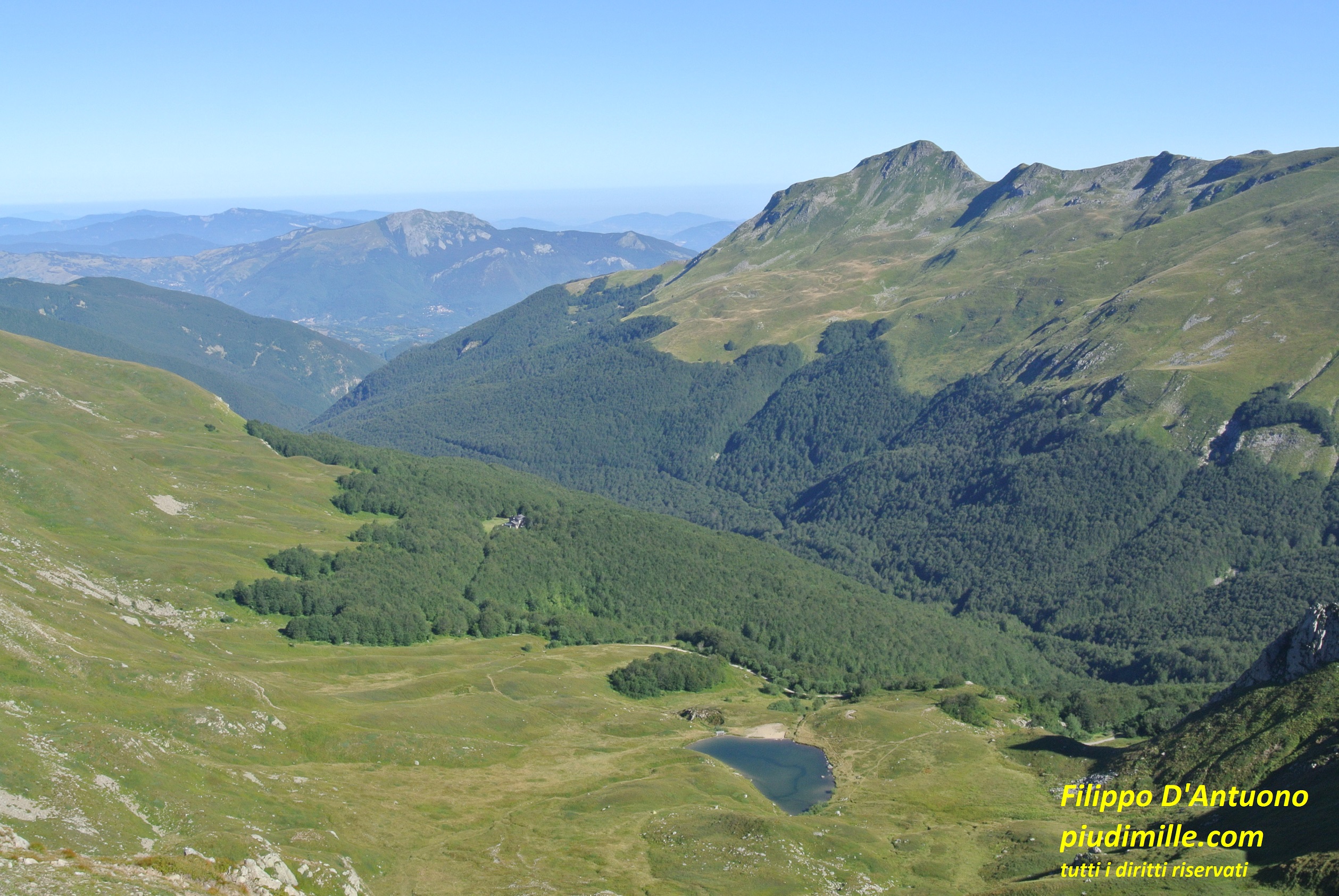
Mount Cusna, lake Bargetana and the upper Ozola valley, from mount Prado
Pania di Corfino
The Pania di Corfino is the biggest of the limestone mountains, raising on the left side of Serchio valley. From the Garfagnana side its rocky sides are what will attract your attention. Seen from the main ridge, the Pania di Corfino looks instead like a relaxing meadow area. So, you can take it from the side you prefer. Ascend from Corfino or from Orecchiella, for a wilder immersion; start from Campaiana, to enjoy its more relaxing side. From the top, the view will not be anyway missing. Corfino is an ancient village, not to be missed. Campaiana is an old pastoral area, with many stone huts, now restored. I have seen it when it was almost abandoned, and cannot tell if it is more fascinating today.
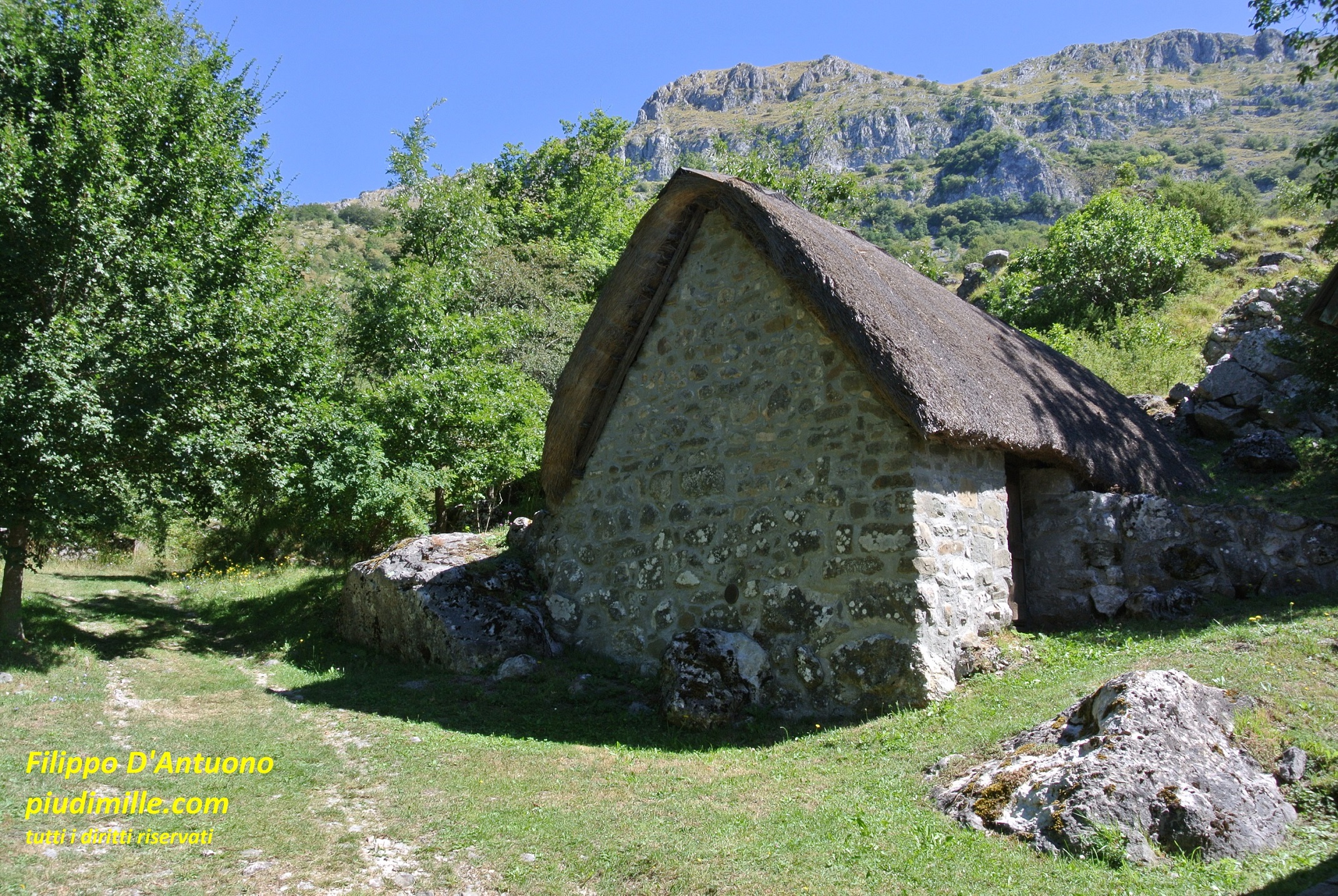
The south side of Pania di Corfino, and one of the traditional huts covered with cane roof
The Orecchiella is a very interesting area, where extended forests alternate with meadows, also characterised by former pastoral settlements where some now restored ancient stone huts with vane roof still exist.
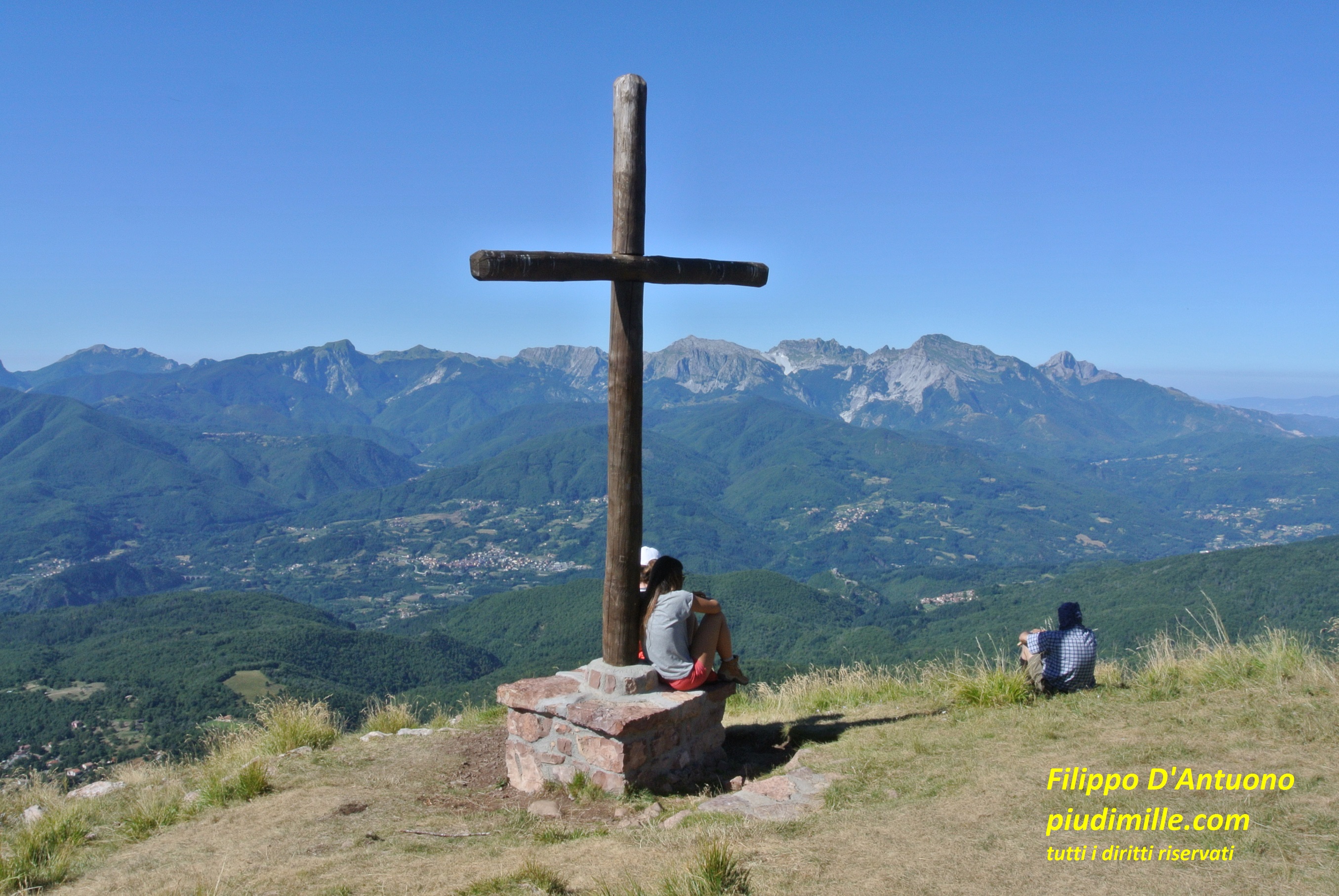
The Apuanian Alps, from the summit of the Pania di Corfino
A lane of Campaiana
Approaching pass delle Radici
Pass delle Forbici is connected to pass Giovarello; mount Giovarello, lays between the two passes: it has an open top and a now forested glacial circle on its north side. Beyond pass Giovarello, the ridge enters in the territory of the Modena province, to the road pass delle Radici. Although this final part is rather easily accessible, it is not highly frequented, despite the nice panoramic point of Alpicella delle Radici, with views already on most the Modena Apennine ridge. The approach to pass Giovarello through the areas of Prati Fiorentini, with the san Geminiano chapel, and the bogs of i Maccherie is also very interesting.
Mount Giovarello, with the background of the high Modena Apennine
The view of the Modena mountains, from the ridge between pass Giovarello and pass delle Radici